You dream of long-distance expedition…. Of Great Wild Areas…. We went exploring for you in 2013 the Apolobamba Cordillera, in the very north of Bolivia. The latter is certainly distant, magnificent and above all wild and secret. We opened a path there on its northwest slope. Passionate mountaineers, with experience, this expedition will delight you with an original trek offering breathtaking landscapes and idyllic camps. You will have the opportunity to climb two new mountains, the Cololo with its technicality on the summit wall, the Huanacuni and its splendid and aerial ridges. The Chaupi orco, the only 6000 in this mountain range is a huge glacial massif nestled at the bottom of a paradise valley. Depending on the year, it can be quite technical on its summit wall. Adventure Guaranteed! A new expedition to discover at all costs!
23 days on the spot.
Spanish speaking driver and private vehicle
Included
UIAGM spanish mountain guide and spanish trekking guide / english speaking guide in La Paz and Titicaca Lake
from 3600m asl to 5260m (6044m asl for the Chaupi Orco)
from May to august
Day 1
Day 2
Day 3
Day 5
Day 6
Day 7
Day 8
Day 9
Day 10
Day 11
Day 12
Day 13
Day 14
Day 21
Day 23
to be coordinated
hotel
none
45 min
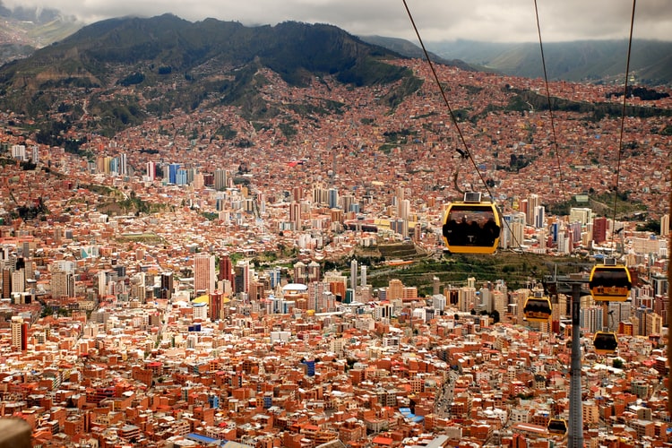
Reception at the airport and transfer to the hotel. Rooms are available from midday, unless otherwise arranged by us. Rest of the day free.
08:00 am
hotel
breakfast
1h
2-3h
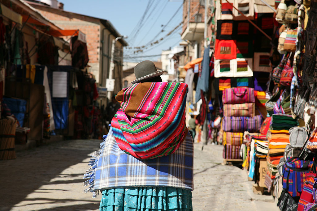
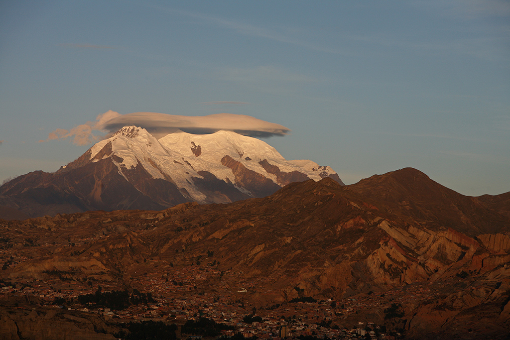
We depart after breakfast to K'Illi K'Illi which offers a magnificent panorama of La Paz and the majestic, snowcapped Illimani mountain (6,400 meters/21,100 feet in elevation). We then descend to the southern zone and Ramon Tito’s studio. Tito is a “paceño” sculptor and watercolorist. His workshop is located on the aptly named “Avenue of the Sculptor.” Tito works mainly with stone he finds in the surrounding mountains. In addition to the clay found in the Valley of Souls, La Paz is known for stone, including basalt, marble, sandstone, alabaster, granite. Locals claim stone carries the Bolivian soul. Tito’s work is testimony to this, From his workshop, the tour continues to the Pedregal Canyon and an easy ascent (3600 meters.18,100 feet). The Canyon is home to impressive fairy chimneys (hoodoo) and a pass that opens into "El Valle Escondido" (the Hidden Valley). The walk continues to a village at the foot of the Muela del Diablo and, for the more adventurous, a trek down the ridge to the edge of Calacoto (1h30 of additional walking). We spend the afternoon exploring the colorful markets and historic center of the city of La Paz on foot.
Special information :
Change in elevation: +330 m/-495 m
08:30 am
monastery
breakfast, lunch, dinner
3h30
2-3h
We depart in the morning from the hotel by private vehicle to the village of Chuquiñapi located off the beaten path on the shores of Lake Titicaca. Our first stop is the José Ferrari Monastery located in the middle of the Andean countryside overlooking the Lake. After lunch at the monastery, we drive to the island of Sunata south of Chuquiñapi (20 minutes). From here we start an easy hike. After exploring the small island of Sunata, we go north along the banks of the Lake, returning to the monastery on foot. From there, you can continue hiking or relax and enjoy the tranquility of the place. Dinner is at the monastery. Return to hotel.
Special information :
Change in elevation: +115 m/-85 m
08:30 am
local houses
breakfast, lunch, dinner
2h
2-3h
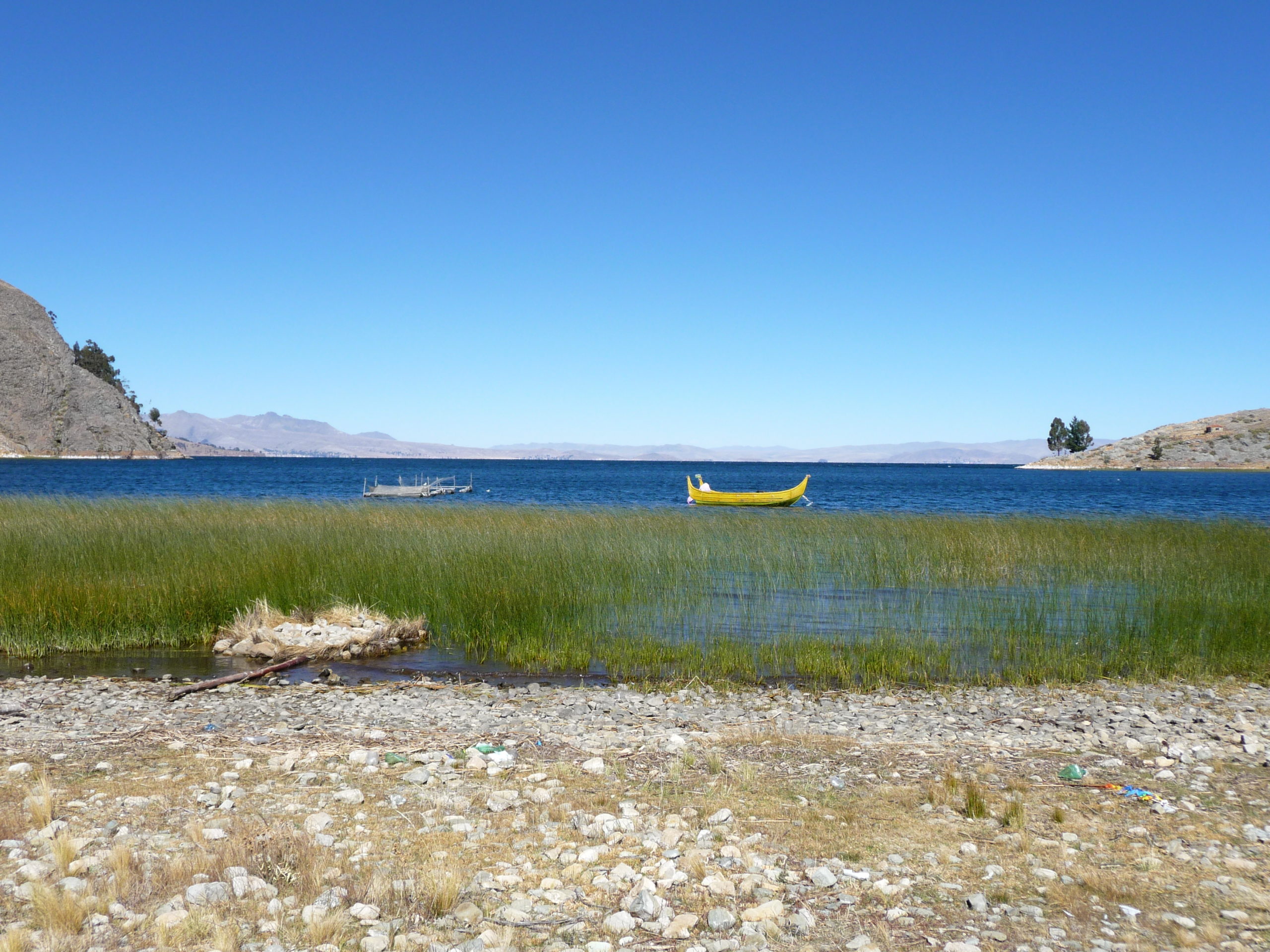
We start the day with a scenic drive to the far side of the bay. Our catamaran and local crew await our arrival. They take you on a morning-long tour of the bay with its breathtaking views of the glacial massifs of the Royal Cordillera. We return to the monastery for lunch and then travel by road to the village of Santiago de Okola ( approx. 2 hours), where we will be warmly welcomed by our local hosts. After getting settled in (2 people per family), we hike along the shore of Lake Titicaca to Tortuga Island, located on the other side of the bay. As our guide will explain, reaching Tortuga Island by foot was not always possible. When he was a child, it was surrounded by water. Lake Titicaca has receded in recent years. It still is home to many birds like ducks, Andean geese, and pink flamingos. We walk to the top of this small island to get a beautiful view of the bay. We return to Santiago de Okola by the same route. Dinner with our local hosts.
Special information :
Change in elevation: +50 m/-50 m
09:00 am
local houses
breakfast, lunch, dinner
0
3h
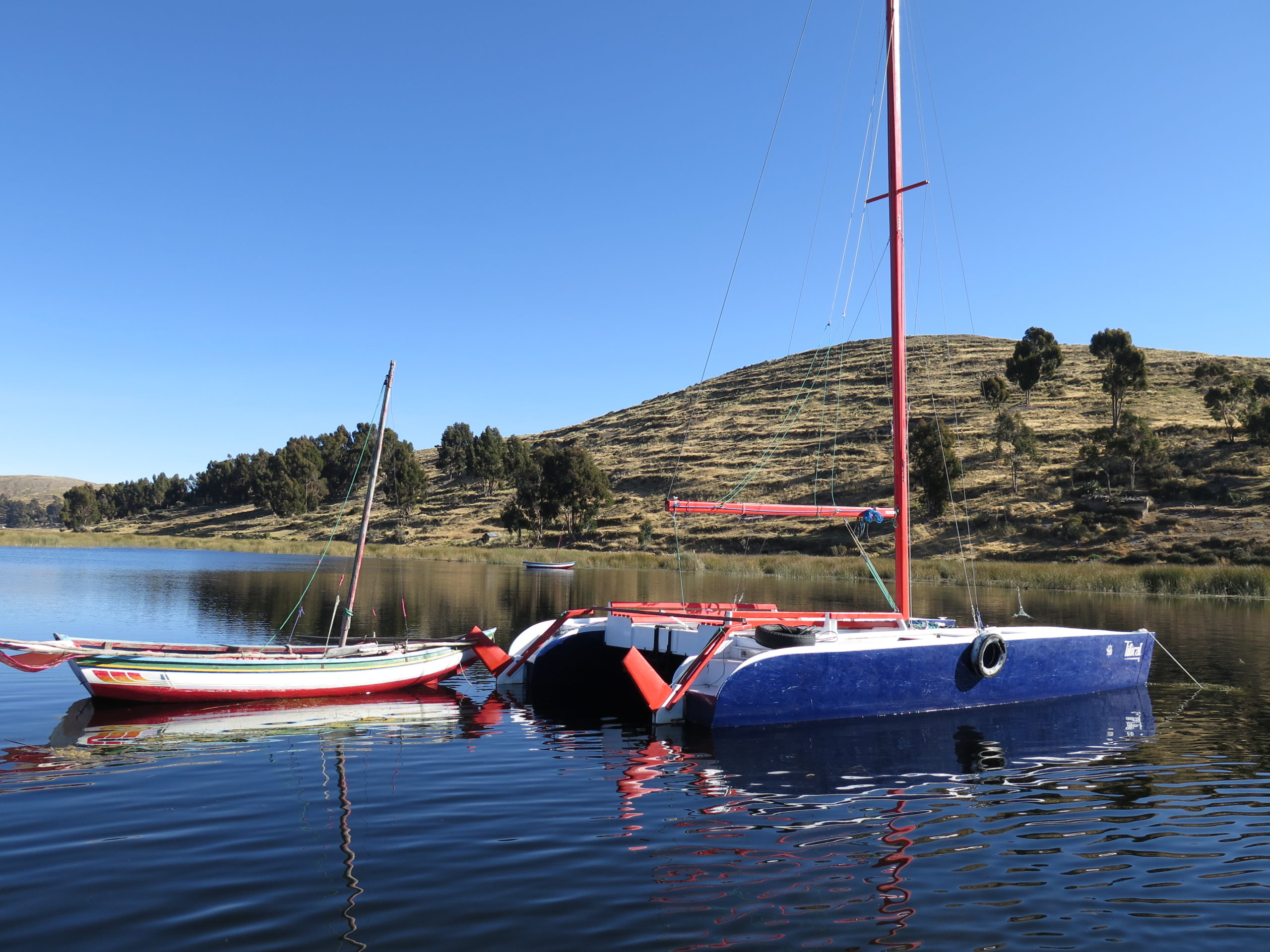
After breakfast with our hosts, we walk to the Sleeping Dragon mountain overlooking the bay. Below the head of the Dragon, there are cave paintings in the rock. From here, we take a leisurely hike up to the top of Tunapa Cave, which offers an amazing panorama of Lake Titicaca, the inland sea, and the Bay of Santiago. We descend from the other side, a more challenging, but beautiful, hike. Upon returning to the village, we visit local artisans known for traditional weaving. This craft is passed across generations and has become an art form. It may take a month to weave an "aguayo", a traditional Andean fabric. Our lunch is an Apthapi, a traditional meal of the Andean countryside collectively prepared by local families. It includes pancakes, donuts, shortbread quinoa, corn, potatoes and small fried fish from the lake. In the afternoon, you can sail on the lake in a traditional boat. We spend the night in Santiago de Okola.
Special information :
Change in elevation: +270 m/-270 m
10:00 am
tent
breakfast, lunch, dinner
5-6h
0
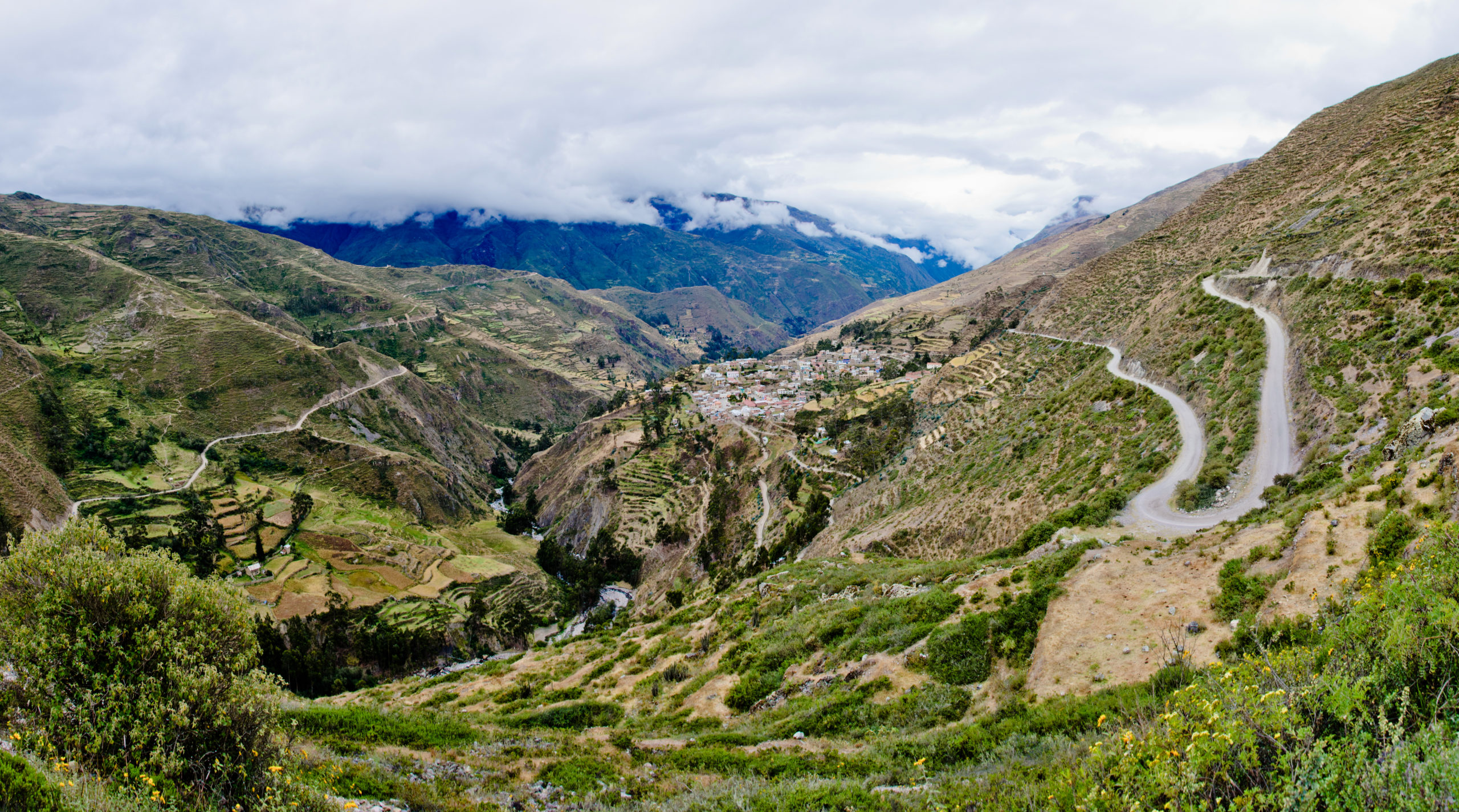
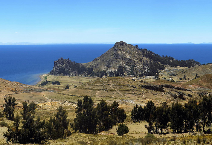
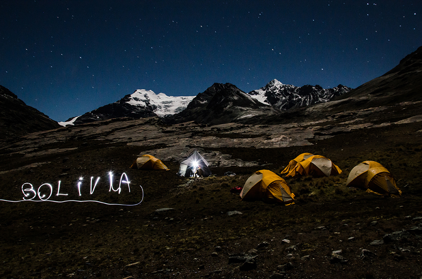
We depart in the morning for a long drive north towards the Apolobamba Mountain. We pass along Lake Titicaca and twist and turn around several passes, up to the highlands at the foot of the mountain. We arrive in the afternoon to the village of Charazani, which is known for its hot springs. We will enjoy the springs, time permitting, before continuing to the small village of Lagunillas. From here, we continue by 4x4 to the village of Kanisaya (end of the track). We spend the night in the village’s hostel.
09:00 am
tent
breakfast, lunch, dinner
0
3-4h
After breakfast, we hike up to a small hamlet known for its stone houses. An imposing rock barrier surrounds the valley. We end the day by climbing north along a steep slope and over a rock barrier to a plateau with a big lake, the Laguna Chuchuja, at 4230 meters /13,900 feet above sea level. We camp overnight at the foot of Akamani.
Special information :
Change in elevation: +360 m/-40 m
08:00 am
tent
breakfast, lunch, dinner
0
8h
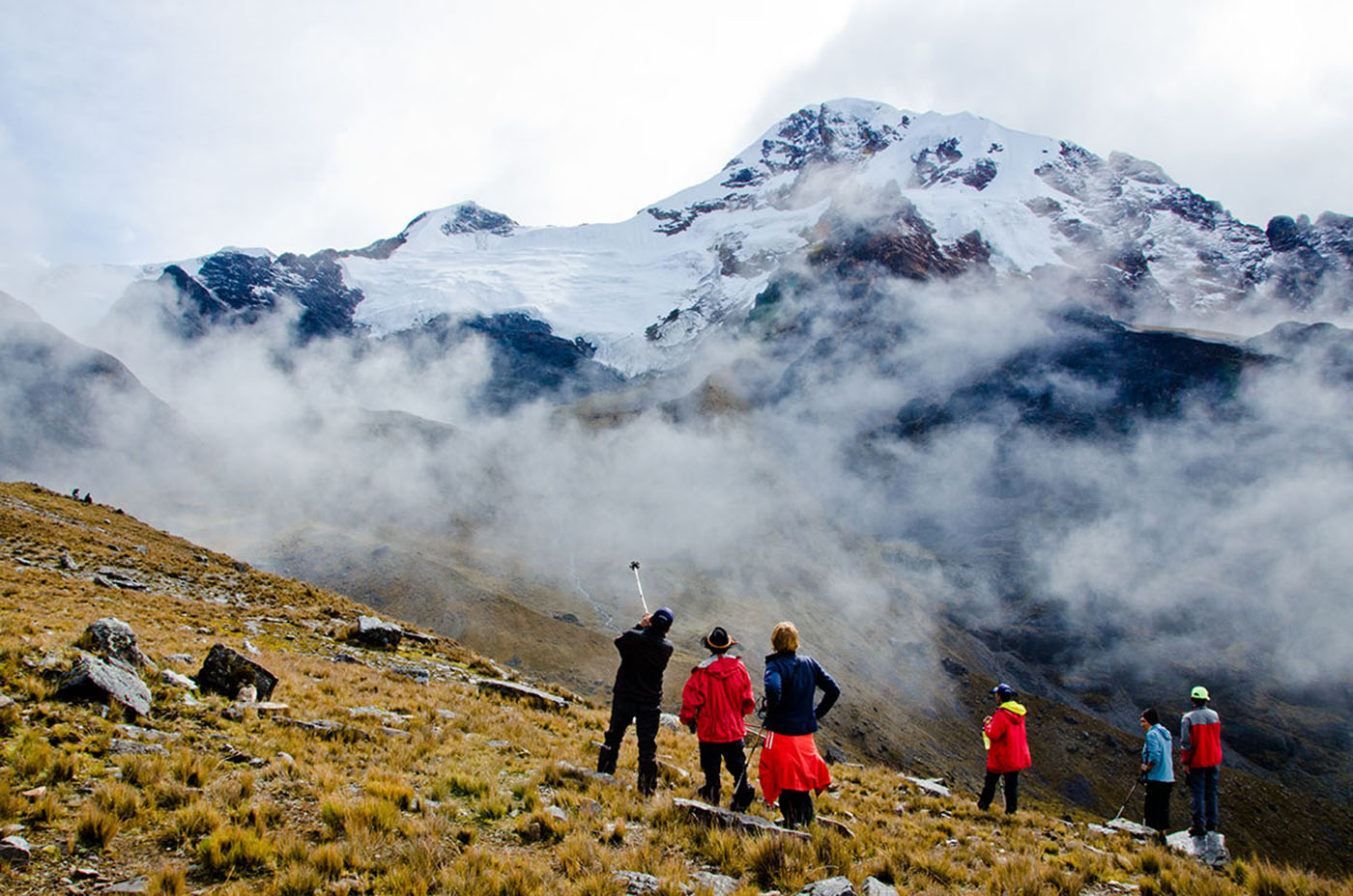
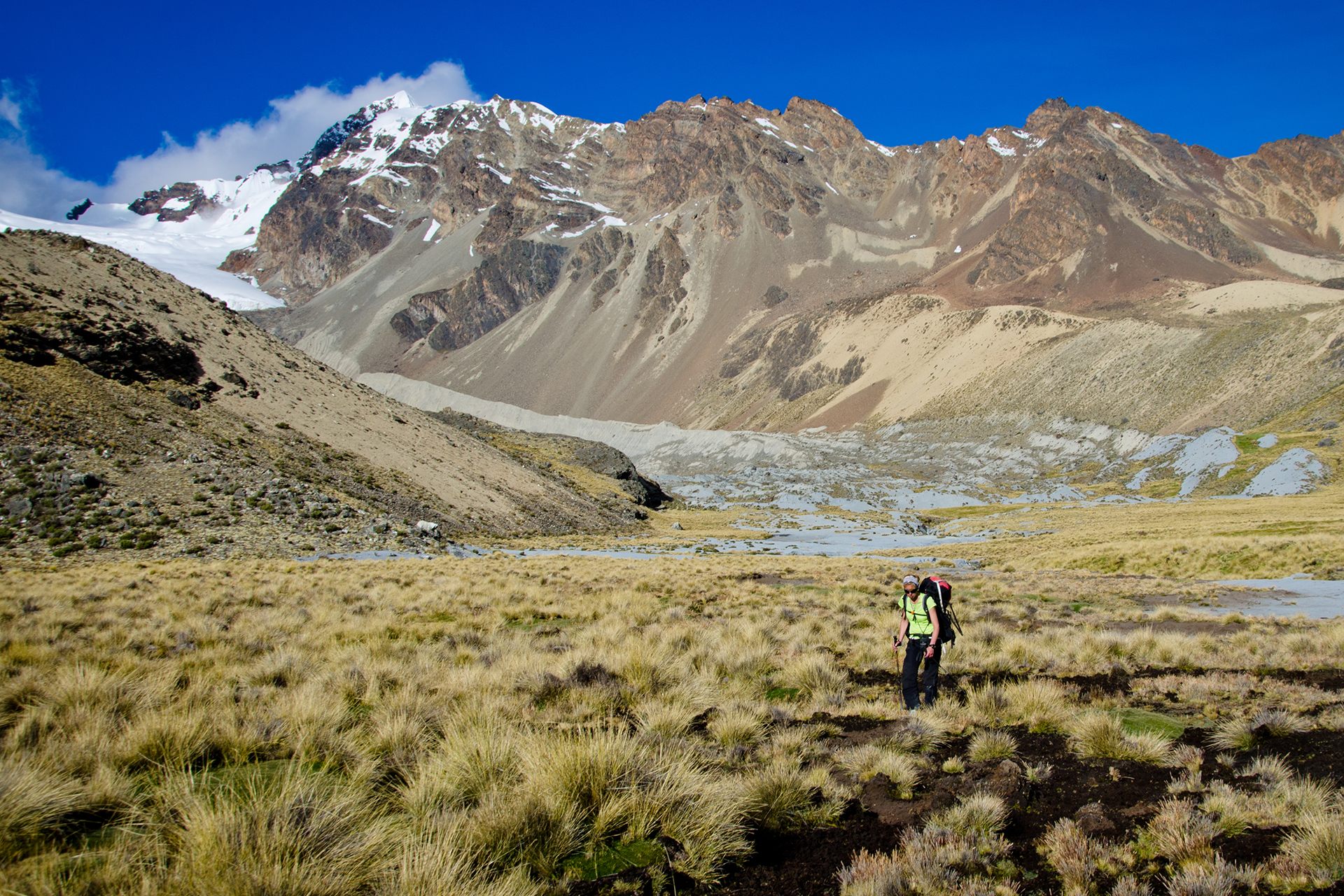
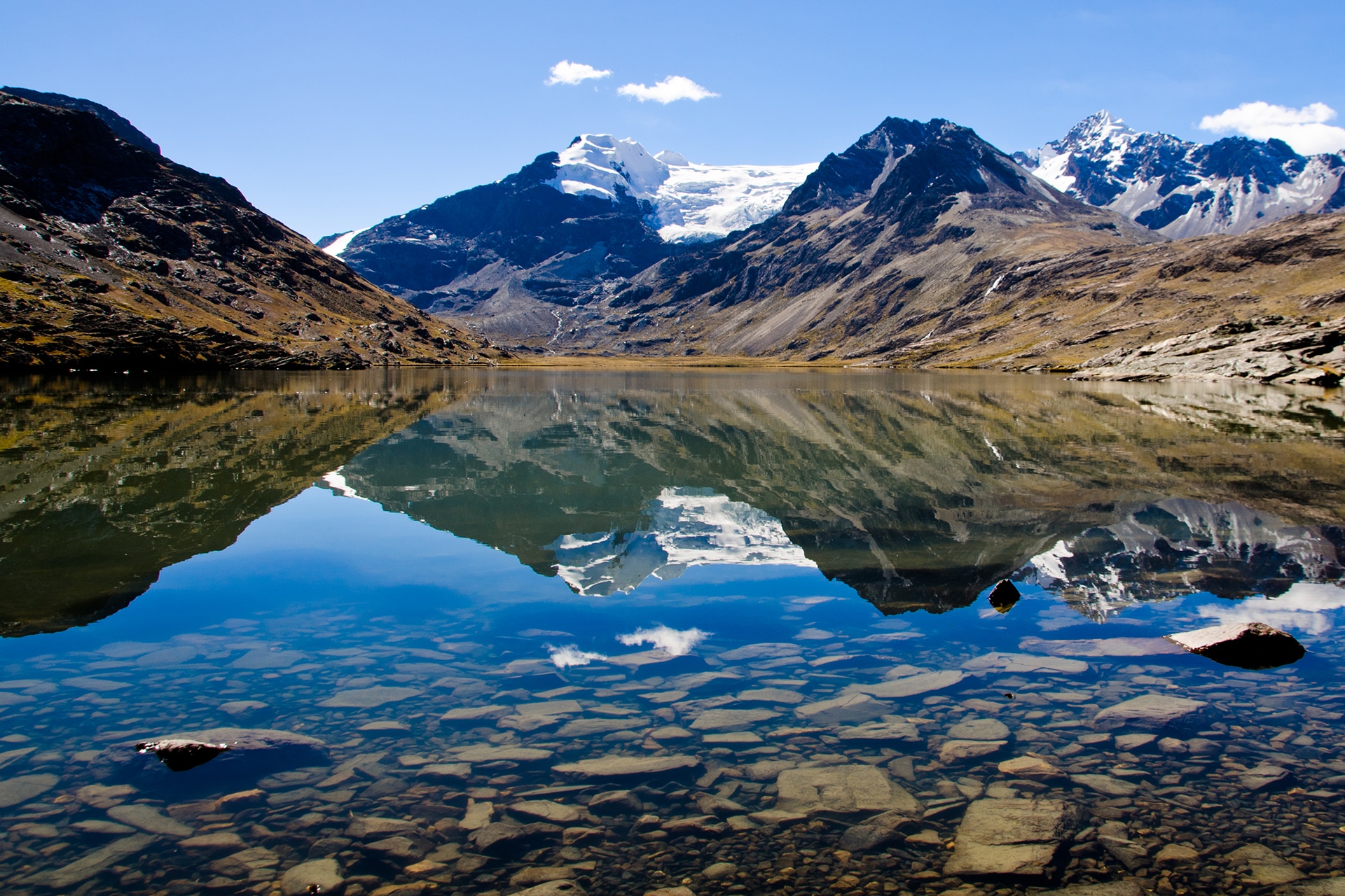
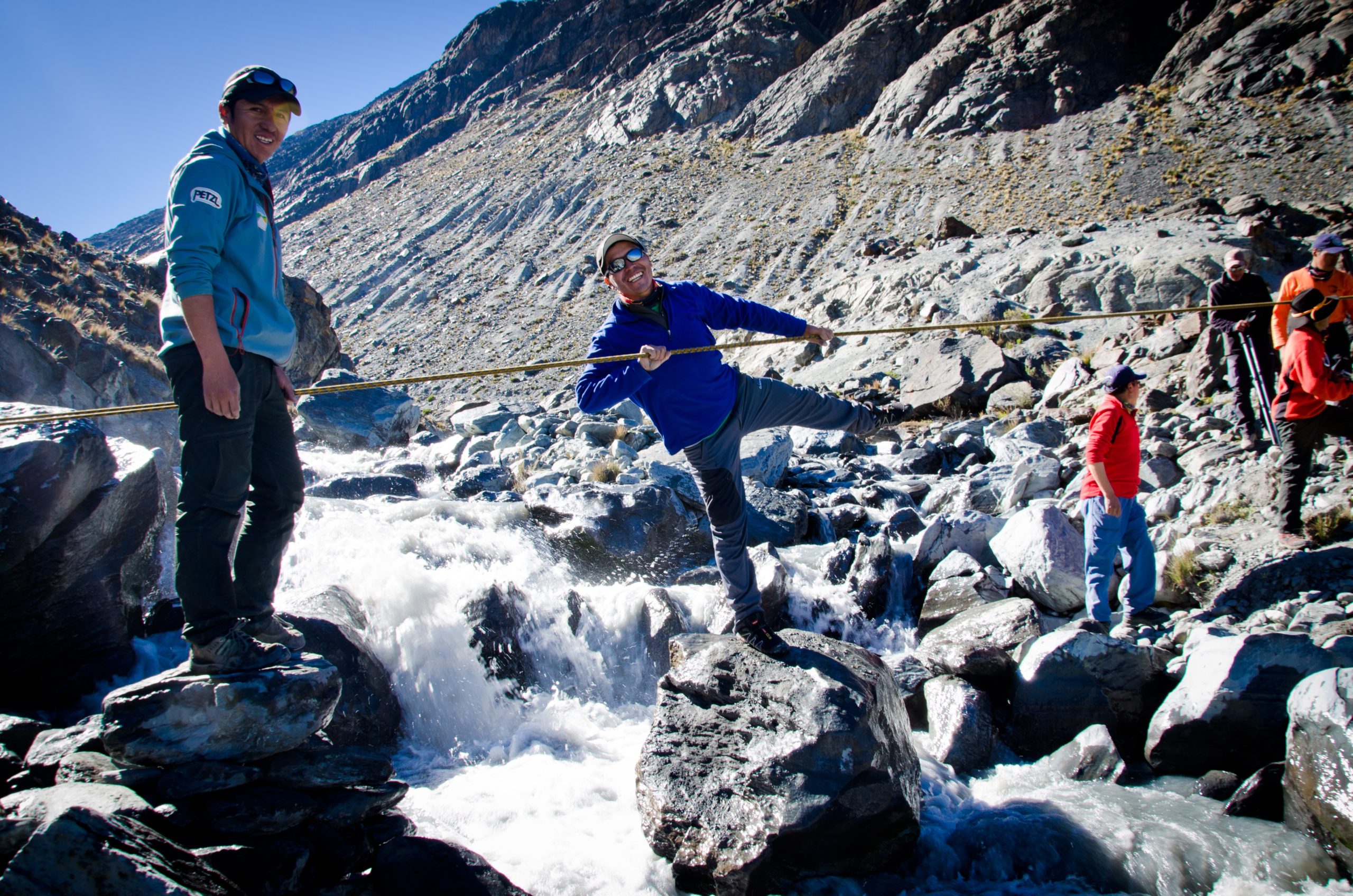
We start the day by climbing north-west above Lake Chuchuja to a high pass (4420 meters/14,500 feet above sea level.) The path goes west following the contour line and then descends into a large valley. We wade across the stream (4235 meters/13,,900 feet above sea level), head north, and walk through the valley. From there, we make a long ascent to the north-west and cross a plateau to a 4945 meter/16,200 foot high pass. Here we get a first look at the glacial massif of Ullakaya (5820 meters/19,000 feet). We descend into the valley on our left, stopping at Lake Kañuhuma to set up camp.
Special information :
Change in elevation: +900 m/-310 m
08:00 am
tent
breakfast, lunch, dinner
0
7h
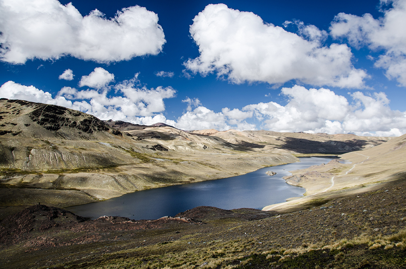
We continue trekking to a plateau located in a swampy glen that overlooks a “bofedal”, a humid high land. We will try to find the best path to cross so our feet don’t get wet! This area backs into a large glacial pass in the east that divides two beautiful summits. We ascend to the next pass at 5110 meters/16,800 feet above sea level. The way up is long but gradual. Impressive views of the Ullakaya and Condorini massifs accompany us throughout this journey. After reaching the pass, we make a short descent into a sandy area and cross to the right to the bottom of another glacial summit. After an easy ascent, we will make a long descent, pass a hamlet, and end up at Lake Pojo Pujo. We will set up camp near by.
Special information :
Change in elevation:: +470 m/-540 m
08:00 am
tent
breakfast, lunch, dinner
0
8h
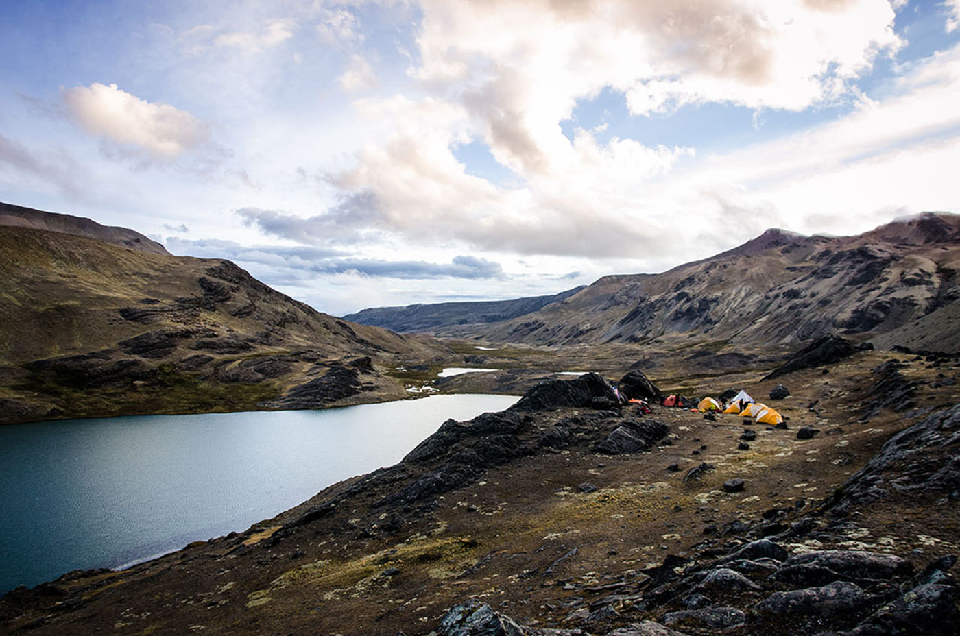
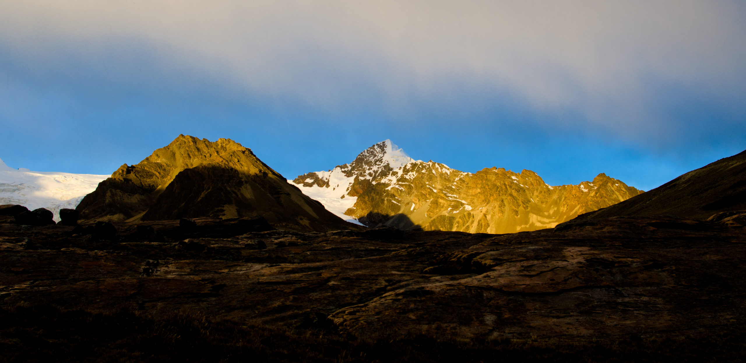
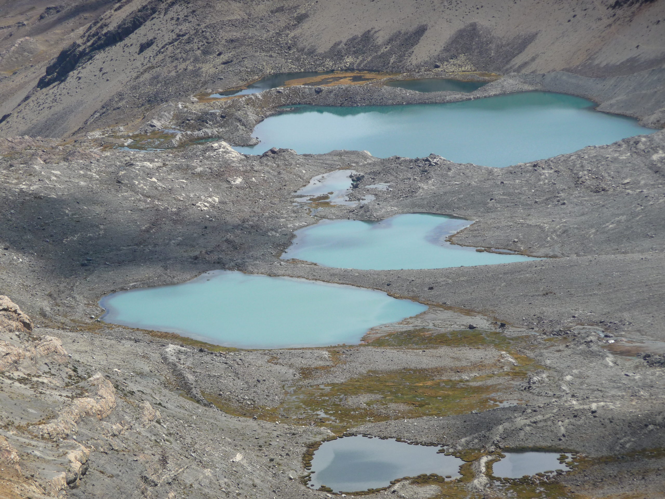
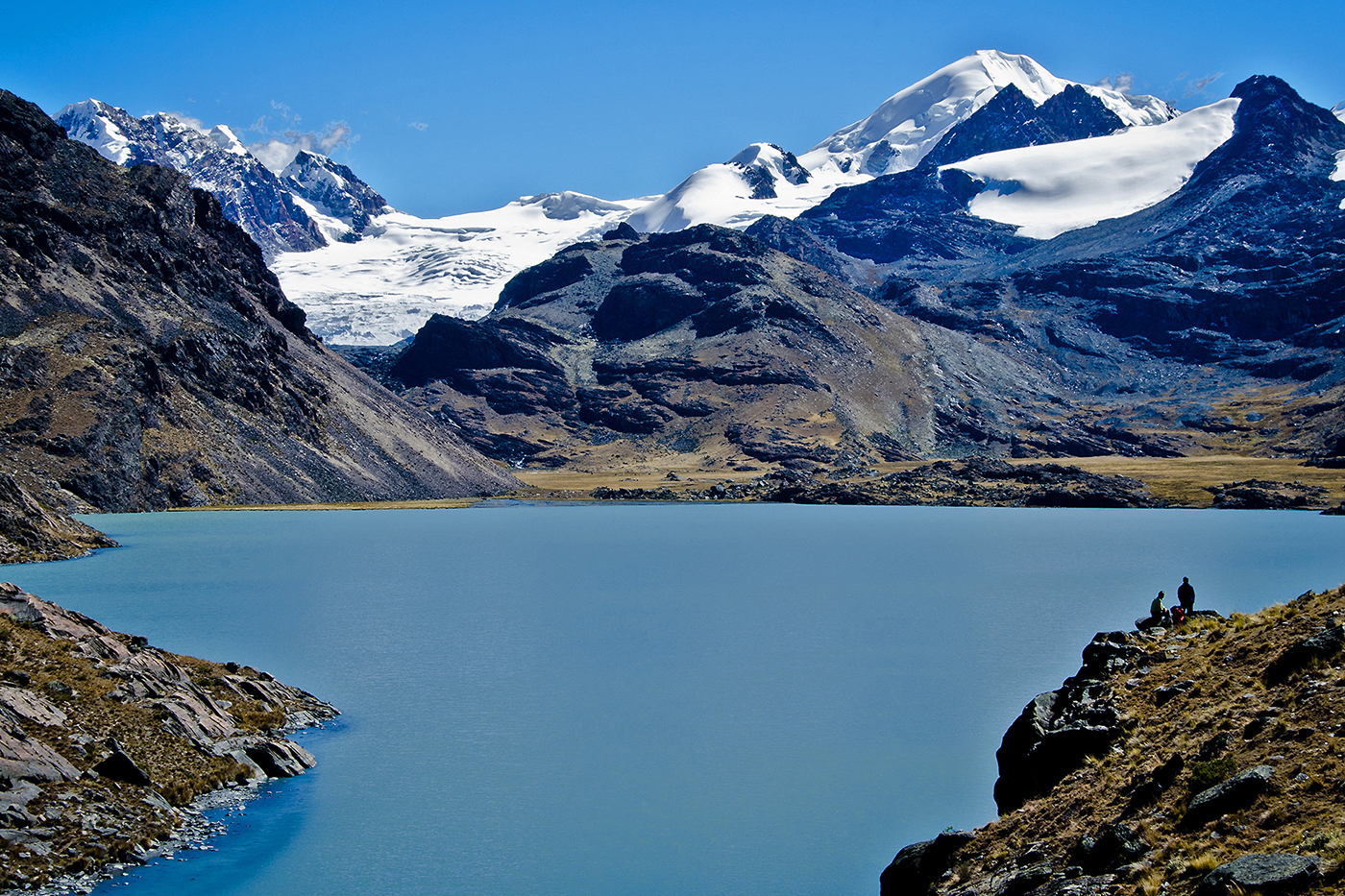
From the lake, we continue on an easy path north-west up to the next pass at 4950 meters/16,200 feet. The path follows the contour line, goes around a rock barrier and leads to a pass at 5000 meters/16,400 feet. Here, the views of the Cololo (or Anta Kjawa) and Huanacuni glaciers and the entire range are amazing. We descend into large valley on our left, cross a stream, and go up towards the north-east into the valley on our right and towards the two glaciers. We follow a stream and two big lakes before setting up camp on the shore of the third lake (4680 meters/15,300 feet above sea level). This place is definitely one of the Cordillera’s most beautiful and the panoramic view is breathtaking. Here we offer the option of heading up to the glacial lake at the foot of Cololo (4960 meters/16,300 feet above sea level), formally know as Anta Kjawa, a name it shares with the valley. From our camp, the way up to Cololo is easy, taking us to the north-east and towards the valley. From the valley we head east on our way back up. Trekking here can be a bit tricky because of the “bofedals”. Before heading back to camp, we reach the lake at the bottom of the Cololo glacier . The hike back to camp takes about 2 hours.
Special information :
Change in elevation: +480 m/-450 m
10:00 am
tent
breakfast, lunch, dinner
0
2-3h
From the base camp, we make an easy ascent north-east towards the valley and then go up We reach the beautiful little lake at the foot of Cololo glacier (2h30 from the previous night’s camp) and set up camp.
Special information :
Change in elevation: +280 m
01:00 am
tent
breakfast, lunch, dinner
0
11-12h
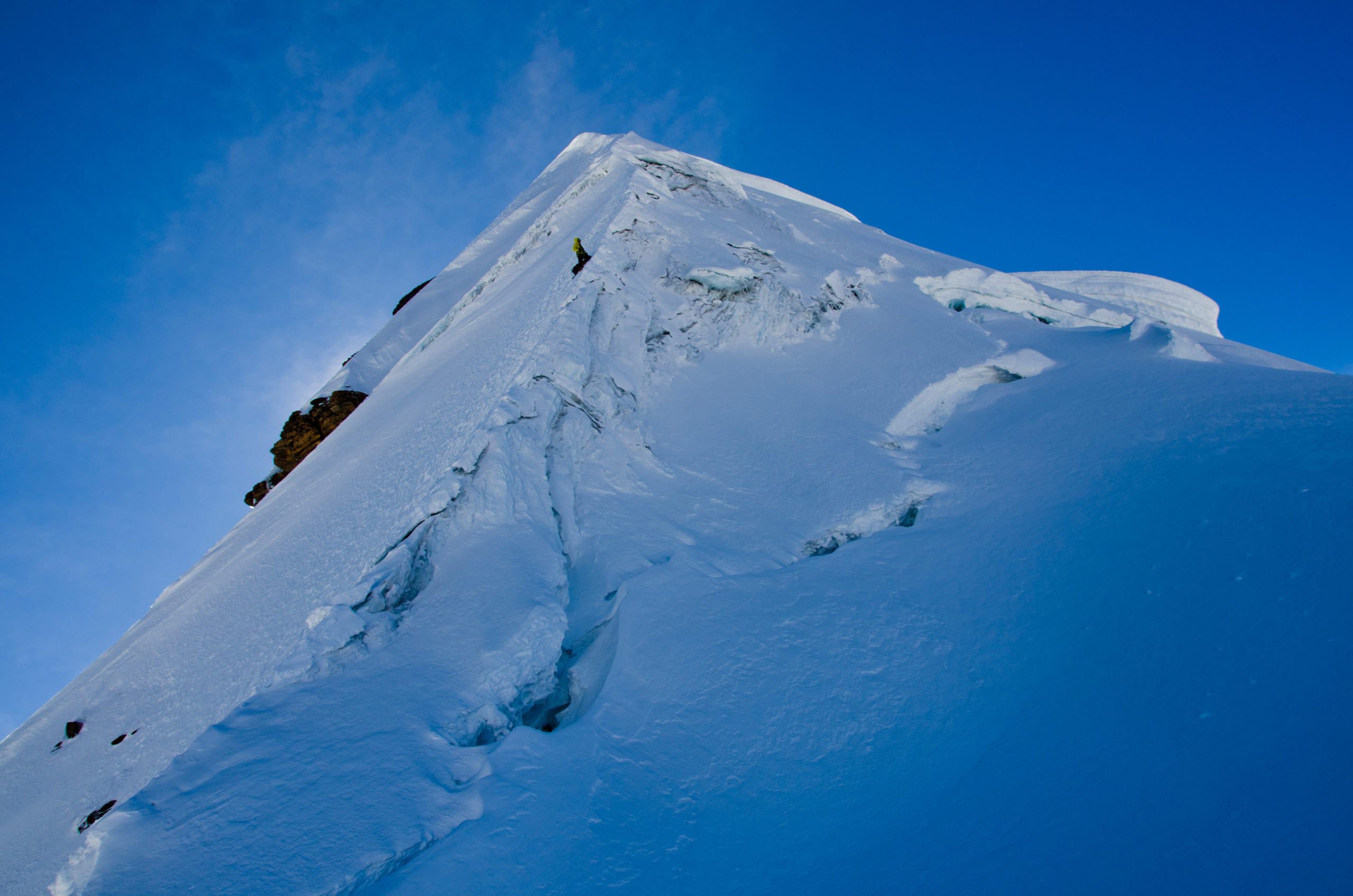
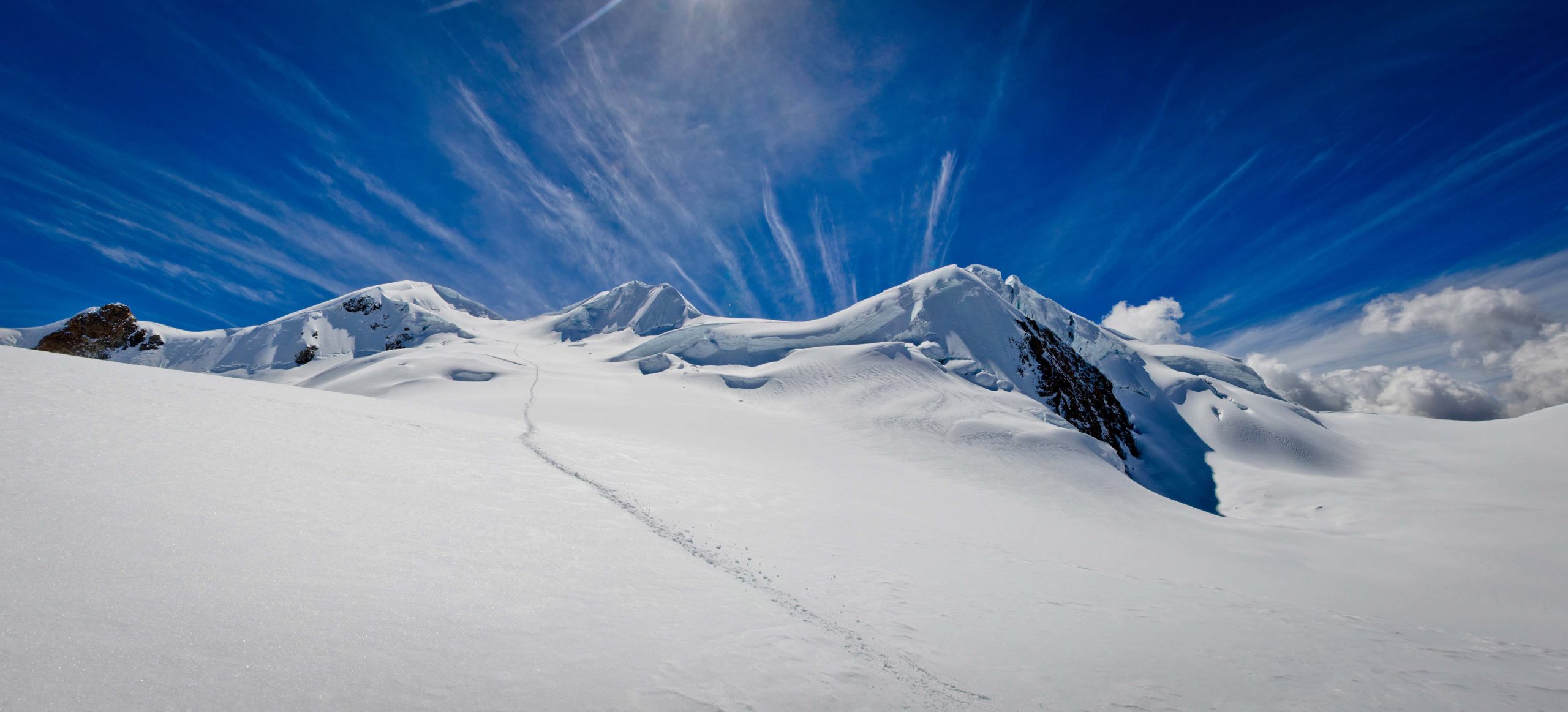
This is a technical and advanced ascent (D+/III). The glacier is at 5045 meters/16,600 feet above sea level. The climb to it is gradual (40º-45º) and has some technical crevasse crossings. After 3 hours ascent from the edge of the glacier, we arrive at a vast plateau. The main peak is to our right. From here, the ascent is steep (55º-60º). After about 2 hours, we reach the foot of the summit wall, which is 150 meters/492 feet high with a 70º slope. Climbing to the summit takes about 2 hours. We descend by the same route (5 to 6h walk)
Special information :
Change in elevation: +1050 m / -1320m
tent
breakfast, lunch, dinner
Day of rest.
10:00 am
tent
breakfast, lunch, dinner
0
2h
We start trekking towards the valley along the left side of the lake. We take a llama path up, which offers an easy ascent to 4850 meters/15,900 feet above sea level. We continue up a valley on the left to a pass at 5250 meters/17,200 feet and set up camp.
Special information :
Change in elevation: +350 m
03:00 am
tent
breakfast, lunch, dinner
8-9h
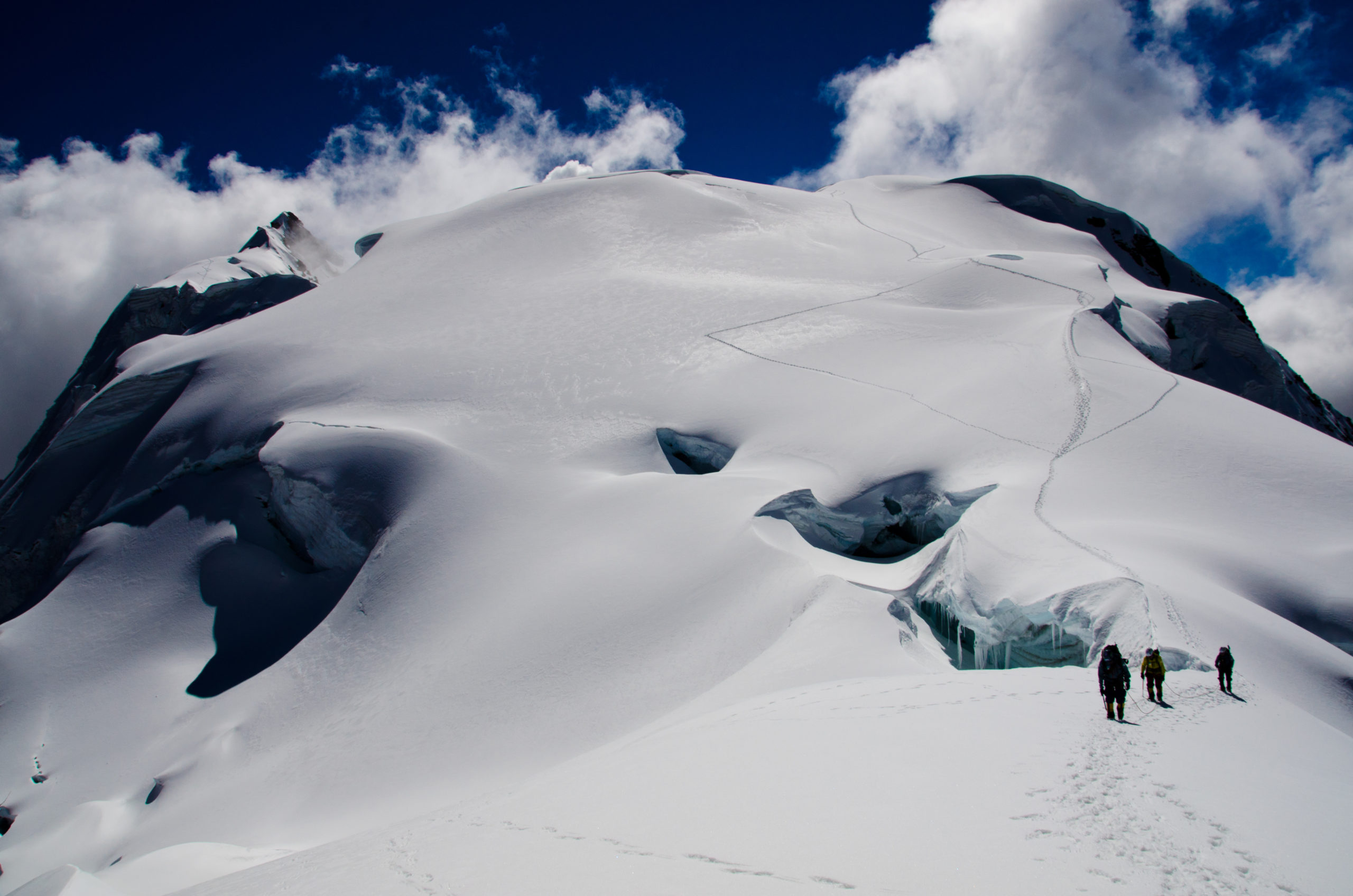
This is a technical and advanced ascent (AD+/III). We begin our ascent towards the glacial massif, passing a rocky barrier to reach an ice field. At 5150 meters/16,900 feet, we pass the bottom of the rocky barrier at a sandy moraine and arrive at the edge of the glacier (2h30 walk). The glacier slopes gradually upwards to 5330 meters/17,500 feet. At this point, it gets progressively steeper (45º/50º). We reach the ridges at 5500 meters/18,000 above sea level (less than 2 hour trek up). The view of the ridge and peak from here is gorgeous. We continue ascending over the ridges and reach a plateau below the main peak at 5615 meters/18,400 feet (2 hours). We continue up the remaining, and steep (65º), ridges and arrive, after about an hour, at the summit (5790 meters/19,000 feet). We descend by the same route to the pass at 5330 meters/17,500 feet (3 hours) and return to the Cololo camp.
Special information :
Change in elevation: +955 m / -1320m
08:00 am
tent
breakfast, lunch, dinner
0
7h
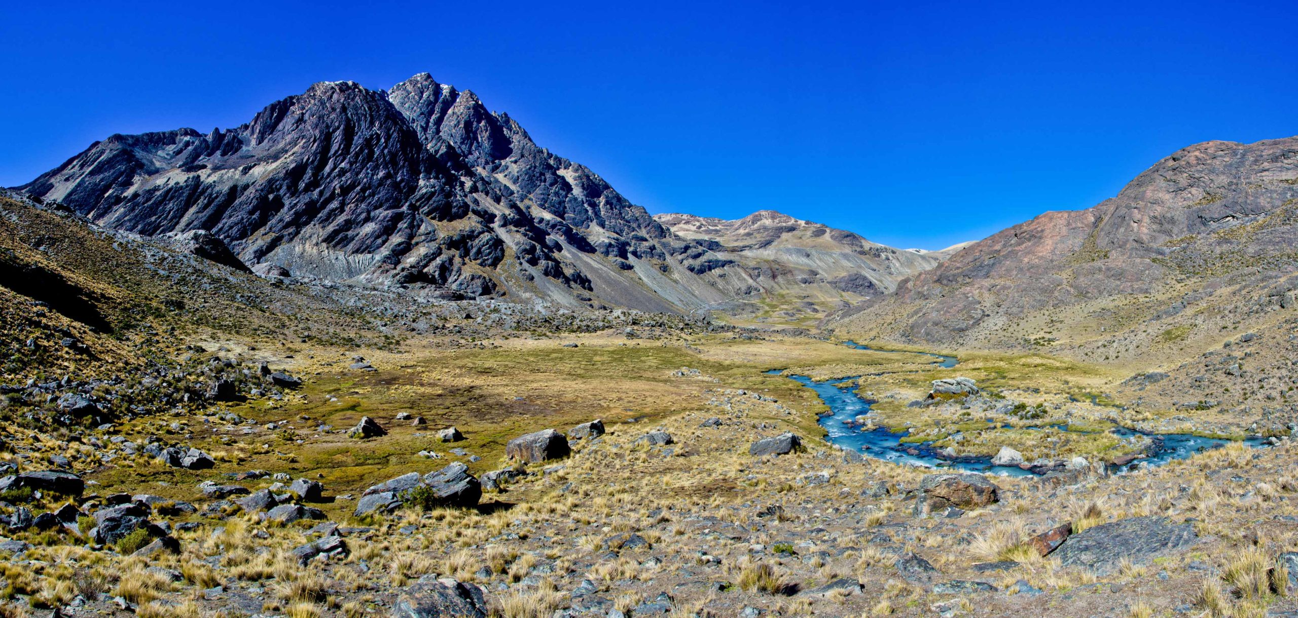
Leaving the beautiful glen of Cololo, we head north to 5260 meters/17,200 feet and a pass at the foot of the Huanacuni glacier (5790 meters/19,000 feet). The way up is not technical. The long descent takes us towards the north-west and into a large valley. The descent starts off easy in ashy soil but gets progressively more difficult. The crux is an unstable rock field. We pass through the main glen to reach a plateau at the foot of the glacial summits of Huanacani. The beautiful ridges of Huanacuni glacier are on the right. We pass three green lakes as we continue to the bottom of the valley. We cross a perpendicular valley, climbing up its right side to a large lake at 4750 meters/15,600 feet).
Special information :
Change in elevation: +580 m/-510 m
07:00 am
tent
breakfast, lunch, dinner
0
9h
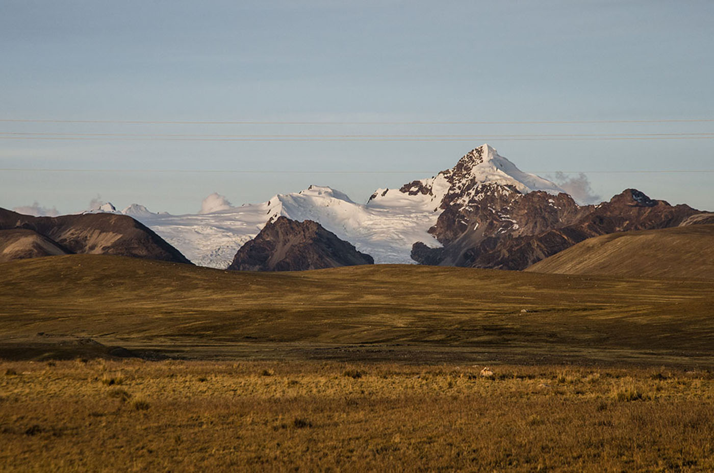
Our trek continues up and above the lake to a pass at 5120 meters/16,800 feet above sea level. The slopes are even and the walk is easy. We often find ourselves in the middle of llama and vicunas herds. We leave the magnificent Huanacuni massif behind and descend towards the lakes near the Pelechuco pass (4850 meters/15,900 feet). As we descend, we have a gorgeous view of the Cerro Presidente, Azucarani and Palomani Grande mountains with their peaks aligned from east to west. After a picnic on the lake shore, we hike up towards the north to a pass at 5230 meters/17.200 feet. We go around a rocky tower and follow a stream. As we get closer to the pass, we have an incredible view of Palomani Grande and the Azucarani Mountains, striped with ice-flutes that seem close enough to touch. After a steeper slope and we reach the pass. On the other side, the Chaupi Orco summit, the Cordillera’s highest peak, comes into sight. This area is home to Andean deer known as venado. The descent to our camp is gorgeous, with views of the west face of the Palomani Grande and a gray lake at its foot, and the eastern end of Lake Suches which borders Peru and has an important gold mine. We arrive to a stream-fed valley at the foot of the Palomani glacier and set up camp
Special information :
Change in elevation: +770 m/-800 m
09:00 am
tent
breakfast, lunch, dinner
0
5-6h
We continue north towards a valley with a meandering stream fed by a small lake with turquoise water. From there, we climb a rocky barrier above a bigger lake - Chucuyo Grande. The view of the glacial massif in front of us will likely be etched in our memory forever. It is a gigantic glacial barrier with multiple peaks, including the south peak of Chaupi Orco, the Cordillera’s highest. on the left. We descend to the valley floor and set up camp at the foot of the glaciers (Chaupi Orco high camp, 5135 meters/16,800 feet asl).
Special information :
Change in elevation: +605 m / - 200 m
01:00 am
tent
breakfast, lunch, dinner
0
13h
This ascent is moderately technical and fairly exposed (AD+/II) We do a steep and rocky climb to a pass at 5300 meters/17,400 feet above sea level. We the descend through a moraine, continuing along the seracs and ascending to the ice field below the south peak of Chaupi Orco (5315 meters/17,450 feet, 3 hours from camp). Ascending the glacial plateau is gradual. A steeper slope (55º) brings us to the crests below the summit at 5850 meters/19,200 feet. We go around a dome shaped formation on the left before arriving to a plateau. From there, the climb to the summit takes 2 about hours. We descend to the crests and take a left through the glacial valley. This is a less technical route (and can also be used for the ascent). We descend to the camp. The trek down from the summit is about 5 hours.
Special information :
Change in elevation: +1070 m / -1310m
09:00 am
tent
breakfast, lunch, dinner
3-4h
We dedicate the morning to exploring this magic place. We head north-east up to a pass at 5295 meters/17,350 feet that leads to the Chaupi Orco glacier. From here, the view of the glacier is amazing. In the afternoon, we head back to Palomani Grande camp taking a slightly different and faster way. From the rocky barrier, we take the path on a ledge. This is the only way accessible to our mules.
Special information :
Change in elevation: +115 m / -260 m
07:00 am
hotel
breakfast, lunch
9-10h
We departure in a 4x4 early in the morning from Palomani Grande camp towards the Pelechuco pass. We start a long crossing of the high plateau. The panorama of all the Apolobamba range on our left is gorgeous. We then descend towards Lake Titicaca and reach La Paz by the end of the day.
hotel
breakfast
Free day to explore La Paz
to be coordinated
none
breakfast
45 min

Transfer to El Alto and the international airport in a private vehicle (3 hours before the international flight departure time).