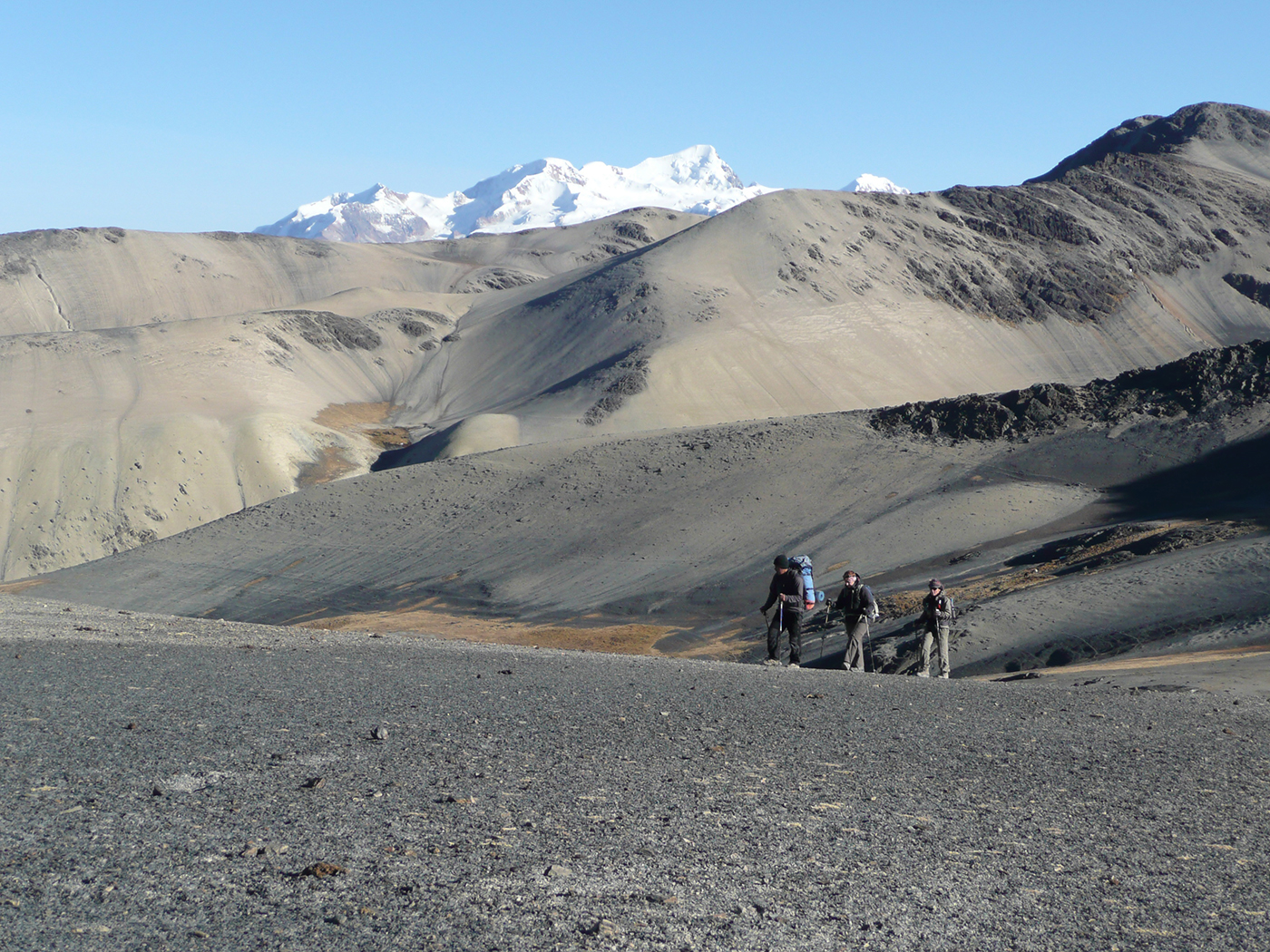
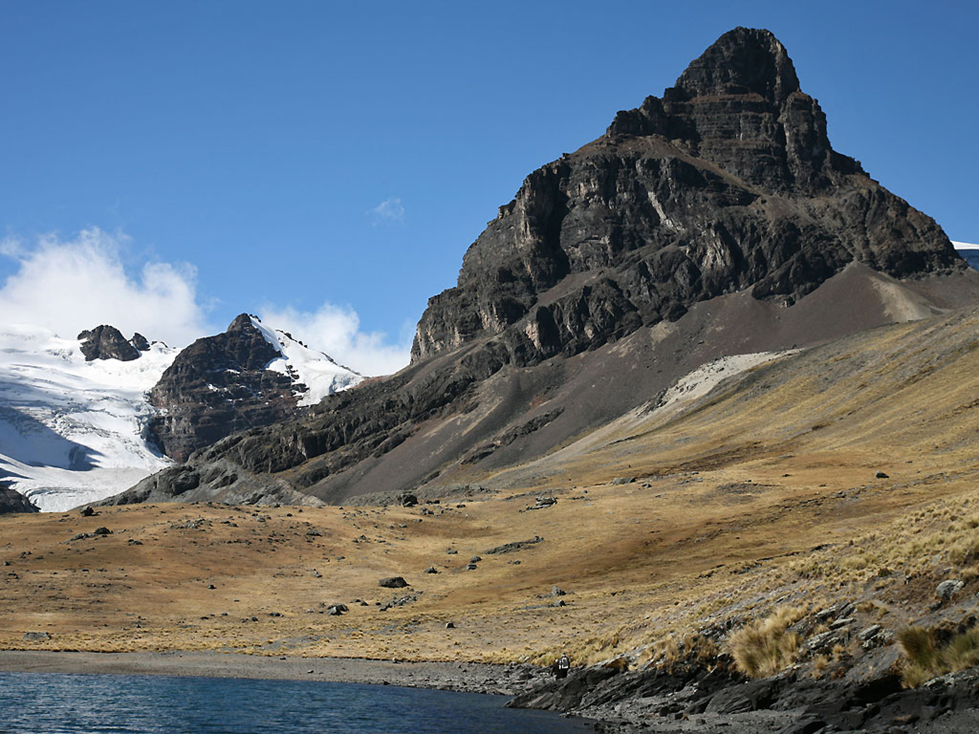
Sporty people with jimmy legs who love trekking may have heard about the Royal Cordillera. This part of the Andes, with peaks exceeding 6000 m, remains little explored and rarely frequented. In the heart of the Bolivian Altiplano, north-east of La Paz and east of Titicaca Lake, this playground for experienced trekkers let you walk out of the beaten tracks, through surprising and mineral valleys. Trekking in the Royal Cordillera is like exploring the soul of Bolivia. This Trek in the Royal Cordillera starts north east, and will satisfy wild spaces lovers with experience in demanding walks at high altitude. You’ll start taking altitude from the village of Sorata, and walk around the Illampu and Ancohuma Massifs, very close to the glaciers, with fantastic views over them. This trek will especially let you discover the west slopes of the Royal cordillera, on the side of the Altiplano, through a region inhabited with lagoons and abandoned by men. The track you will draw, because there is no path, will lead you to lagoons with varied shapes and colours, at the foot of little known and sumptuous glaciers, walking through deep and swampy valleys and crossing lunar and mineral landscapes. You’ve been warned…
16 days on the spot.
Private vehicle
NA
spanish speaking trekking guide
from 2.675 m to 5.300 m
from May to September
Day 1
Day 2
Day 3
Day 4
Day 5
Day 6
Day 7
Day 8
Day 9
Day 10
Day 11
Day 12
Day 13
Day 14
Day 15
Day 16
8:00 am
hostal
0
between 3.600 m and 2.675 m
03h30
0
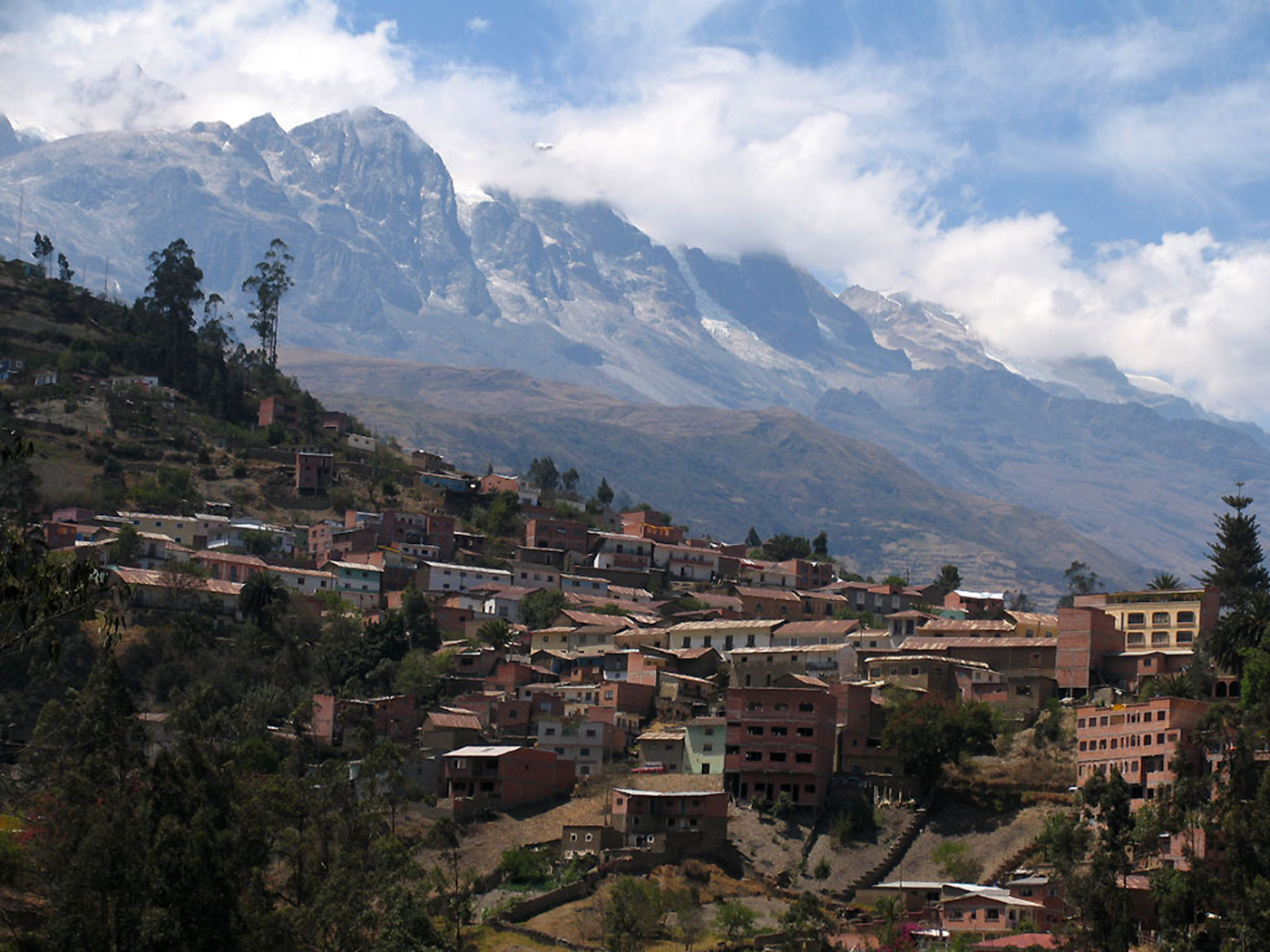
Depart from La Paz., following the Royal Cordillera and Huayna Potosi, towards Lake Titicaca. We descend to Sorata, (2675 meters / 8776 feet asl)) nested at the bottom of a steep valley at the foot of Illampu and Ancohuma Massifs. We spend the night here.
08:00 am
overnight under tent
breakfast, lunch, dinner
between 2.675 m and 4.200 m
0
6/7 h
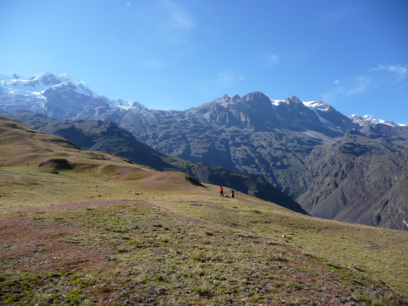
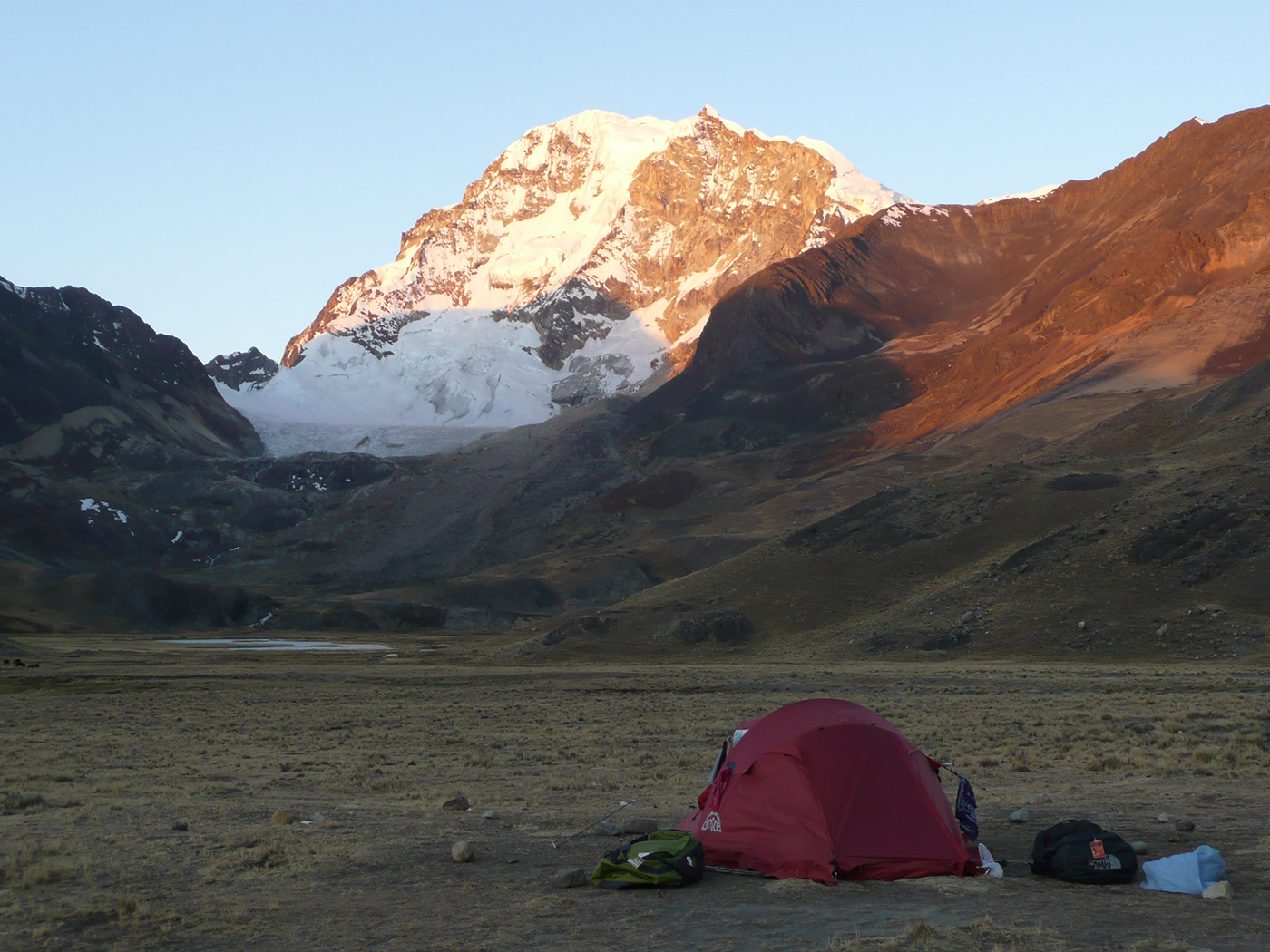
From Sorata, we head south-west, though fields scattered with houses. As we ascend, the majestic Illampu Massif comes into view, distracting us from the change in elevation. We make our way to Chilata Lake (4200 meters / 13 779 feet asl.) and, on a small plateau overlooking Sorata, make our camp. Bivouac near the lake for this second night trekking in the Royal Cordillera.
Special information :
Height Difference: +1520 m
08:00 am
overnight under tent
breakfast, lunch, dinner
between 4.200 m and 4.300 m
0
6-7 h
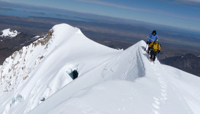
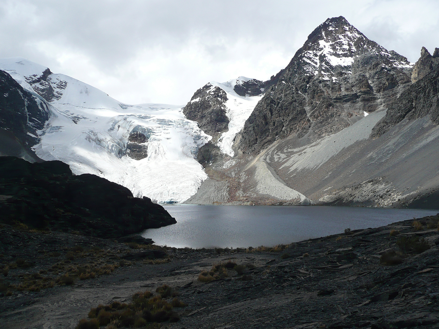
We continue up towards the south-east of the Royal Cordillera, cross a gap at 4400 meters / 14 435 feet asl, and follow a contour line on the west slope of Illampu and the Ancohuma Massif. We head up a steep slope over rocks to the Glacier Lagoon (5 045 meters / 13 779 feet asl). To the east, we have an amazing view of the Illampu Massif, seracs and vertical walls. From here, we have a rocky descent off-trail to Camp Venado at 4300 m above sea level.
Special information :
Height Difference: +900 m/-795 m
08:00 am
overnight under tent
breakfast, lunch, dinner
entre 4.300 m et 4.360m
0
6-7 h
The trek in the Royal Cordillera begins south on a balcony route on the mountainside, up to a pass at 4350 meters / 14 271 feet above sea level, overlooking a large valley and the the Susana Mine (silver and tin). As we descend, we see traces of mining activity etched in the mountain. We follow the west slope of the Achachi Khollu Mountain (4363 meters / 14 314 feet asl.). Before descending to the village of Millipaya (3475 meters / 11 400 feet asl.), we cross a creek, head south on the other side of the valley, and climb up to Khota Pata Lake (4052 meters / 13 293 feet asl.), with the Chuto Kalani mountain (4388 meters / 14 396 feet asl) in the foreground. We continue to the south, passing a number of small lakes, to Lojena (4360 meters / 14 304 feet asl.), where we set up camp overlooking the Millipaya Valley.
Special information :
Height Difference: +640 m/-610 m
08:00 am
overnight under tent
breakfast, lunch, dinner
between4.360 m et 4.520 m
0
5/6 h
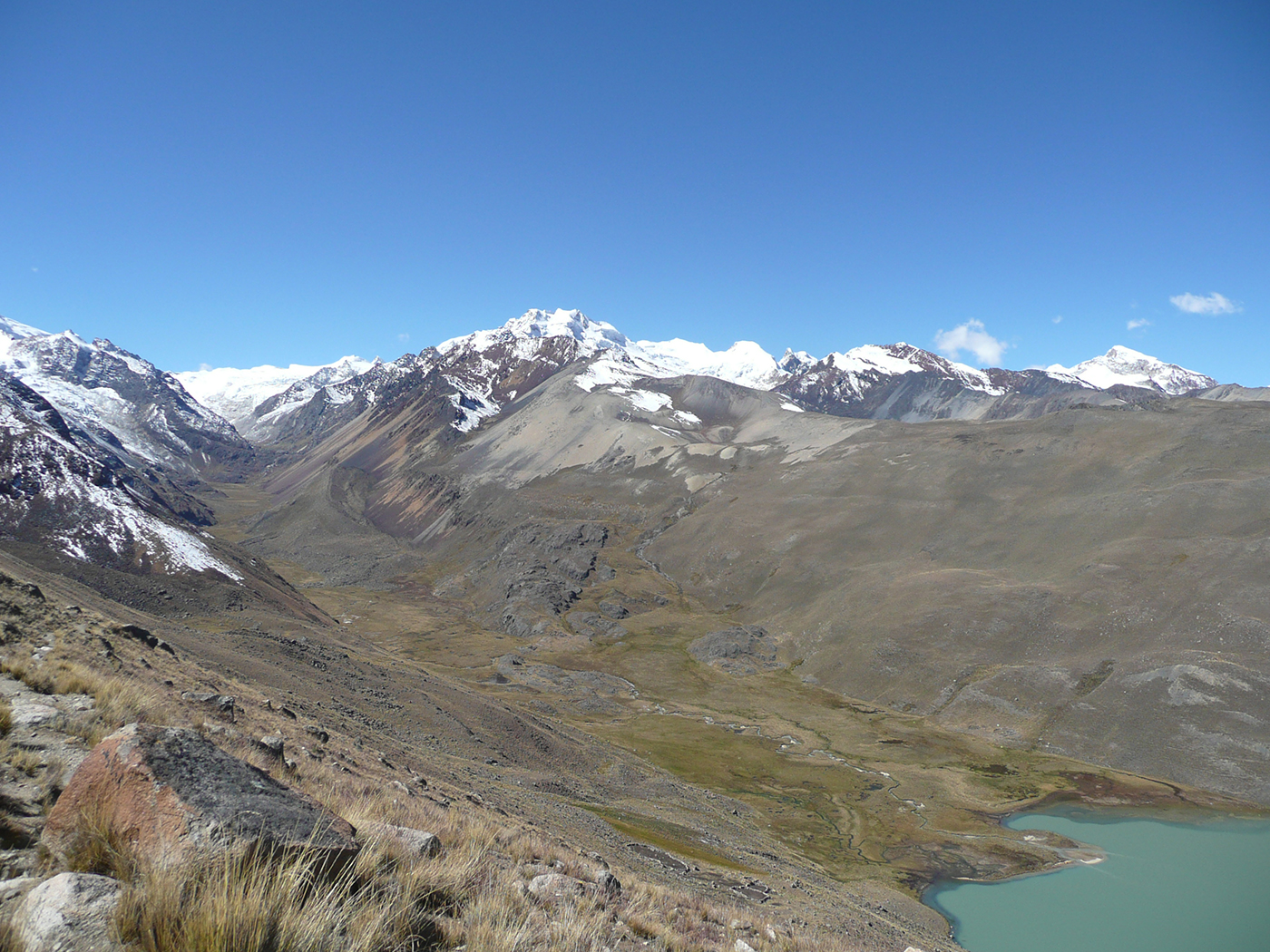
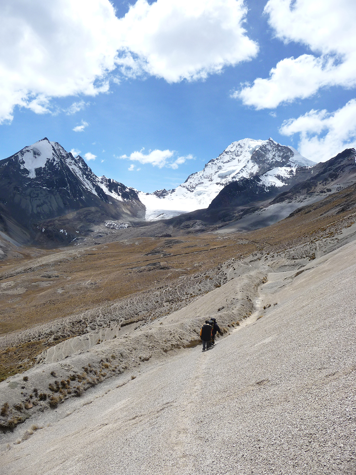
Our trek rolls with the landscape. Our view stretches from the Altiplanoto Lake Titicaca. Our last ascent takes us to the Chotanlona Pass (4910 metres / 16 108 feet asl.) surrounded by the Illampu, Ancohuma and Chearoco Massifs and the Calzada Glacier. We descend towards the east and Lake San Francisco, turquoise in color and nestled in a valley. Hot springs are nearby. We camp on the shore of the lake.
Special information :
Height Difference: +700 m/-560 m
08:00 am
overnight under tent
breakfast, lunch, dinner
between 4.520 m et 4.720 m
0
6/7 h
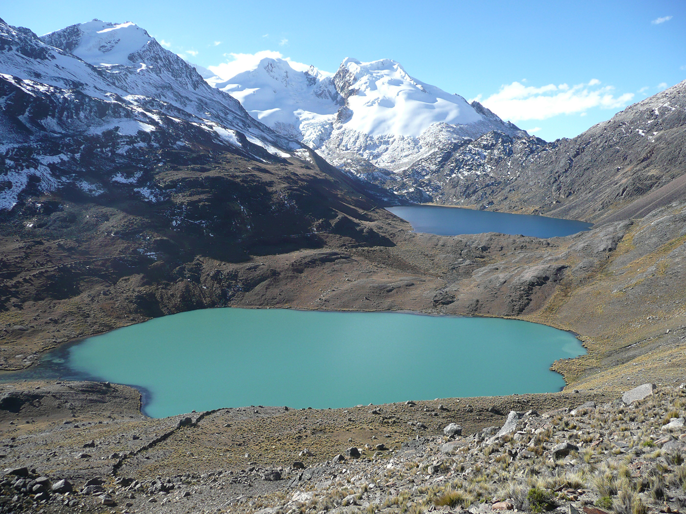
We ascend 3 passes at almost 5000 m above sea level (16 404 feet asl). Our day’s trek goes south-east until Ajoyan Lake, at about 4780 m above sea level (15 682 feet asl), heads to the north-west to a beautiful valley with 2 turquoise lakes - Chojña Khota Lake (4722 meters / 15 485 feet asl.) and Carizal Lake (4767 meters / 15 639 feet asl.), and ends at the foot of Calzada Pass and its peak (5650 meters / 18 536 feet asl.). We set up camp next to the lake, one of the most gorgeous places of the Royal Cordillera.
Special information :
Height Difference: +745 m/-510 m
08:00 am
overnight under tent
breakfast, lunch, dinner
between 4.720m et 4.560m
0
3-4 h
In the morning you can choose either to relax in the sun around the lake, or climb up to the Calzada Pass to the Carizal Lake. In this case, we follow the shoreline towards the north-east up to the Calzada Pass (5050 meters / 16 568 feet asl.), nestled between the Kasiri and Calzada Massifs. We descend by the same route to Chojña Khota. After lunch, we head out towards the south to Lake Jistaña. We cross a pass at 5100 meters / 16 732 feet asl and descend through the valley to the lake.
Special information :
Height Difference: +350 m/-515 m
08:00 am
breakfast, lunch, dinner
overnight under tent
between 4.560m et 4.820m
0
7h
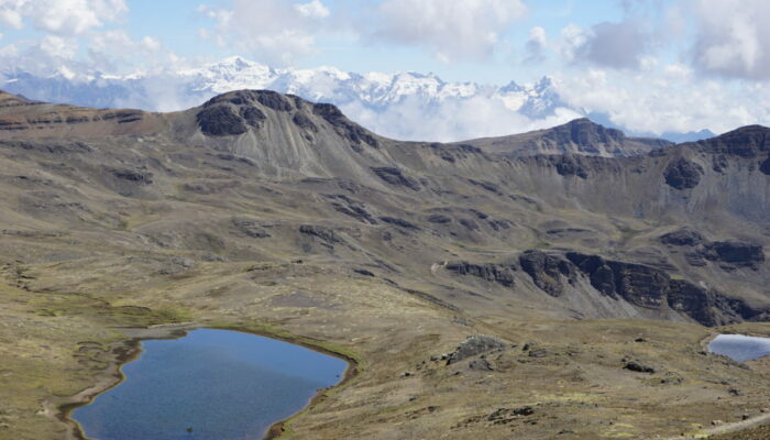
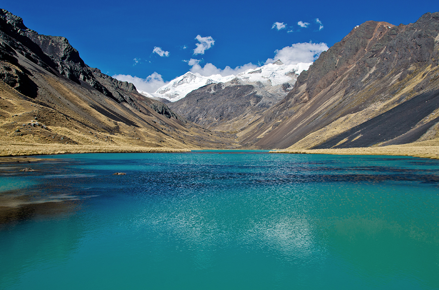
We hike to Chiscacalliuani Lake. Our day’s trek takes us west across the mountain and south to Niquioyo Khota Lake (4672 meters / 15 328 feet asl.). We see the Condor Jipina (5 315 meters / 17 437 feet asl.) in the foreground. We follow a ridge towards the south-west that offers an amazing panorama of the Altiplano and Lake Titicaca. We continue across 2 passes, the first at 4950 meters ( 16 240 feet asl) and the second at 5000 meters ( 16 404 feet asl), descending through a steep scree to the green waters of Chiscacalliuani Lake.
Special information :
Height Difference: +800 m/-585 m
08:00 am
overnight under tent
breakfast, lunch, dinner
between 4.560m et 4.480 m
0
7/8 h
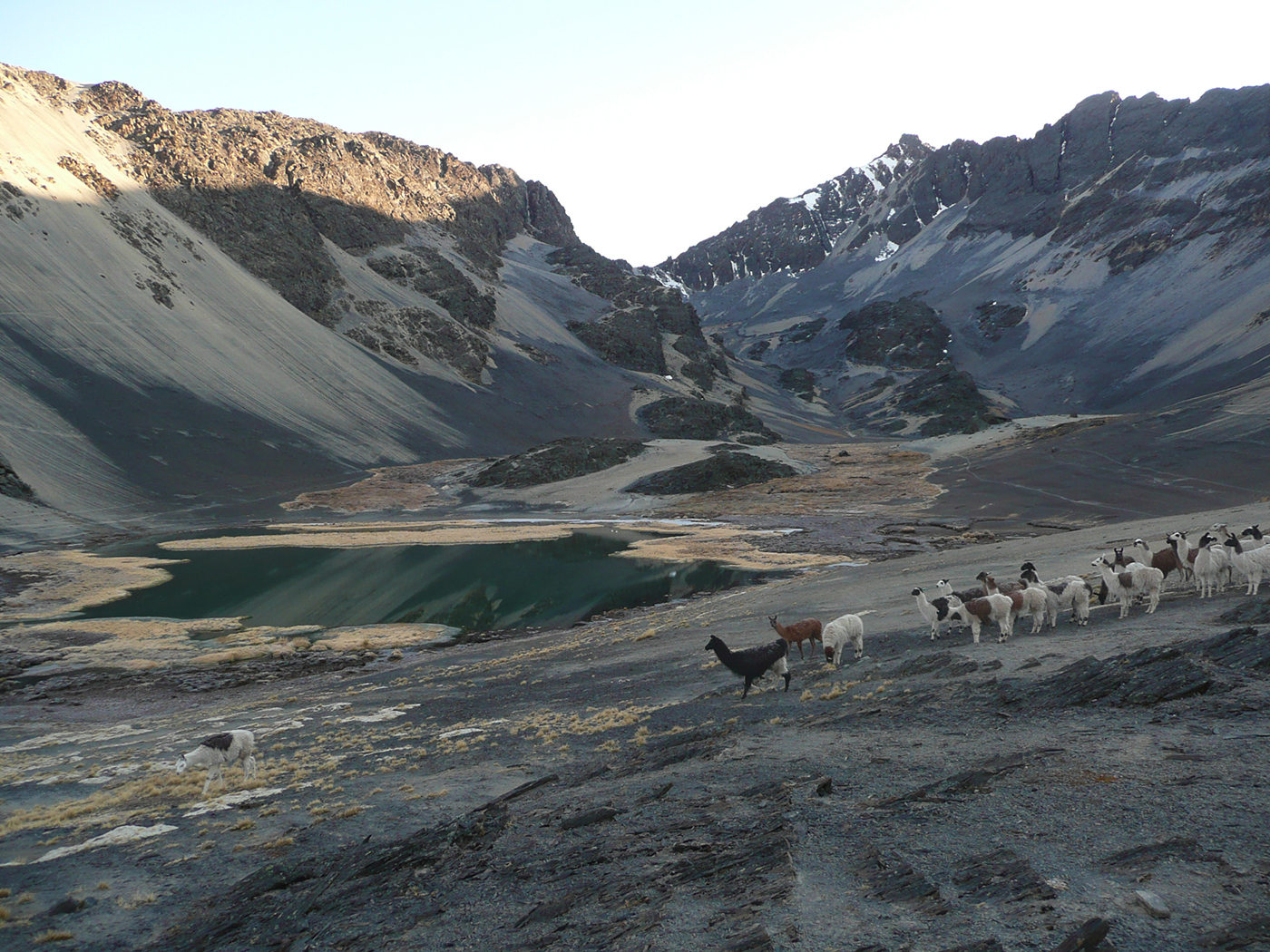
We head towards the south to the swampy valley of Chacha Kumani Valley (4430 meters / 14 534 feet asl.) and its glacier massif. After crossing the “bofedals” (swampy zones with soaked moss), we start up the valley to the north-east, crossing some plateau to a pass at 5000 m ( 16 404 feet asl). Along the way, we have a clear view of the Chachacomani glacier (6074 meters / 19 927 feet asl.). We descend into the Pur Purani Valley, cross 3 passes and reach the Rio Jayllawaya Valley (4480 meters / 14 698 feet asl), where we set up camp.
Special information :
Height Difference: +905 m/-1210 m
08:00 am
overnight under tent
breakfast, lunch, dinner
between 4.480 m et 4.450 m
0
7-8 h
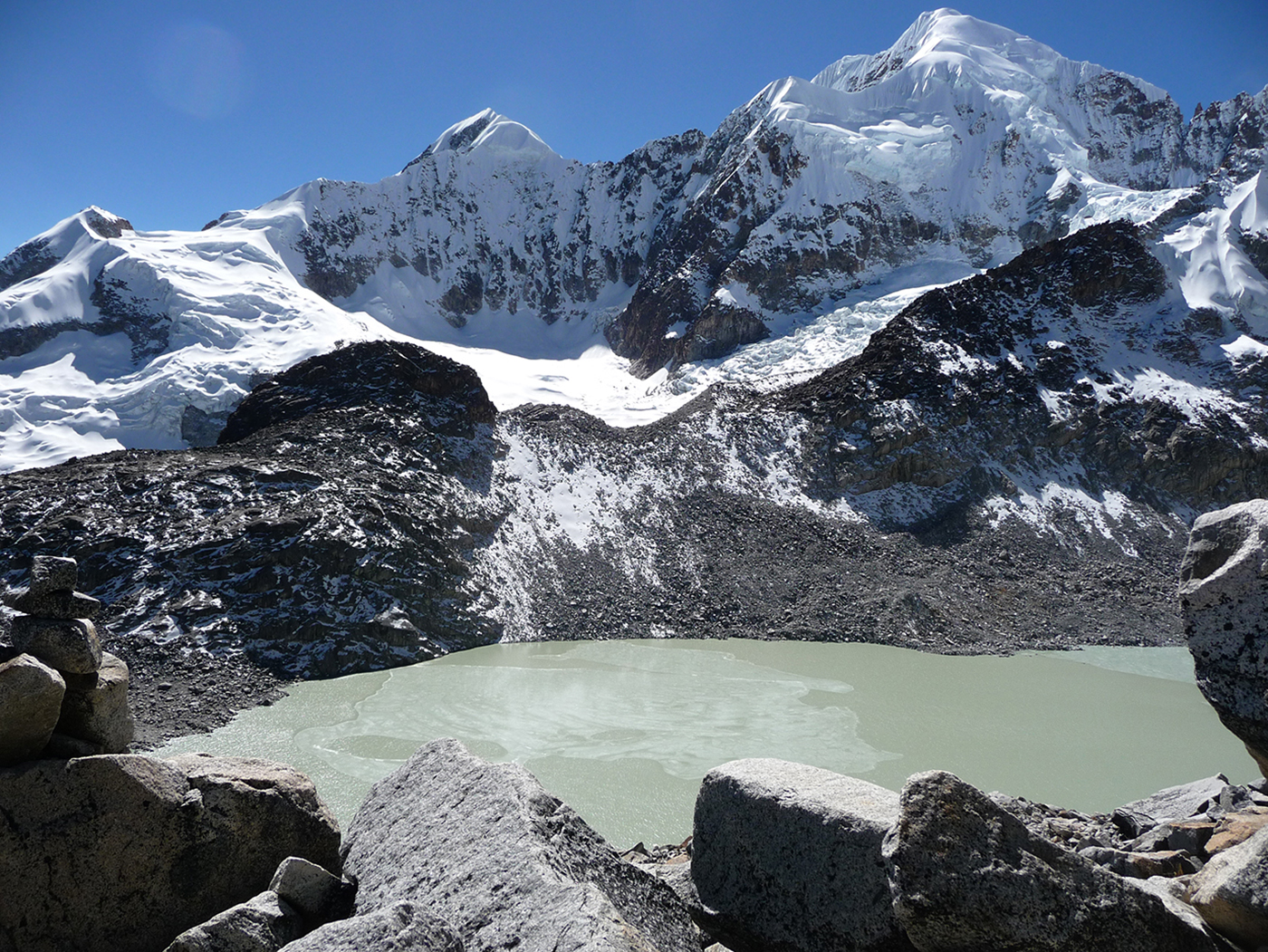
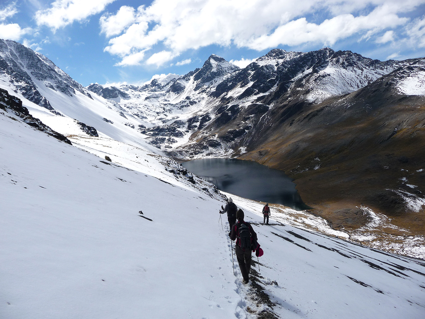
We start the day with a hike up a steep slope to a higher plateau (4620 meters / 15 157 feet asl.) and towards the Wara Warani Lagoon. Our trek takes us into a valley and across a rocky barrier before arriving at the Lagoon at 4930 m ( 16 174 feet asl) at the foot of the Wara Warani glacier. The glacier feeds a small lake with turquoise waters, while the Lagoon has a deep blue color. Very surprising and magic! After enjoying the beauty of the place, we follow the lake and climb south-east to a steep pass (5500 meters / 18 044 feet asl)) overlooking the Kunu Pampa glacier. We descend through a scree and across an ice field to an isolated valley, at about 4760 m (15616 feet asl. After we cross this valley, we continue south-east to the Minchin pass (5000 meters / 16 404 feet asl.), and descend to the Khotia lagoon (4450 meters / 14 599 feet asl.).
Special information :
Height Difference: +810 m/-840 m
08:00 am
overnight under tent
breakfast, lunch, dinner
between 4.450 m et 4.615 m
0
5h
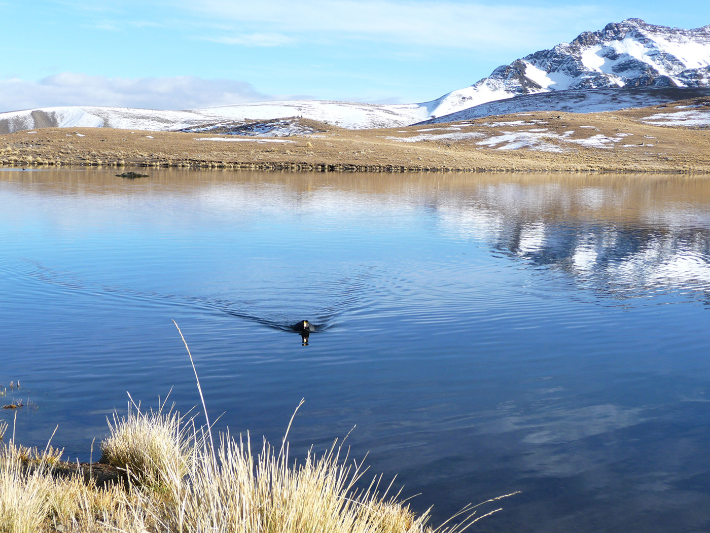
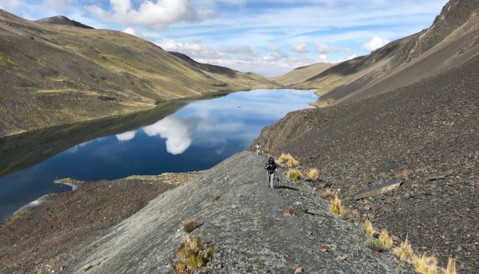
From the Khotia Lake, the trail to Chiarkhota Lake is non-technical and among the most traveled in the Royal Cordillera. We start towards south, ascend to the “Contador” pass (4760 meters / 15 616 feet asl.), which offers a pretty view of mountain peaks that seem to plunge into a large valley. Lake Alka Quta is in view, as is the Palcoco nmine. We continue our descent to the valley following the cordillera, crossing a semi-swampy area close to the Surakhota lake (4410 meters / 14 468 feet asl.), and then heading up towards the south-east on the mountain to the Ajwani Lake (Lake of the birds, 4615 meters / 15 141 feet asl.), home to many ducks.
Special information :
Height Difference: +550 m/-385 m
08:00 am
overnight under tent
breakfast, lunch, dinner
between 4.615 m et 4.700m
0
4h
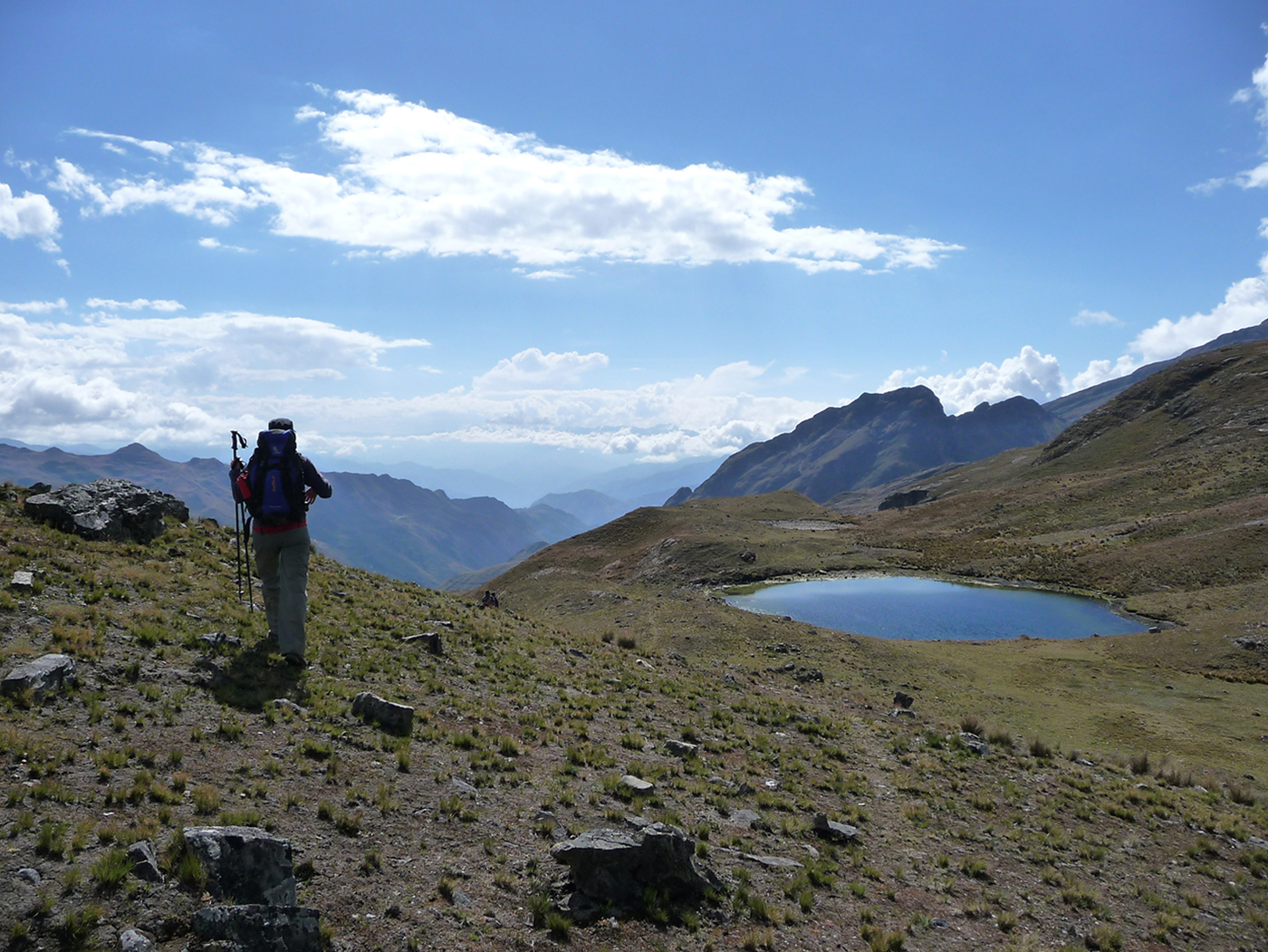
We head south-east following the mountain. The Ajwani Lake remains in sight until we reach the next valley. After crossing the Milluni pass (4910 meters / 16 108 feet asl.), where Huayna Potosi seems close enough to touch, we descend to Sistaña Lake (4670 meters / 15 321 feet asl.). We then head up towards the south-west to the Janchallani pass at 4885 meters (16 026 feet asl). We have an amazing view of the Condoriri Massif, one of the most beautiful glaciers of the cordillera. We descend to Jurikhota Lake (4700 meters / 15 419 feet asl.), nested in a narrow valley, with the head and the left wing of the Condor in sight.
Special information :
Height Difference: +530 m/-445 m
08:00 am
overnight under tent
breakfast, lunch, dinner
between 4.700 m and 4.680 m
0
5h
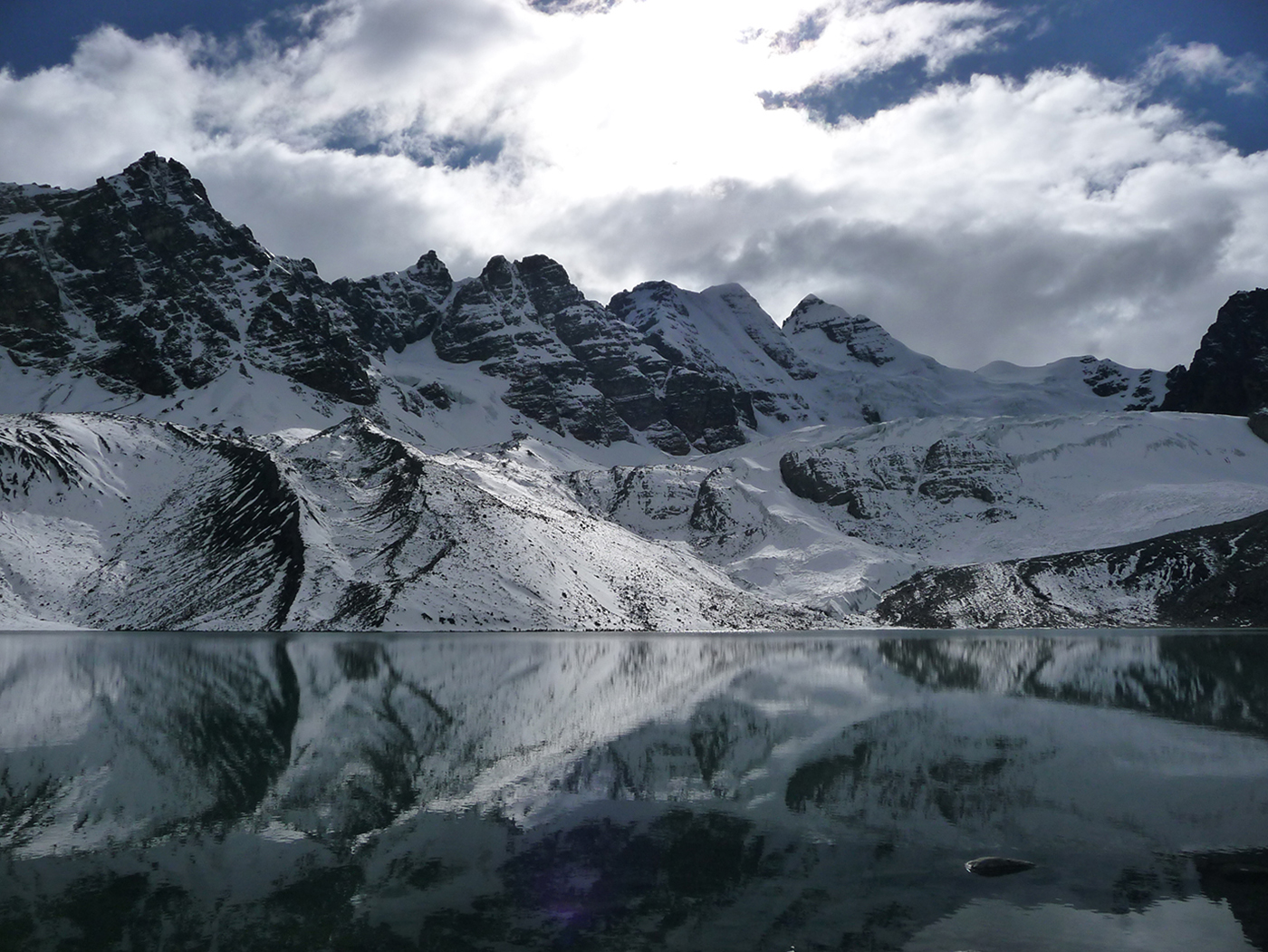
We start off the day in the Royal Cordillera towards the north-east, following the lake to a moraine. We climb up to Congelada lake (4880 meters / 16 010 feet asl.). The place is magic. The view is splendid, with the Condoriri glacier plunging into turquoise waters. The cliffs of the Left Wing and the Head of the Condor look imposing from here. We continue to the south-east and up a steep slope to the Austria pass at 5140 meters / 16 863 feet above sea level. A steep trek up screed terrain to its peak (5330 meters / 17 486 feet asl ) is optional before starting the descent. The Austria peak offers the best view of the Condoriri massif. We descend towards the south-east to Chiarkhota Lake (4680 meters / 15 354 feet asl), where we set up camp.
Special information :
Height Difference: +505 m/-695 m
08:00 am
overnight under tent
breakfast, lunch, dinner
4.680m
0
7h
We start towards the east to the Jallayko pass (5025 meters / 16 486 feet asl.) at the foot of the Aguja Negra. As we gain elevation, the Pequeño Alpamayo glacier comes into sight. On the other side of the pass, we see rocky peaks. We descend into the next valley and then climb to the Tillipata pass (5000 meters / 16 404 feet asl.) and the Tuni lake. Amazing view of the lakes, Huayna Potosi and Maria Lloco peak accompany our ascent. We descent to the Wichu Khota lake and set up the camp.
Special information :
Height Difference: +845 m/-845 m
09:00 am
overnight under tent
breakfast, lunch, dinner
between 4.680 m and 4.700m
0
5-6 h
We pass many lakes before reaching the old camp of the Santa Fe mine. From there, we continue south-east to the Campo Canal and the the glacier lake of Huayna Potosi, at the foot of its west face.
Special information :
Height Difference: +220 m/-200 m
09:00 am
none
breakfast, lunch
between 4.700m and 3.600m
3h
4h00
For our last day in the Royal Cordillera, we ascend to Paso Miluni at 5000 meters / 16 404 feet asl. The view of Huayna Potosi’s west face is amazing. We hike around the massif to its east face and the Casa Blanca refuge at 4795 meters / 15 731 feet above sea level. Our trek ends here, at the foot of Huayna Potosi. We return to La Paz.
Special information :
Height Difference: +300 m/-200 m