Condoriri Trekking

The Condoriri trekking is a very nice trek without great technical difficulty, relatively close to La Paz, and allowing beautiful views of the Condoriri massif. It allows you to gain height, always in “mode” trek to Pic Austria which culminates at 5300m above sea level. It also allows you to experience part of the wild atmosphere of the Bolivian Andes and disconnect completely in the heart of exceptional nature. Breathtaking view of the imposing “Condor´s head”. A very nice atmosphere for average trekkers.

Overview :

Length of stay :

3 days on the spot.

Transport :

Driver with private vehicle

Entry of the sites :

Included

Guide :

Spanish speaking trekking guide

Altitude of the journey:

between 3.600 and 5.300 m asl

Best moment of year :

from may to October

Request a custom quote, free and without commitment: Get free quote

Steps and highlights:

Main steps:

Day 1

Day 2

Day 3

Highlights:

  • Beautiful trek without difficulty and offering a beautiful atmosphere for average trekkers
  • Discovery of beautiful lagoons
  • Breathtaking view of the Condoriri from Pic Austria

Day 1 : LAPAZ - LAGUNA KHOTIA - LAGUNA AJWANI (4615 meters / 15 141 feet asl.)

More infos
Departure :

08:00 am

Accommodation :

tent

Meals included :

lunch, dinner

Altitude :

Time of transport :

3h

Walking time :

5h

LAPAZ - LAGUNA KHOTIA - LAGUNA AJWANI (4615 meters / 15 141 feet asl.)

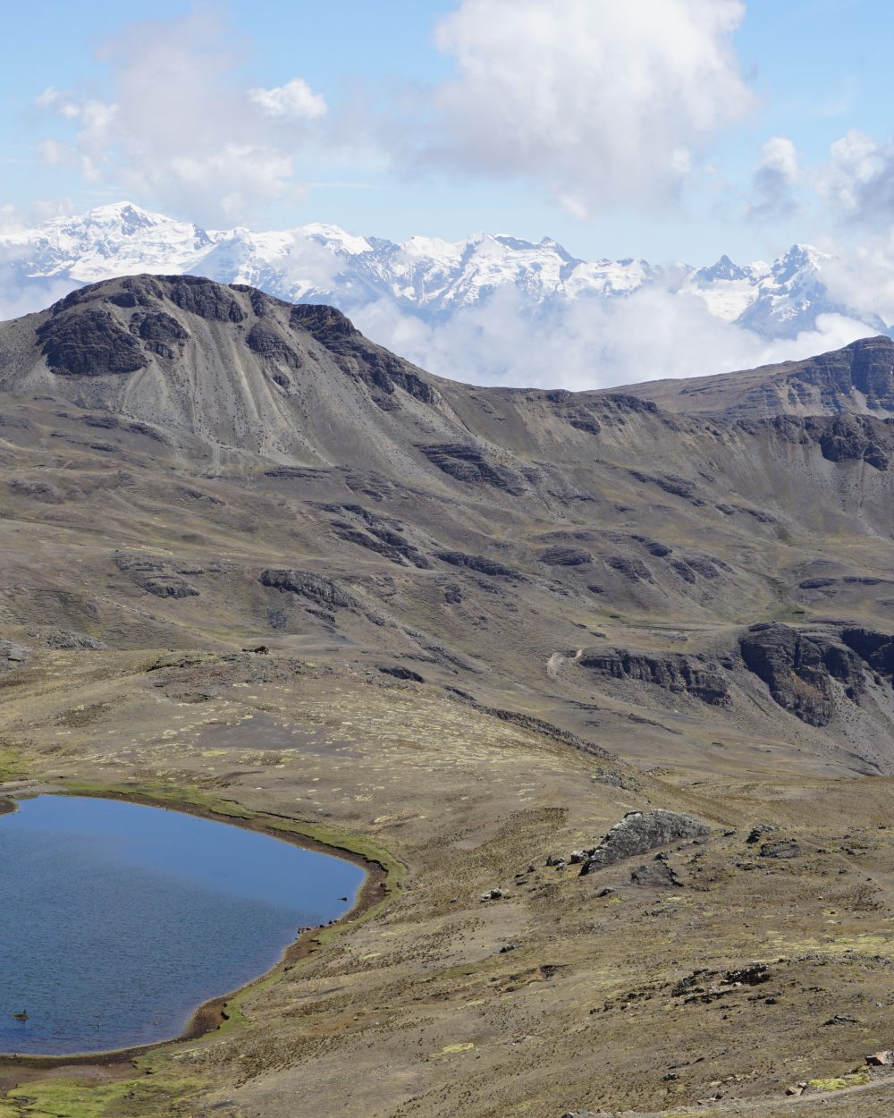
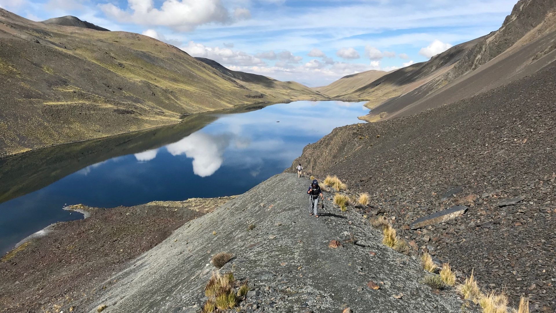
Departure from La Paz to reach the Laguna Khotia located in the south part of the Cordillera Real. From the Khotia Lake, the trail to Chiarkhota Lake is non-technical and among the most traveled in the Royal Cordillera. We start towards south, ascend to the “Contador” pass (4760 meters / 15 616 feet asl.), which offers a pretty view of mountain peaks that seem to plunge into a large valley. Lake Alka Quta is in view, as is the Palcoco nmine. We continue our descent to the valley following the cordillera, crossing a semi-swampy area close to the Surakhota lake (4410 meters / 14 468 feet asl.), and then heading up towards the south-east on the mountain to the Ajwani Lake (Lake of the birds, 4615 meters / 15 141 feet asl.), home to many ducks.

Special information :
Change in elevation: +550 m/-385 m

Day 2 : LAGUNA AJWANI (4615 meters / 15 141 feet a.s.l) - LAGUNA JURIKHOTA (4700 meters / 15 419 feet a.s.l)

More infos
Departure :

09:00 am

Accommodation :

tent

Meals included :

breakfast, lunch, dinner

Altitude :

Time of transport :

0

Walking time :

4h

LAGUNA AJWANI (4615 meters / 15 141 feet a.s.l) - LAGUNA JURIKHOTA (4700 meters / 15 419 feet a.s.l)

Special information :
Change in elevation: +530 m/-445 m

Day 3 : LAGUNA JURIKHOTA (4700 meters / 15 419 feet a.s.l) - LAGUNA CONGELADA - AUSTRIA PASS (5140 meters / 16 863 feet a.s.l) - LAGUNA CHIARKHOTA (4680 meters / 15 354 feet a.s.l)- RINCONADA (4505 meters / 14 780 feet asl.) - LA PAZ (3600 meters / 11 811 feet asl.)

More infos
Departure :

09:00 am

Accommodation :

none

Meals included :

breafast, lunch, dinner

Altitude :

Time of transport :

3h

Walking time :

6h

LAGUNA JURIKHOTA (4700 meters / 15 419 feet a.s.l) - LAGUNA CONGELADA - AUSTRIA PASS (5140 meters / 16 863 feet a.s.l) - LAGUNA CHIARKHOTA (4680 meters / 15 354 feet a.s.l)- RINCONADA (4505 meters / 14 780 feet asl.) - LA PAZ (3600 meters / 11 811 feet asl.)

We start off towards the north-east, following the lake to a moraine. We climb up to Congelada lake (4880 meters / 16 010 feet asl.). The place is magic. The view is splendid, with the Condoriri glacier plunging into turquoise waters. The cliffs of the Left Wing and the Head of the Condor look imposing from here. We continue to the south-east and up a steep slope to the Austria pass at 5140 meters / 16 863 feet above sea level. A steep trek up screed terrain to its peak (5330 meters / 17 486 feet asl ) is optional before starting the descent. The Austria peak offers the best view of the Condoriri massif. We descend towards the south-east to Chiarkhota Lake (4680 meters / 15 354 feet asl), which is the base camp for Condoriri and Pequeño Alpamayo. Walking to reach the Rinconada spot where the vehicle is waiting. Private transfer to return to La Paz.

Special information :
Change in elevation: +505 m/-695 m

Do you like this trip ?

Contact us