10 days on the spot.
Spanish speaking driver and private vehicle
Included
Spanish speaking trekking guide
from 3600 m asl à 5200 m asl
from May to August
Day 1
Day 2
Day 3
Day 4
Day 5
Day 6
Day 7
Day 8
Day 9
Day 10
06h30
refuge
lunch, dinner
between 3.600 m asl and 3.870 m asl
09-10h
0
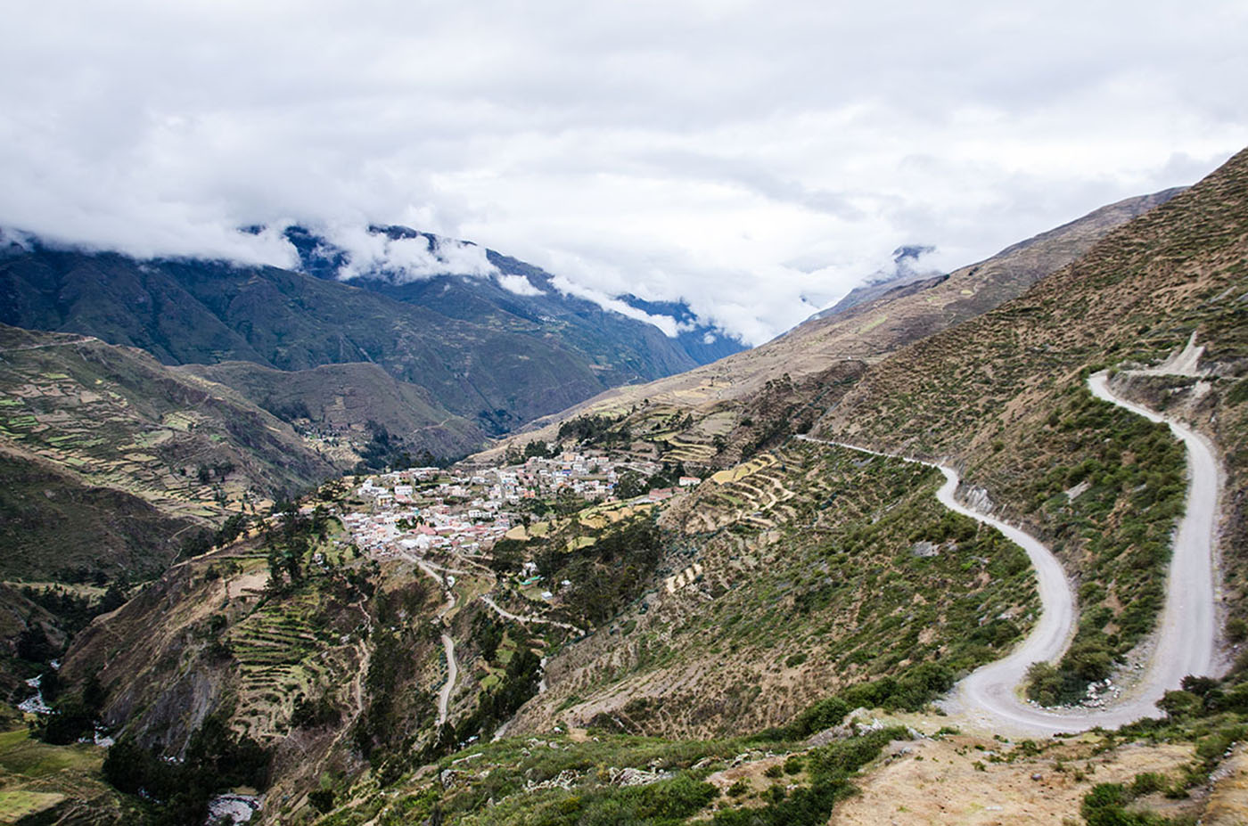
We depart in the morning for a long drive north towards the Apolobamba Mountain. We pass along Lake Titicaca and twist and turn around several passes, up to the highlands at the foot of the mountain. We arrive in the afternoon to the village of Charazani, which is known for its hot springs. We will enjoy the springs, time permitting, before continuing to the small village of Lagunillas. From here, we continue by 4x4 to the village of Kanisaya (end of the track). We spend the night in the village’s hostel.
09:00 am
tent
breakfast, lunch, dinner
between 3.870 m asl and 4.230 m asl
0
3-4 h
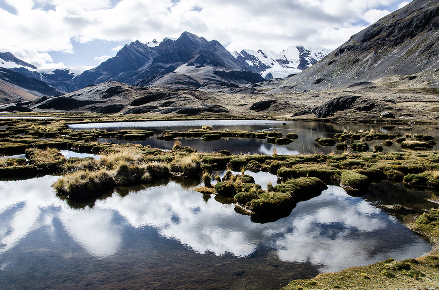
After breakfast, we hike up to a small hamlet known for its stone houses. An imposing rock barrier surrounds the valley. We end the day by climbing north along a steep slope and over a rock barrier to a plateau with a big lake, the Laguna Chuchuja, at 4230 meters /13,900 feet above sea level. We camp overnight at the foot of Akamani.
Special information :
Change in elevation: +360 m/-40 m
08:00 am
tent
breakfast, lunch, dinner
between 4.230 m asl and 4.720 m asl
0
8h
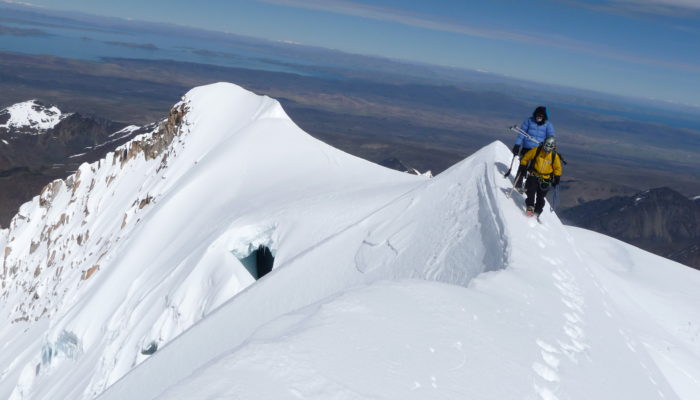
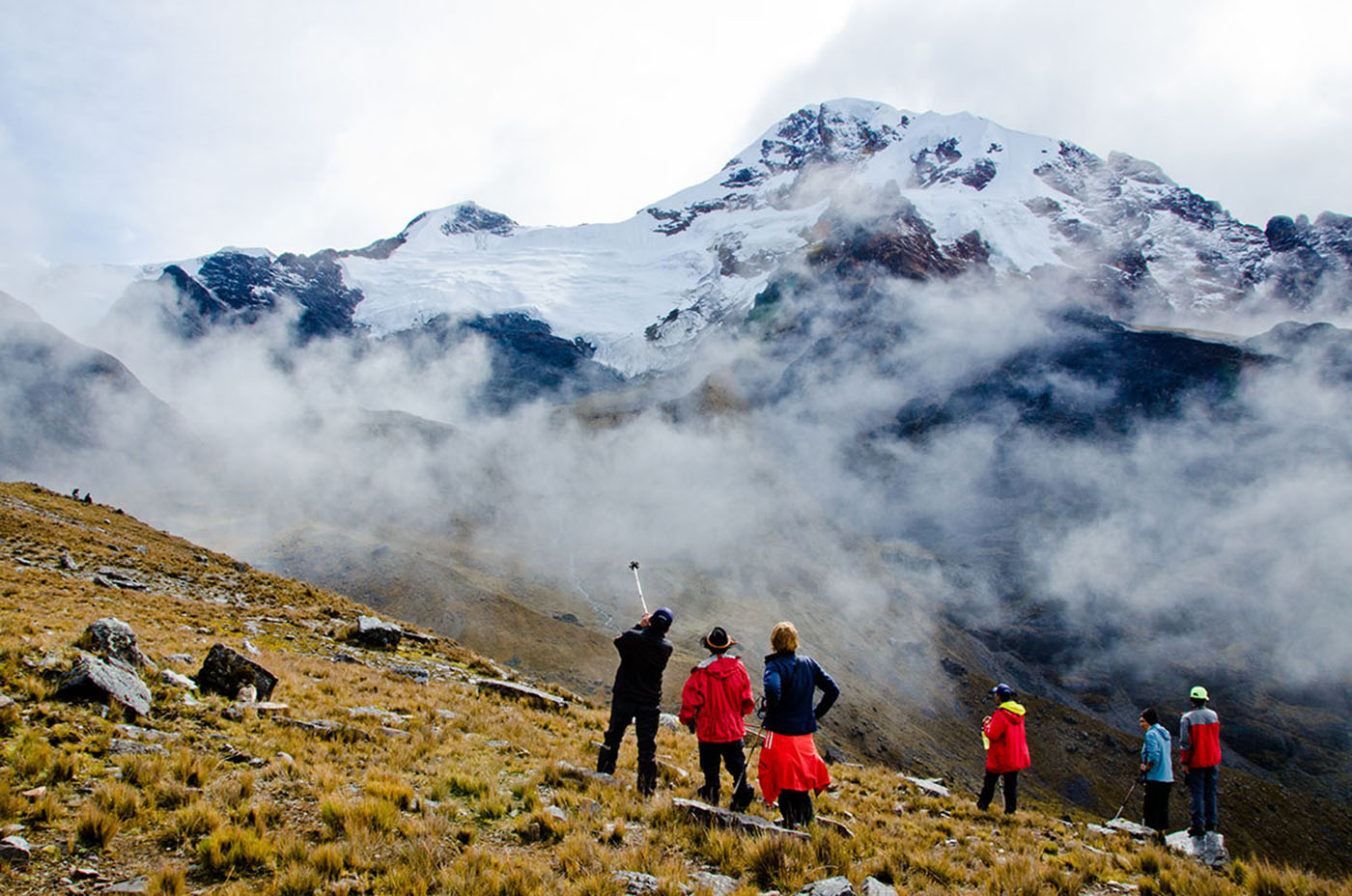
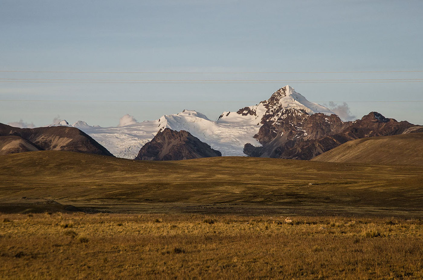
We start the day by climbing north-west above Lake Chuchuja to a high pass (4420 meters/14,500 feet above sea level.) The path goes west following the contour line and then descends into a large valley. We wade across the stream (4235 meters/13,,900 feet above sea level), head north, and walk through the valley. From there, we make a long ascent to the north-west and cross a plateau to a 4945 meter/16,200 foot high pass. Here we get a first look at the glacial massif of Ullakaya (5820 meters/19,000 feet). We descend into the valley on our left, stopping at Lake Kañuhuma to set up camp.
Special information :
Change in elevation: +900 m/-310 m
08:00 am
tent
breakfast, lunch, dinner
between 4.720 m asl and 4.655 m asl
0
7h
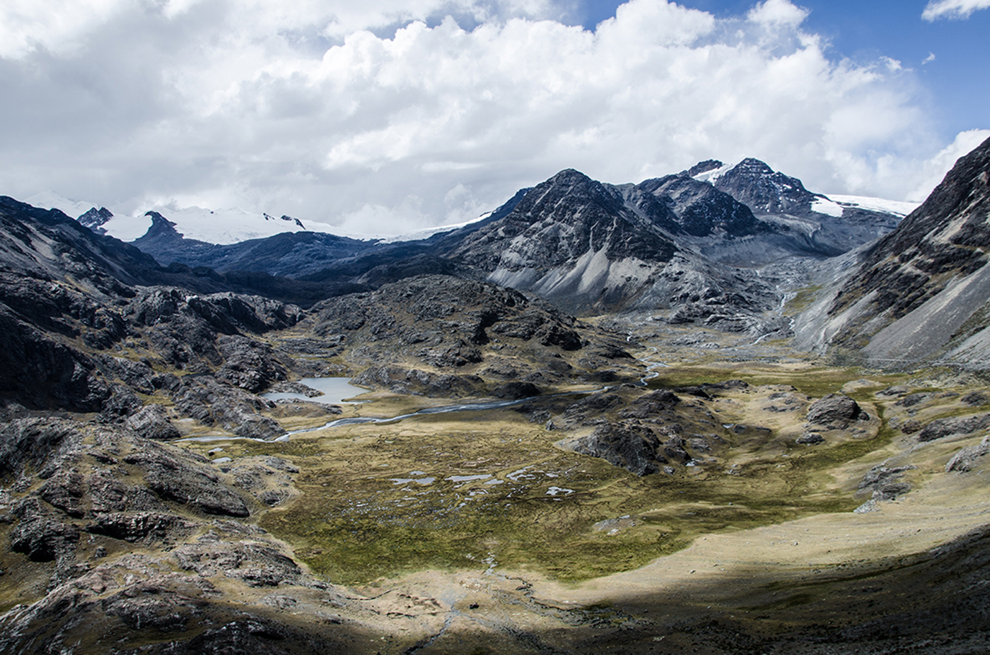
We continue trekking to a plateau located in a swampy glen that overlooks a “bofedal”, a humid high land. We will try to find the best path to cross so our feet don’t get wet! This area backs into a large glacial pass in the east that divides two beautiful summits. We ascend to the next pass at 5110 meters/16,800 feet above sea level. The way up is long but gradual. Impressive views of the Ullakaya and Condorini massifs accompany us throughout this journey. After reaching the pass, we make a short descent into a sandy area and cross to the right to the bottom of another glacial summit. After an easy ascent, we will make a long descent, pass a hamlet, and end up at Lake Pojo Pujo. We will set up camp near by.
Special information :
Change in elevation: +470 m/-540 m
08:00 am
tent
breakfast, lunch, dinner
between 4.655 m asl and 4.680 m asl
0
8h
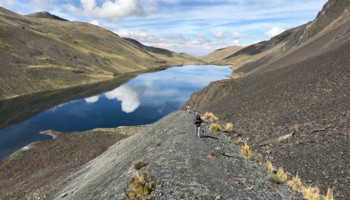
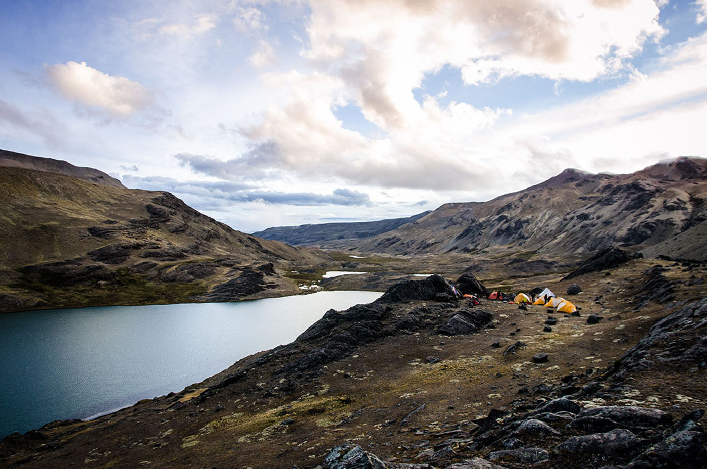
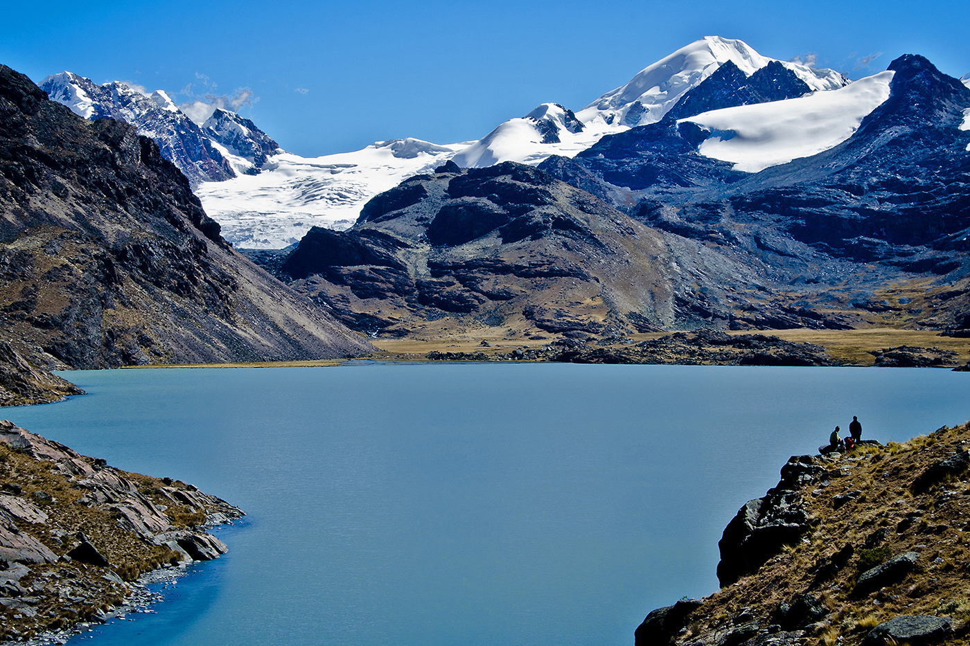
From the lake, we continue on an easy path north-west up to the next pass at 4950 meters/16,200 feet. The path follows the contour line, goes around a rock barrier and leads to a pass at 5000 meters/16,400 feet. Here, the views of the Cololo (or Anta Kjawa) and Huanacuni glaciers and the entire range are amazing. We descend into large valley on our left, cross a stream, and go up towards the north-east into the valley on our right and towards the two glaciers. We follow a stream and two big lakes before setting up camp on the shore of the third lake (4680 meters/15,300 feet above sea level). This place is definitely one of the Cordillera’s most beautiful and the panoramic view is breathtaking. Here we offer the option of heading up to the glacial lake at the foot of Cololo (4960 meters/16,300 feet above sea level), formally know as Anta Kjawa, a name it shares with the valley. From our camp, the way up to Cololo is easy, taking us to the north-east and towards the valley. From the valley we head east on our way back up. Trekking here can be a bit tricky because of the “bofedals”. Before heading back to camp, wereach the lake at the bottom of the Cololo glacier . The hike back to camp takes about 2 hours.
Special information :
Change in elevation: +480 m/-450 m
08:00 am
tent
breakfast, lunch, dinner
between 4.680 m asl and 4.750 m asl
0
7h
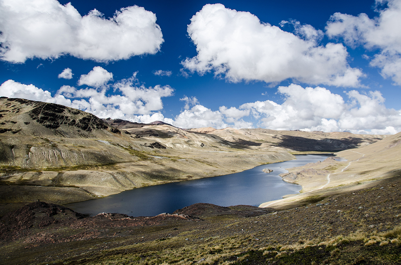
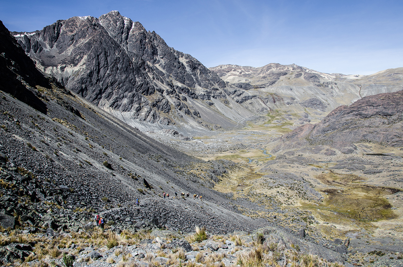
Leaving the beautiful glen of Cololo, we head north to 5260 meters/17,200 feet and a pass at the foot of the Huanacuni glacier (5790 meters/19,000 feet). The way up is not technical. The long descent takes us towards the north-west and into a large valley. The descent starts off easy in ashy soil but gets progressively more difficult. The crux is an unstable rock field. We pass through the main glen to reach a plateau at the foot of the glacial summits of Huanacani. The beautiful ridges of Huanacuni glacier are on the right. We pass three green lakes as we continue to the bottom of the valley. We cross a perpendicular valley, climbing up its right side to a large lake at 4750 meters/15,600 feet).
Special information :
Change in elevation: 580 m/-510 m
08:00 am
tent
breakfast, lunch, dinner
between 4.750 m asl and 4.730 m asl
0
9h
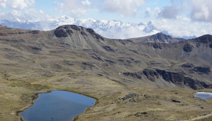
Our trek continues up and above the lake to a pass at 5120 meters/16,800 feet above sea level. The slopes are even and the walk is easy. We often find ourselves in the middle of llama and vicunas herds. We leave the magnificent Huanacuni massif behind and descend towards the lakes near the Pelechuco pass (4850 meters/15,900 feet). As we descend, we have a gorgeous view of the Cerro Presidente, Azucarani and Palomani Grande mountains with their peaks aligned from east to west. After a picnic on the lake shore, we hike up towards the north to a pass at 5230 meters/17.200 feet. We go around a rocky tower and follow a stream. As we get closer to the pass, we have an incredible view of Palomani Grande and the Azucarani Mountains, striped with ice-flutes that seem close enough to touch. After a steeper slope and we reach the pass. On the other side, the Chaupi Orco summit, the Cordillera’s highest peak, comes into sight. This area is home to Andean deer known as venado. The descent to our camp is gorgeous, with views of the west face of the Palomani Grande and a gray lake at its foot, and the eastern end of Lake Suches which borders Peru and has an important gold mine. We arrive to a stream-fed valley at the foot of the Palomani glacier and set up camp.
Special information :
Change in elevation: +770 m/-800 m
08:00 am
tent
breakfast, lunch, dinner
between 4.730 m asl and 4.895 m asl
0
3-4 h
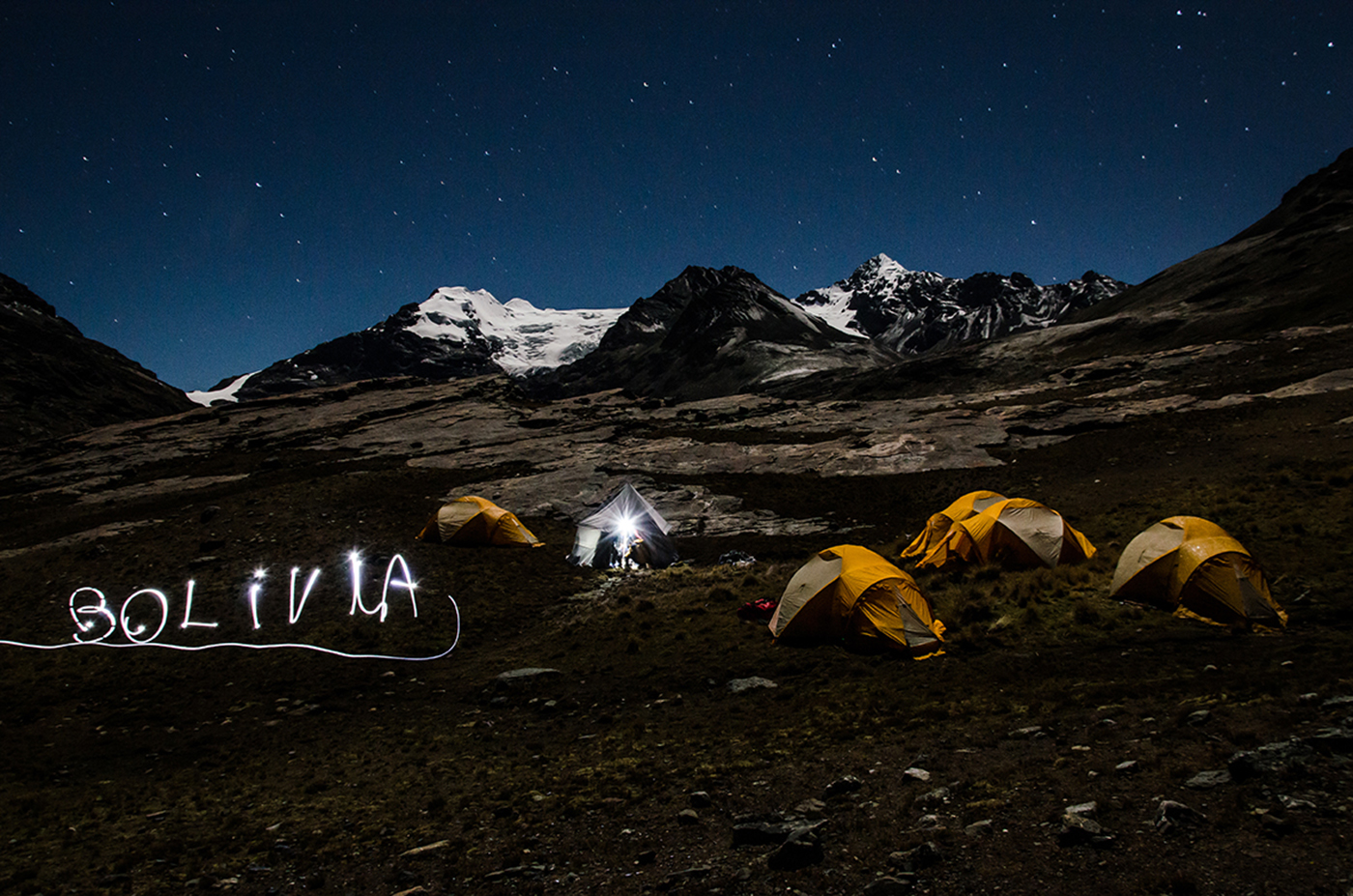
We continue north towards a valley with a meandering stream fed by a small lake with turquoise water. From there, we climb a rocky barrier above a bigger lake - Chucuyo Grande. The view of the glacial massif in front of us will likely be etched in our memory forever. It is a gigantic glacial barrier with multiple peaks, including the south peak of Chaupi Orco, the Cordillera’s highest. on the left. We descend to the valley floor and set up camp at the foot of the glaciers (Chaupi Orco base camp, 4895 meters/16,000 feet asl).
Special information :
Change in elevation: +365 m/-200 m
08:00 am
tent
breakfast, lunch, dinner
between 4.895 m sal and 4.730 m sal
0
3-4 h
We dedicate the morning to exploring this magic place. We head north-east up to a pass at 5295 meters/17,350 feet that leads to the Chaupi Orco glacier. From here, the view of the glacier is amazing. In the afternoon, we head back to Palomani Grande camp taking a slightly different and faster way. From the rocky barrier, we take the path on a ledge. This is the only way accessible to our mules.
Special information :
Change in elevation: +115 m/-260 m
07:00 am
none
breakfast, lunch
between 4.895 m asl and 3.600 m asl
9-10 h
0
We departure in a 4x4 early in the morning from Palomani Grande camp towards the Pelechuco pass. We start a long crossing of the high plateau. The panorama of all the Apolobamba range on our left is gorgeous. We then descend towards Lake Titicaca and reach La Paz by the end of the day.