Condoriri Ascent

This summit of 5648m located in the south of the Cordillera Real is made up of 3 peaks which represent a Condor (the head of the Condor and its 2 adjacent peaks: the Right Wing and the Left Wing). It has 150 meters of ice corridor inclined at 60º / 65º, which leads to the summit ridge. His ascent is technical and demanding (D / III). For experienced mountaineers looking for a sporty, aerial and aesthetic climb. A real treat !

Overview :

Length of stay :

3 days on the spot.

Transport :

private vehicle

Entry of the sites :

variable

Guide :

IFMGA english speaking guide (subject to availibity)

Altitude of the journey:

5.648 m asl

Best moment of year :

From May to October

Request a custom quote, free and without commitment: Get free quote

Steps and highlights:

Main steps:

Day 1

Day 3

Highlights:

– An aerial and sporty ascent with lot of sensations in a unique landscape.

– A summit ridge very narrow and aerial at will.

Day 1 : LA PAZ - RINCONADA (4505 M.A.S.L./14780 FEET) - LAGUNA CHIARKHOTA (4680M.A.S.L./15354 FEET)

More infos
Departure :

08:00 am

Accommodation :

tent

Meals included :

lunch, dinner

Altitude :

Time of transport :

3h

Walking time :

1h30

LA PAZ - RINCONADA (4505 M.A.S.L./14780 FEET) - LAGUNA CHIARKHOTA (4680M.A.S.L./15354 FEET)

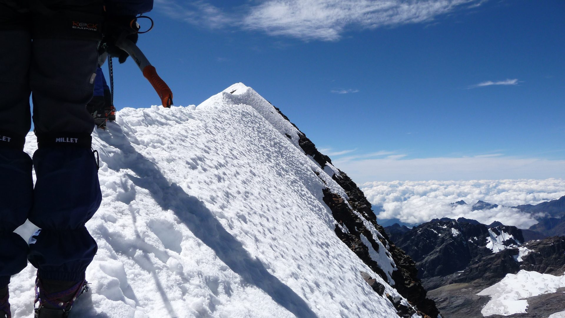
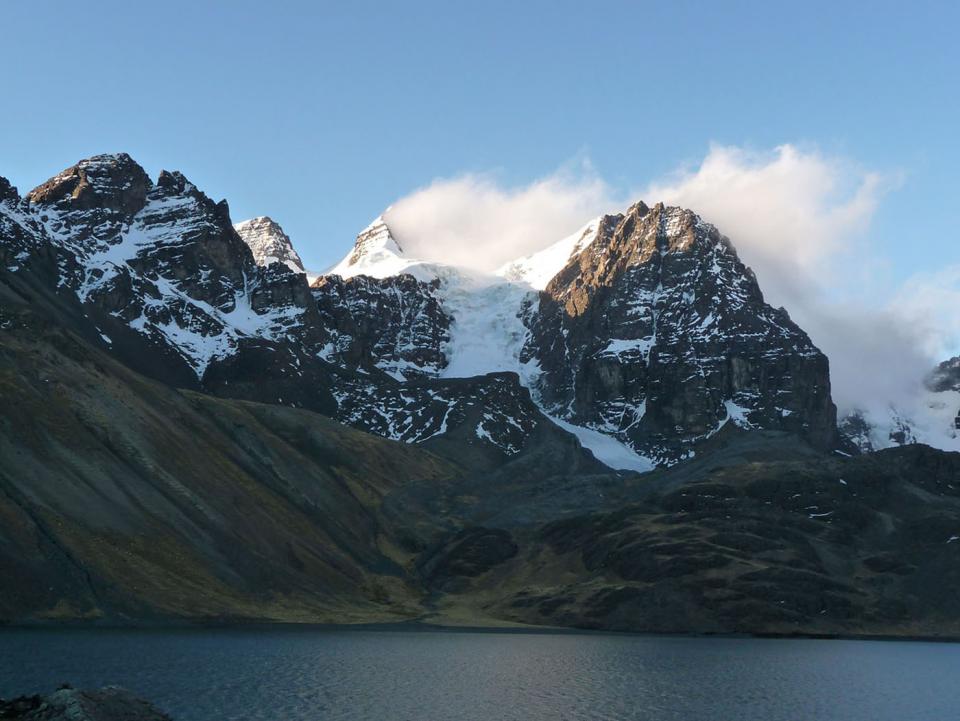
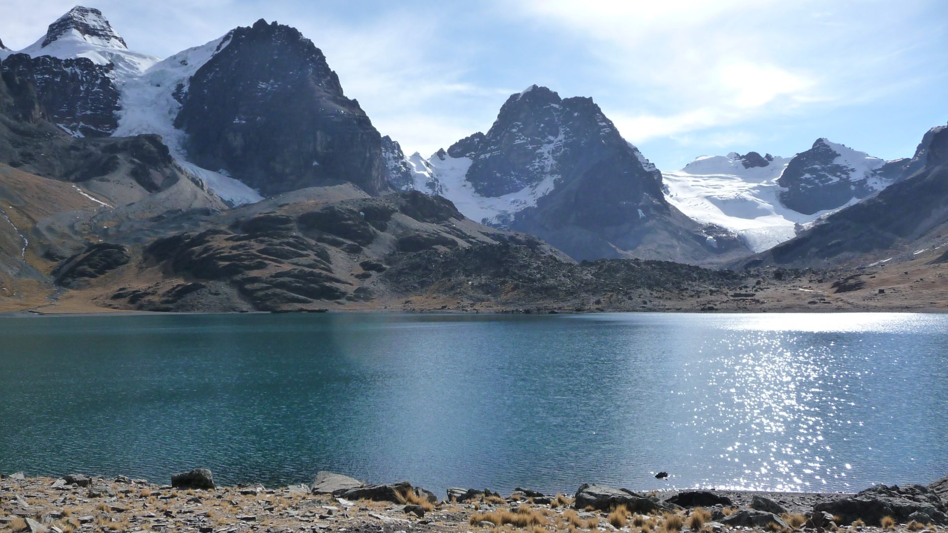
Transfer by vehicle to Rinconada (4505 meters / 14 780 feet asl.), at the foot of Condoriri massif. Easy walk up above the stream to catch up with the trail to Chiarkhota Lake, base camp for Condoriri, at 4680 meters / 15 355 feet asl..

Special information :
Change in elevation: +195 m/-30 m

Day 2 : ASCENT OF THE HEAD OF THE CONDOR (5648 M.A.S.L./15354 FEET)

More infos
Departure :

01:00 am

Accommodation :

tent

Meals included :

breakfast, lunch, diner

Altitude :

Time of transport :

Walking time :

10/12h

ASCENT OF THE HEAD OF THE CONDOR (5648 M.A.S.L./15354 FEET)

Ascent technical and demanding (D/III). Departure in the night (around 1 am). Long and demanding progression on the moraine, then on very a steep scree to a pass at 5200 m.a.s.l./17060 feet of altitude, just below the glacier. Climb on a fairly steep slope to a plateau below the Head of the Condor (5460 m.a.s.l./17913 feet) Ascent through a very steep couloir until the summit ridge (60º). 7 to 8 hours of ascent from base camp. Descent to the Chiarkhota Lake in the afternoon (about 4 hours)

Special information :
Change in elevation: +1000 m/-1000m

Day 3 : LAGUNA CHIARKHOTA (ALT. 4680M) - RINCONADA (4505 M.A.S.L./14780 FEET) - LA PAZ (3600 M.A.S.L./11811 FEET)

More infos
Departure :

09:00 am

Accommodation :

none

Meals included :

breakfast, lunch

Altitude :

Time of transport :

3h

Walking time :

1h

LAGUNA CHIARKHOTA (ALT. 4680M) - RINCONADA (4505 M.A.S.L./14780 FEET) - LA PAZ (3600 M.A.S.L./11811 FEET)

Hike from the laguna to reach the spot of the Rinconada. Private vehicle to come back to La Paz

Special information :
Change in elevation: +935 m/-935 m

Do you like this trip ?

Contact us