Huanacuni Ascent

In the middle of the Apolobamba Cordillera, two peaks are part of our favorites. These are Cololo and Huanacuni. They are accessible by the Laguna Pujo Pujo. A day’s walk is then necessary to reach an idyllic base camp at the edge of a turquoise lagoon. The Huanacuni (5790m) forms a splendid ridge which leads to the main peak. This crossing of the ridges is not very technical and it is only happiness and dazzling so the place is magic. This summit is highly recommended for mountain lovers looking for breathtaking landscapes! Wild, new and splendid!

Overview :

Length of stay :

6 days on the spot.

Transport :

Chauffeur et véhicule privé

Entry of the sites :

variable

Guide :

IFMGA english speaking guide (subject to availibity)

Altitude of the journey:

5.925 m asl

Best moment of year :

from may to october

Request a custom quote, free and without commitment: Get free quote

Steps and highlights:

Main steps:

Day 1

Day 2

Day 3

Day 6

Highlights:

  • A Paradisiacal base camp between Cololo and Huanacuni
  • Magnificent and aerial crossing of the ridges. Unforgettable!
  • A glacial route unreleased and a favourite in the Apolobamba Cordillera.


Day 1 : LA PAZ – LAGUNA PUJO PUJO (4655 m.a.s.l./15270 feet)

More infos
Departure :

07:00 am

Accommodation :

tent

Meals included :

lunch, dinner

Altitude :

Time of transport :

8/9h

Walking time :

LA PAZ – LAGUNA PUJO PUJO  (4655 m.a.s.l./15270 feet)

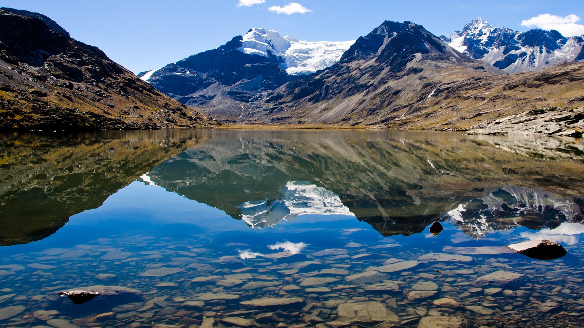
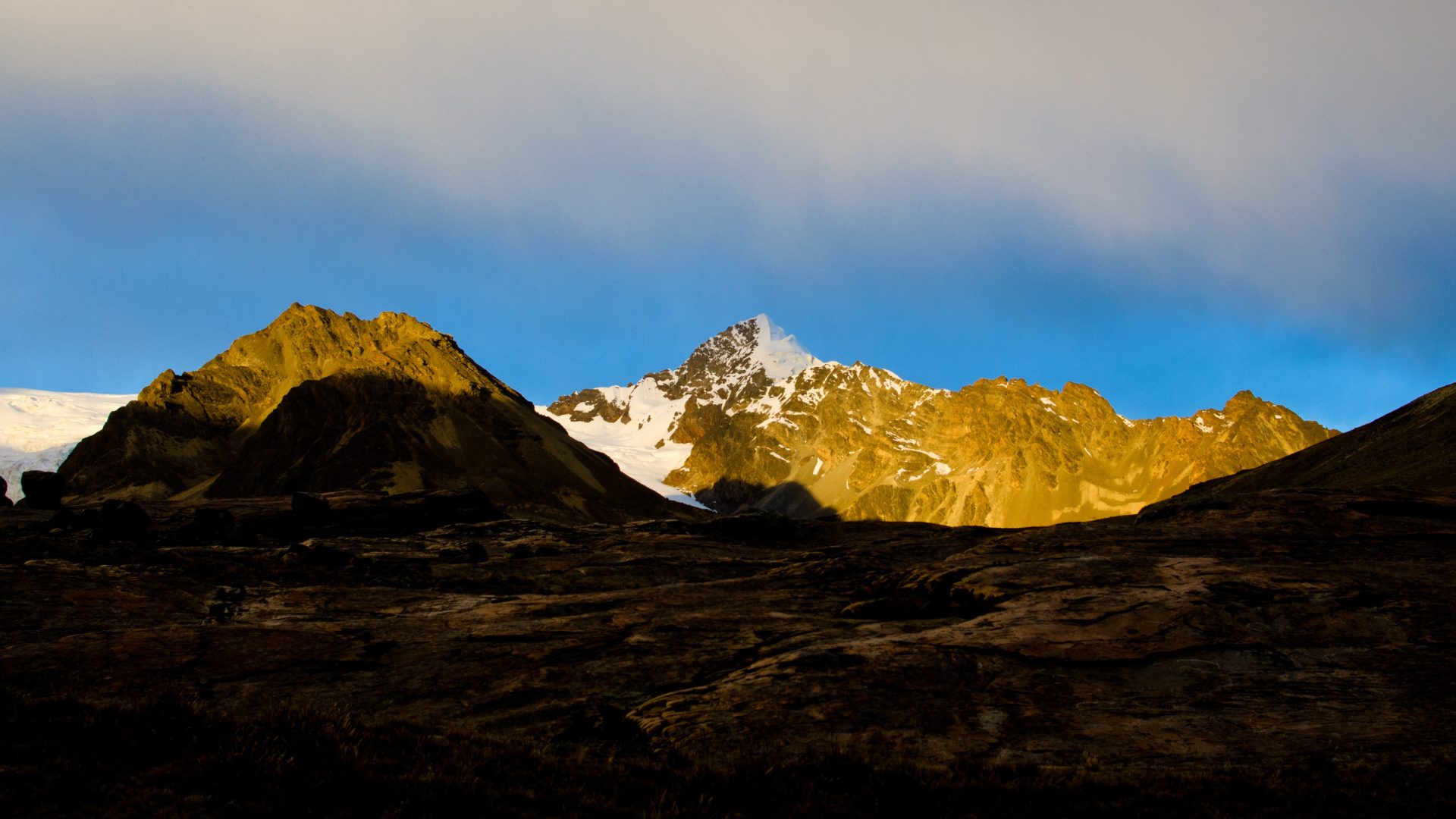
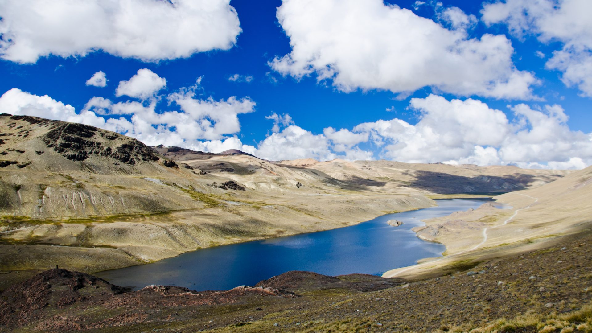
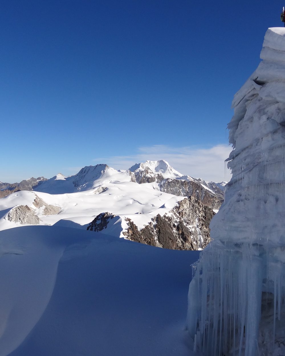
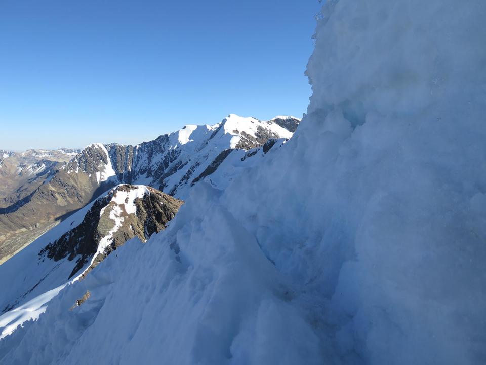
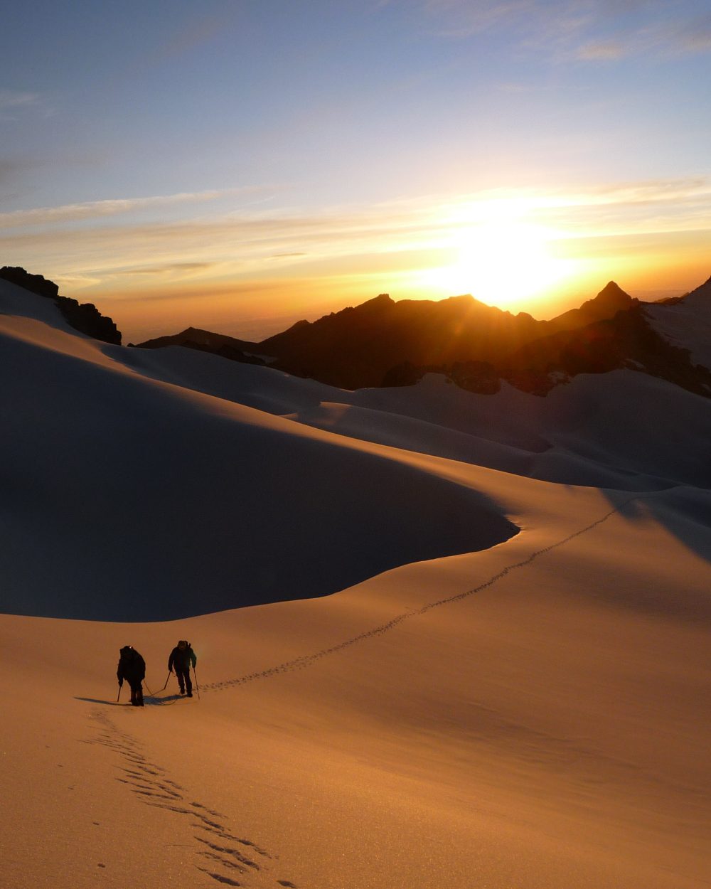
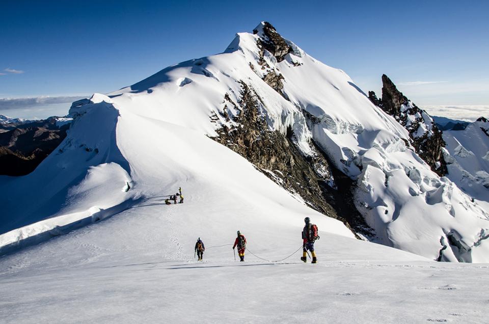
Departure north early in the morning to the Apolobamba Cordillera. After driving along Titicaca Lake, many passes and hairpin curves leads us to the high plateaux below the cordillera. We follow the cordillera to reach Pujo Pujo lake by the end of the day. Camp next to the lake.

Day 2 : LAGUNA PUJO PUJO – CAMP COLOLO (4680 m.a.s.l./15350 feet)

More infos
Departure :

08:00

Accommodation :

tent

Meals included :

breakfast, lunch, dinner

Altitude :

Time of transport :

Walking time :

8h

LAGUNA PUJO PUJO – CAMP COLOLO (4680 m.a.s.l./15350 feet)

From the lake, it is an easy way up north-west to the next pass at 4950 m als. / 16 240 feet. Our Path goes on following a contour line, then get around a rock barrier and arrive at our last pass at 5000 m asl. / 16 404 feet, an incredible viewpoint on the mountain range. The view on Cololo (or Anta Kjawa) and Huanacuni glaciers are simply gorgeous. We have now to descend in a large valley on our left, cross a nice stream, and go up north-east into the valley on our right, towards the two glaciers. Then we follow a stream and some big lakes before setting up our camp on the shore of the third lake at around 4680 m.a.s.l./15350 feet of altitude. This place is definitely one of the most beautiful of the Cordillera, and the panorama is breathtaking.

Special information :
Change in elevation: +480 m/-450m

Day 3 : COLOLO CAMP ( 4680 m.a.s.l./15354 feet) – CAMP BASE HUANACUNI ( 5020 m.a.s.l.16470 feet)

More infos
Departure :

10:00 am

Accommodation :

tent

Meals included :

breakfast, lunch, dinner

Altitude :

Time of transport :

Walking time :

2h

COLOLO CAMP ( 4680 m.a.s.l./15354 feet) – CAMP BASE HUANACUNI ( 5020 m.a.s.l.16470 feet)

Departure to the end of the valley, along the left side of the lake. Easy way up on the hillside on a lama path, until 4850 m.a.s.l./15910 feet of altitude. Then we walk up in a valley on the left, to a pass at 5250 m asl. / 17 224 feet, which allow switching into the next valley. Before the pass, we set up the camp at 5020 m asl. / 16 470 feet on a flat area.

Special information :
Change in elevation: +350 m

Day 4 : HUANACUNI BASE CAMP ( 5020 m.a.s.l./16470) – HUANACUNI CROSSING ( 5790 m.a.s.l./18996 feet) - COLOLO CAMP (4680 m.a.s.l./15354 feet)

More infos
Departure :

03;00 am

Accommodation :

tent

Meals included :

breakfast, lunch, dinner

Altitude :

Time of transport :

Walking time :

8/9h

HUANACUNI BASE CAMP ( 5020 m.a.s.l./16470) – HUANACUNI CROSSING  ( 5790 m.a.s.l./18996 feet) - COLOLO CAMP (4680 m.a.s.l./15354 feet)

We start on our right towards the glacial massif. We have to pass a rocky barrier to reach the ice tongue. We walk by the bottom of the rocky barrier at the level of the sandy moraine, on a pass at 5150 m.a.s.l./16896 feet and finally arrive at the glacier edge (2h30 walk). Easy progression on the glacier until a pass at 5330 m.a.s.l./17486 feet then we climb on the right on steeper slopes(45º/50º) until the ridges at 5500m.a.s.l./18044 feet of altitude, after less than 2 hours from the start on the glacier. Gorgeous view on the whole ridges and the main peak. We continue on the ridges, with another good climb before reaching the plateau at 5615 m.a.s.l./18420 feet at the bottom of the main peak (2 hours). We continue on the last steep ridges (65º). After 1 hour, we arrive at the summit ( 5790 m.a.s.l./18996 feet) Descent by the same route, until the pass at 5330 m.a.s.l./17486 feet (3 hours), and then return to the Cololo camp.

Special information :
Change in elevation: +955m/-1320 m.

Day 5 : COLOLO CAMP ( 4680 m.a.s.l./15354 feet) – LAGUNA PUJO PUJO (4655 m.a.s.l./15270 feet)

More infos
Departure :

08:00 am

Accommodation :

tent

Meals included :

breakfast, lunch, dinner

Altitude :

Time of transport :

Walking time :

8h

COLOLO CAMP ( 4680 m.a.s.l./15354 feet) – LAGUNA PUJO PUJO (4655 m.a.s.l./15270 feet)

Return to Pujo Pujo Lake by the same route. Night at the camp.

Special information :
Change in elevation:+450m./-480m

Day 6 : LAGUNA PUJO PUJO – LA PAZ ( 3600 m.a.s.l./11811 feet)

More infos
Departure :

08:00 am

Accommodation :

none

Meals included :

breakfast, dinner

Altitude :

Time of transport :

8/9h

Walking time :

LAGUNA PUJO PUJO – LA PAZ ( 3600 m.a.s.l./11811 feet)

Departure in a 4WD vehicle early in the morning from Pujo Pujo Lake. We start a long crossing of the high plateaux. The panorama of all the Apolobamba range on our left is totally gorgeous. Then we go down towards the Titicaca Lake and reach La Paz by the end of the day.

Do you like this trip ?

Contact us