Summits off the beaten path in Royal Cordillera

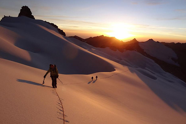
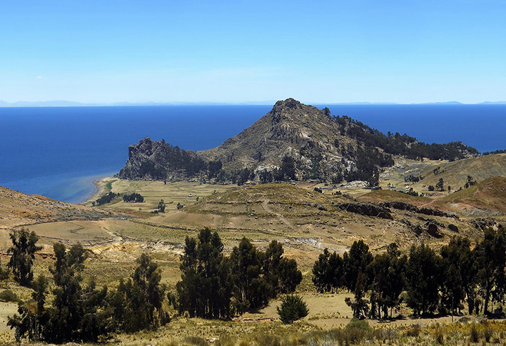
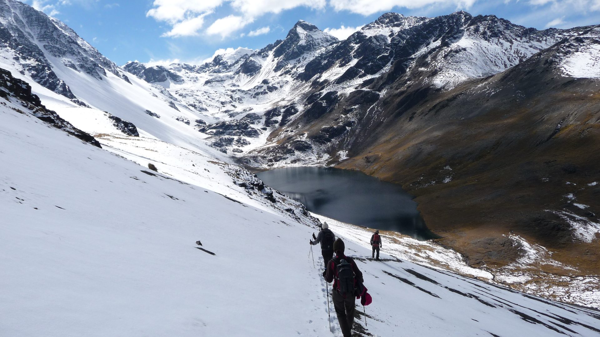
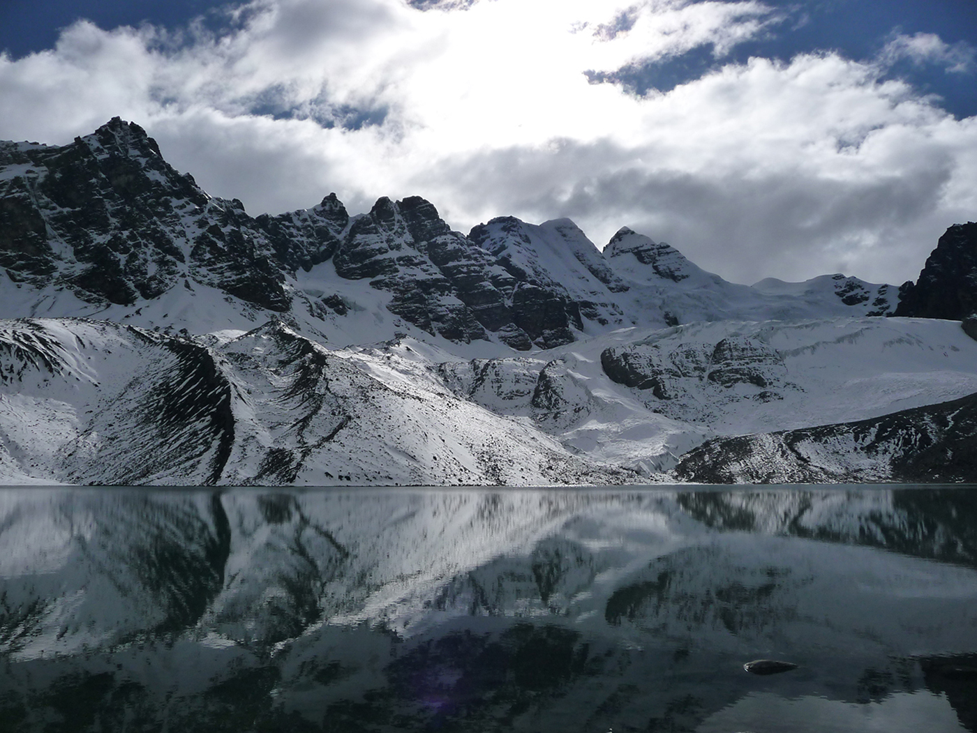
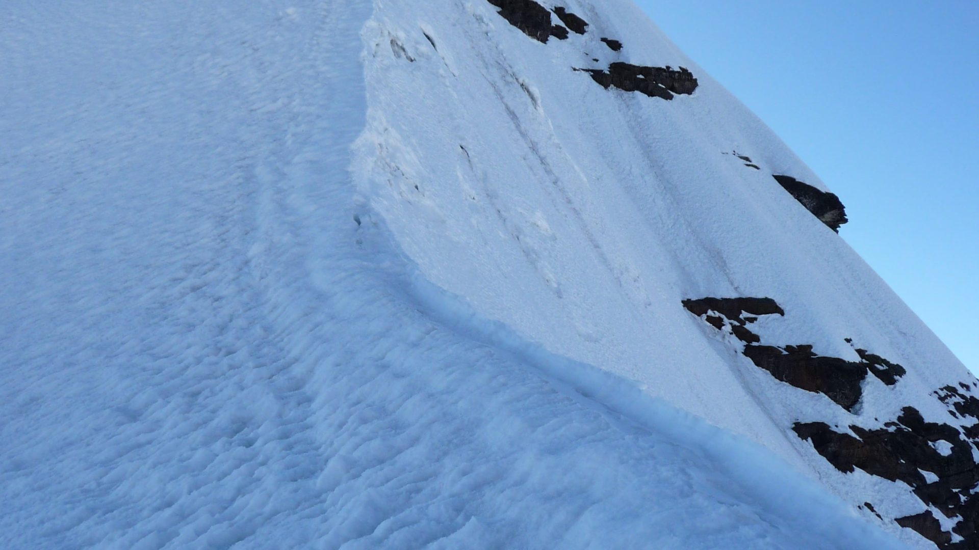
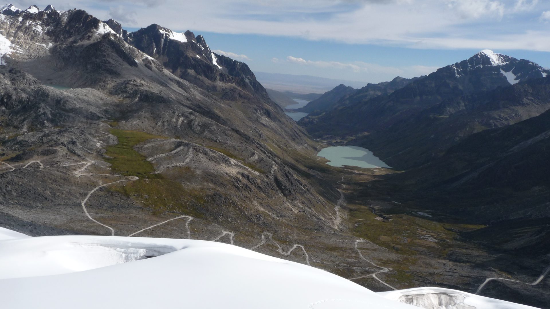
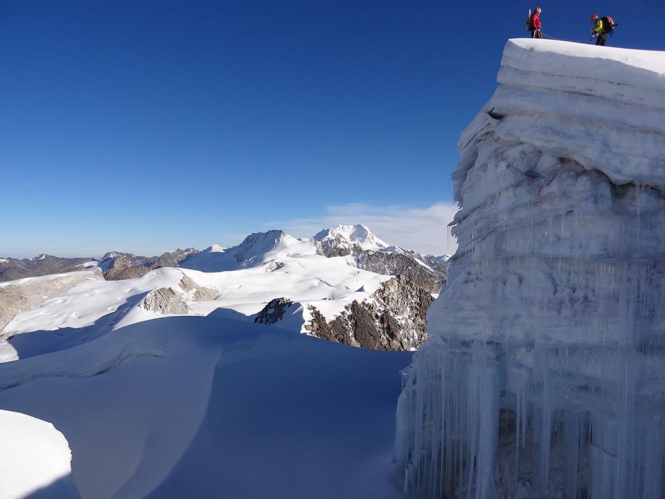
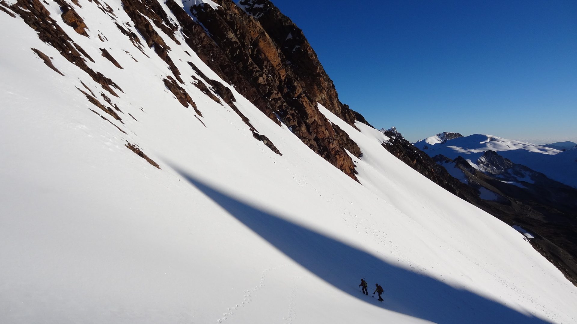
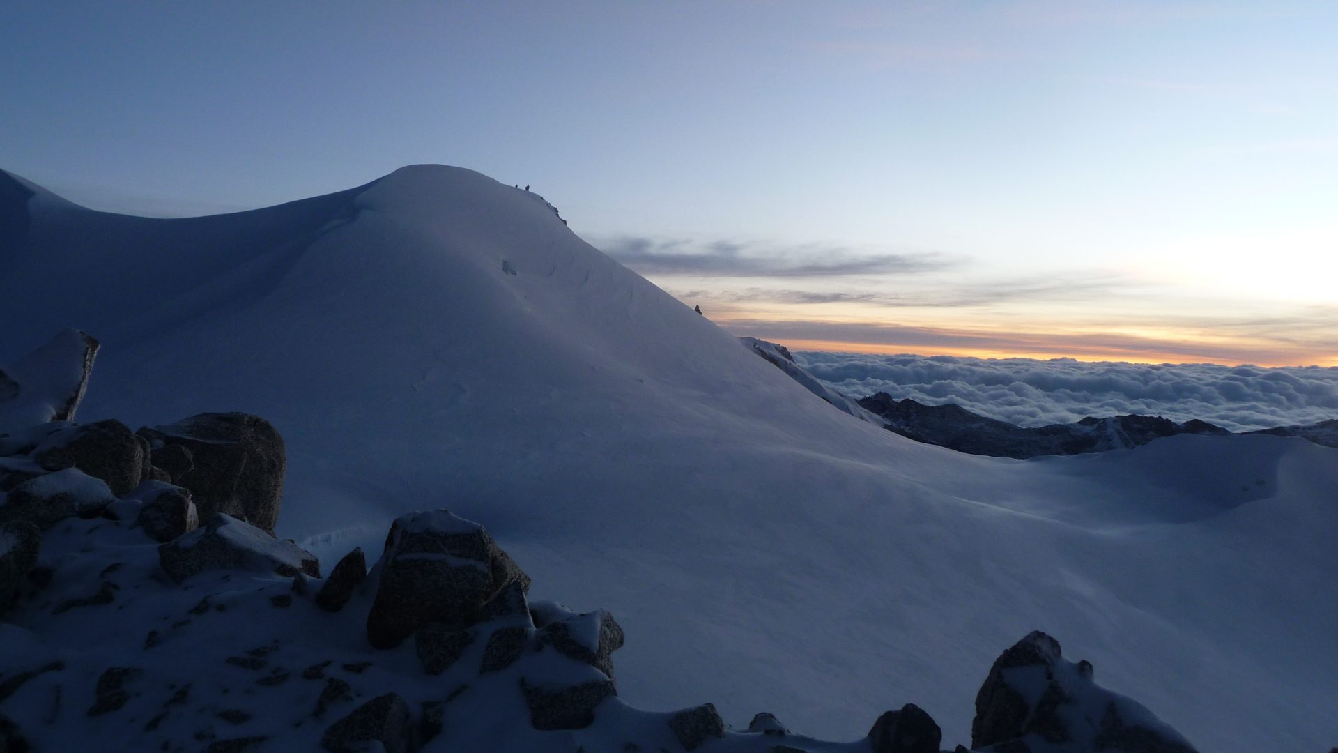
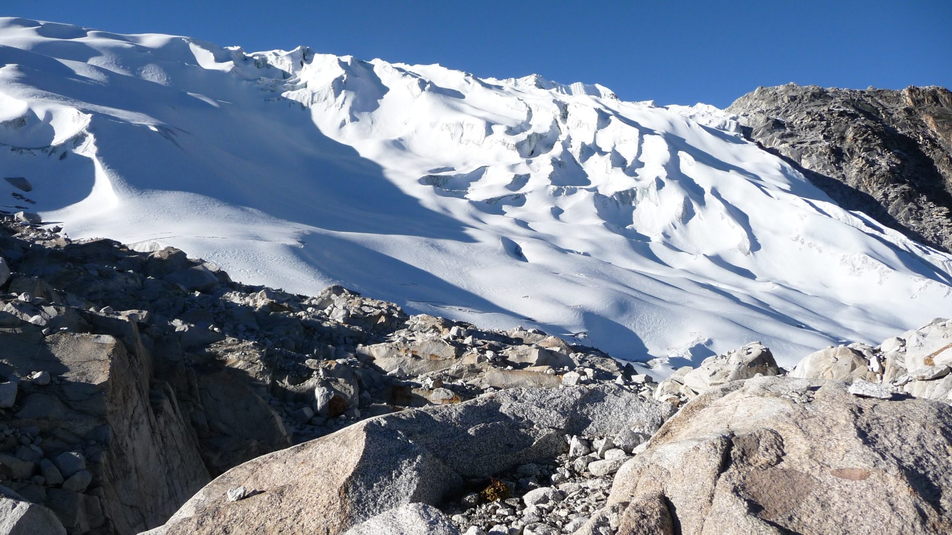
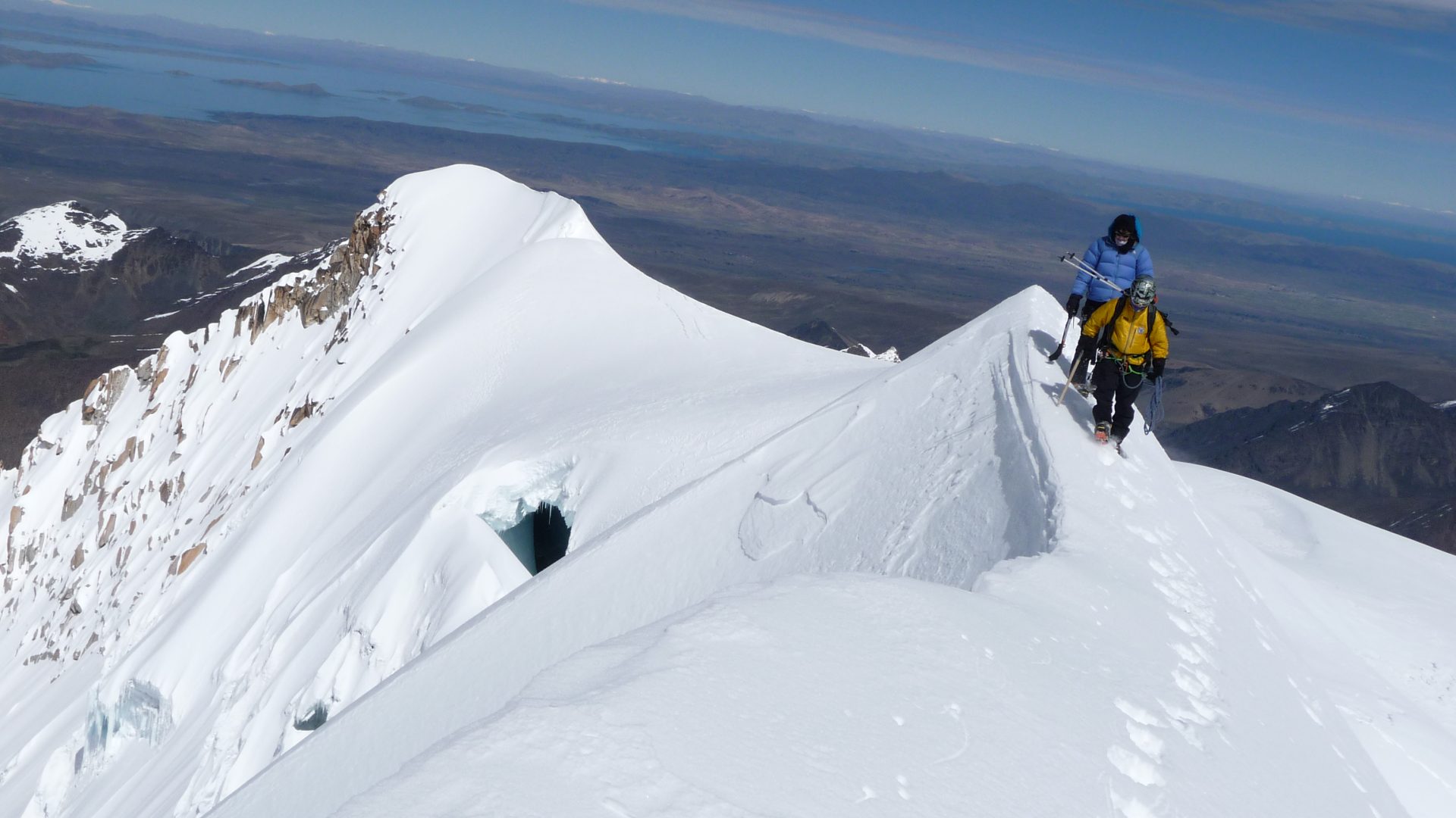
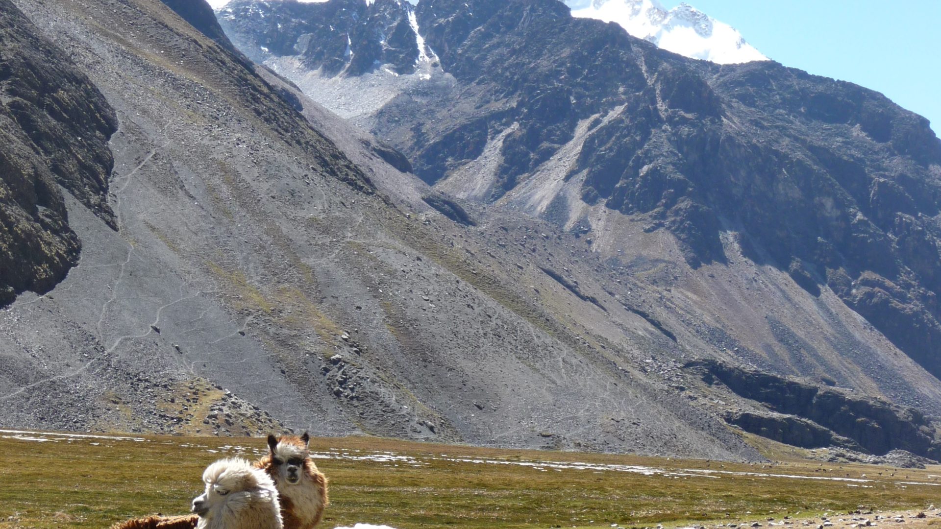
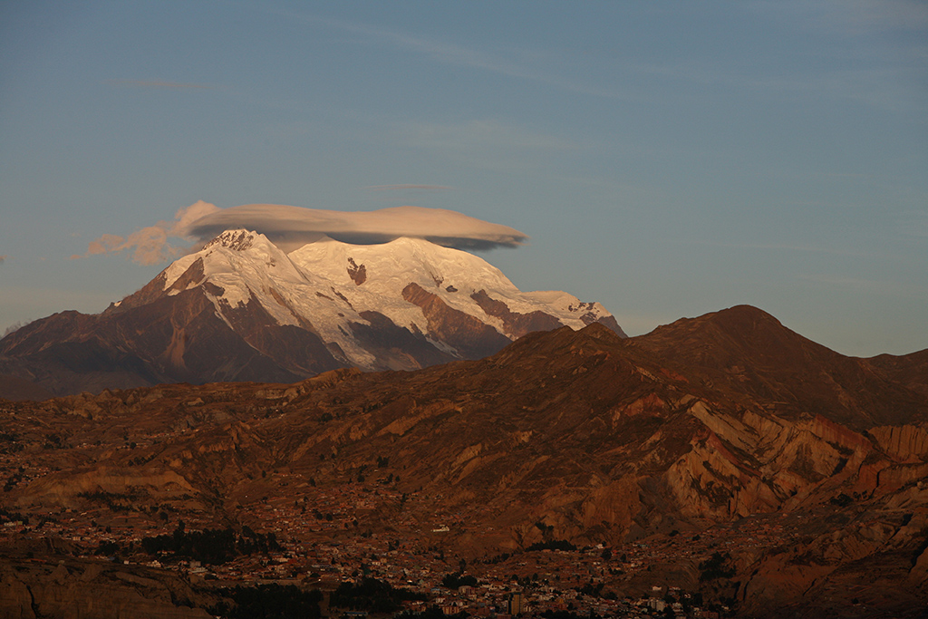
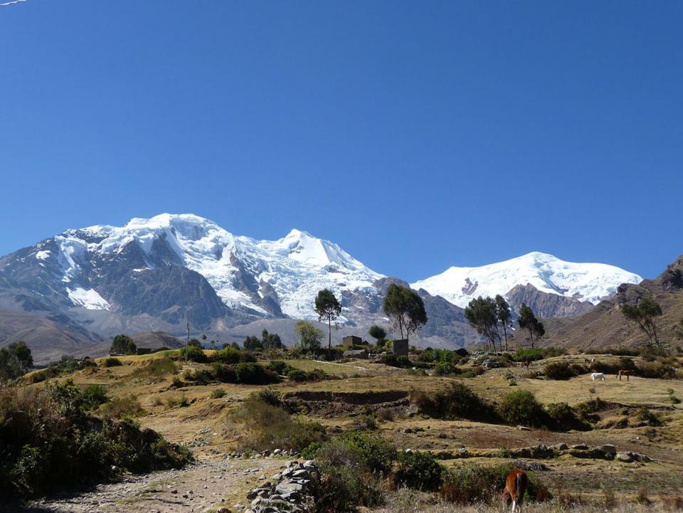
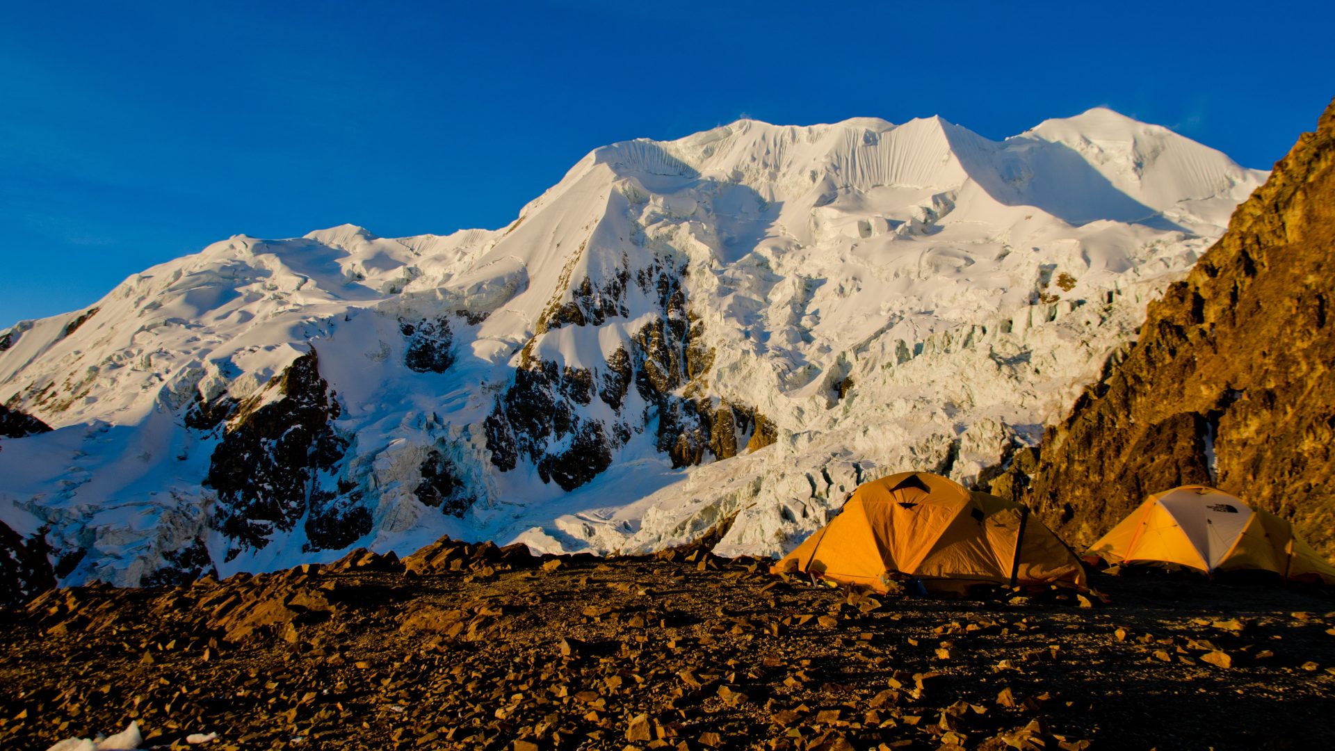
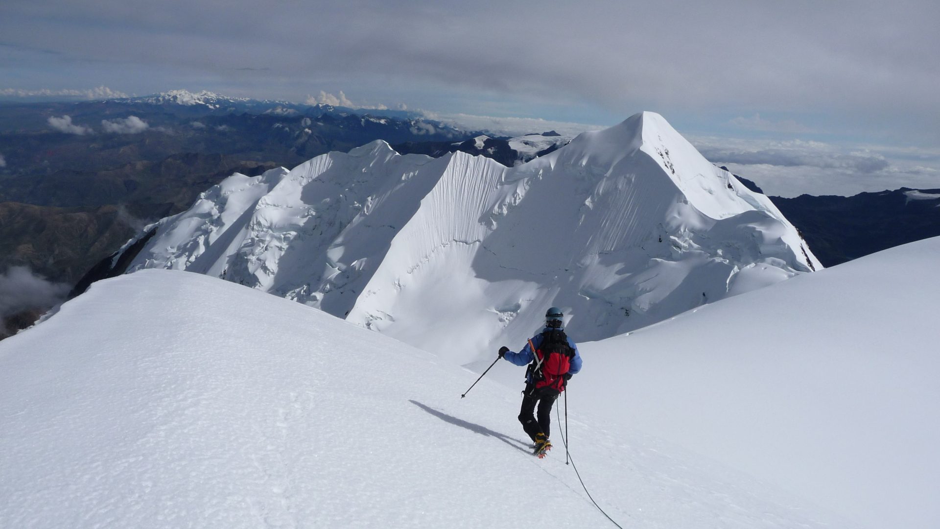
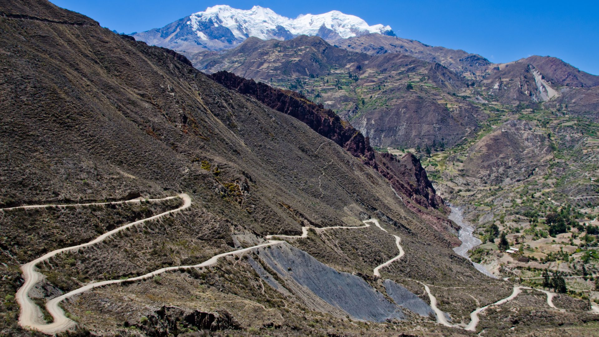
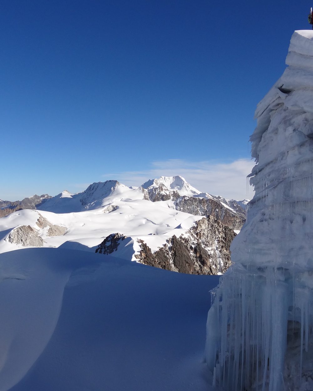
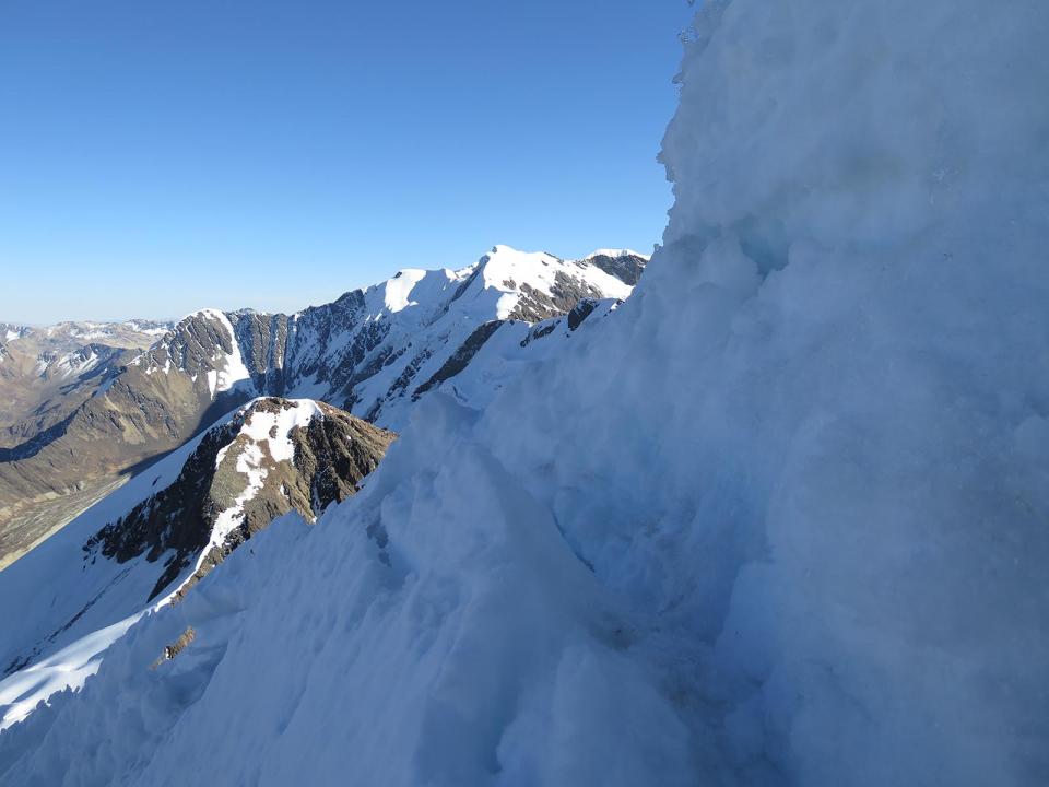
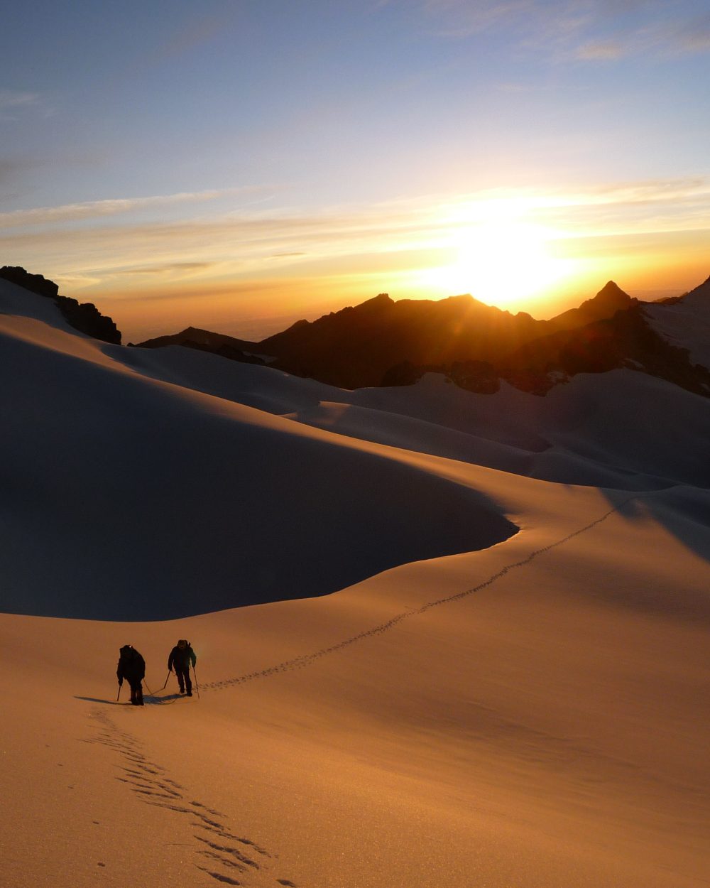
You are experienced mountain dwellers, in love with the great wilderness. You want to discover one of the most beautiful cordilleras of the Andes, the legendary Cordillera Real. This trip is for you. After acclimatization as close as possible to the communities of the Lake Titicaca, you will leave to discover the most beautiful corners of this mountain range. The Pequeño Alpamayo is the most aesthetic of all, the Janq’u Uyu will delight rock climbing and ice race addicts with its original aerial crossing. The Pacha Pata is for him a fairly short glacial race but offering its share of technicality. And for the more adventurous among you, you can embark on the crazy crossing of the glacial massif between the Janqu Uyu and the Chachacomani, almost never visited. Adventure guaranteed! The Chacahcomani offers you a beautiful glacial race, easy technically but physically at will for this first 6000. And you will end up with the inescapable and mythical Illimani, protector of the city of La Paz.

Overview :

Length of stay :

21 days on the spot.

Transport :

Spanish speaking driver and private vehicle

Entry of the sites :

Included

Guide :

UIAGM spanish mountain guide and spanish trekking guide / english speaking guide in La Paz and Titicaca Lake

Altitude of the journey:

from 3.600 m asl to 5.300m asl (6.439m asl for the Illimani)

Best moment of year :

from May to august

Request a custom quote, free and without commitment: Get free quote

Steps and highlights:

Main steps:

Day 1

Day 2

Day 3

Day 4

Day 5

Day 6

Day 7

Day 9

Day 10

Day 12

Day 13

Day 14

Day 15

Day 16

Day 17

Day 18

Day 19

Day 20

Day 21

Highlights:

  • Gentle acclimatization in La Paz and Lake Titicaca, nice encounter with a community of Lake Titicaca
  • Trek in the Cordillera Real, ascent of Pico Austria and Pequeno Alpamayo, one of the most attractive peaks of the Cordillera Real
  • Ascent of new summits Janq’u Uyu, Pach’a Pata, Chachacomani
  • Ascent of the mythical Illimani

Day 1 : LA PAZ ARRIVAL (3600 m a.s.l / 11 800 FT)

More infos
Departure :

to be coordinated

Accommodation :

hotel

Meals included :

none

Altitude :

Time of transport :

30 min

Walking time :

LA PAZ ARRIVAL (3600 m a.s.l / 11 800 FT)

Reception at the airport and transfer to the hotel. Rooms are available from midday, unless otherwise arranged by us. Rest of the day free.

Day 2 : LA PAZ - ARTISAN TOUR - FAIRY CHIMNEYS - COLORFUL MARKETS

More infos
Departure :

08:00 am

Accommodation :

hotel

Meals included :

breakfast

Altitude :

Time of transport :

1h

Walking time :

2-3h

LA PAZ - ARTISAN TOUR - FAIRY CHIMNEYS - COLORFUL MARKETS

We depart after breakfast to K'Illi K'Illi which offers a magnificent panorama of La Paz and the majestic, snowcapped Illimani mountain (6,400 meters/21,100 feet in elevation). We then descend to the southern zone and Ramon Tito’s studio. Tito is a “paceño” sculptor and watercolorist. His workshop is located on the aptly named “Avenue of the Sculptor.” Tito works mainly with stone he finds in the surrounding mountains. In addition to the clay found in the Valley of Souls, La Paz is known for stone, including basalt, marble, sandstone, alabaster, granite. Locals claim stone carries the Bolivian soul. Tito’s work is testimony to this, From his workshop, the tour continues to the Pedregal Canyon and an easy ascent (3600 meters.18,100 feet). The Canyon is home to impressive fairy chimneys (hoodoo) and a pass that opens into "El Valle Escondido" (the Hidden Valley). The walk continues to a village at the foot of the Muela del Diablo and, for the more adventurous, a trek down the ridge to the edge of Calacoto (1h30 of additional walking). We spend the afternoon exploring the colorful markets and historic center of the city of La Paz on foot.

Day 3 : LA PAZ - ACHACACHI - SANTIAGO DE OKOLA (3810 meters/12.500 FT)

More infos
Departure :

08:00 am

Accommodation :

local house

Meals included :

breakfast, lunch, dinner

Altitude :

Time of transport :

4h

Walking time :

3h

LA PAZ - ACHACACHI - SANTIAGO DE OKOLA (3810 meters/12.500 FT)

Departure in the morning towards the small village of Santiago de Okola, on Lake Titicaca shore. After crossing the village of Achacachi, we will head north in direction of Carabuco. After 4 hours drive from La Paz, we will reach this small village nested in a gorgeous bay overlooked by a hill named “Sleeping dragon”. It is a magical and heavenly place, with its beach and crystal clear waters. Upon arrival, you will be warmly welcomed by one of the 12 families of the community. We will start the day with a delicious Apthapi, a traditional meal of the Andean countryside collectively prepared by local families. It includes pancakes, donuts, shortbread quinoa, corn, potatoes and small fried fish from the lake. After lunch, we visit local artisans known for traditional weaving. This craft is passed across generations and has become an art form. It may take a month to weave an "aguayo", a traditional Andean fabric. After this nice meeting, we walk to the Sleeping Dragon mountain overlooking the bay. Below the head of the Dragon, there are cave paintings in the rock. From here, we take a leisurely hike up to the top of Tunapa Cave, which offers an amazing panorama of Lake Titicaca, the inland sea, and the Bay of Santiago. We descend from the other side, a more challenging, but beautiful, hike.

Special information :
Change in elevation: +230 m/-230 m

Day 4 : SANTIAGO DE OKOLA – TURTLE ISLAND – LA PAZ (3,600 meters/18,100 FT)

More infos
Departure :

09:00 am

Accommodation :

hotel

Meals included :

breakfast, lunch

Altitude :

Time of transport :

4h

Walking time :

3h

SANTIAGO DE OKOLA – TURTLE ISLAND – LA PAZ (3,600 meters/18,100 FT)

Departure in the morning, we hike along the shore of Lake Titicaca to Tortuga Island, located on the other side of the bay. As our guide will explain, reaching Tortuga Island by foot was not always possible. When he was a child, it was surrounded by water. Lake Titicaca has receded in recent years. It still is home to many birds like ducks, Andean geese, and pink flamingos. We walk to the top of this small island to get a beautiful view of the bay. We return to Santiago de Okola by the same route. After a quinoa based Andean lunch, we will leave our host with regrets, and return to La Paz.

Special information :
Change in elevation: +30 m/-30 m

Day 5 : LA PAZ - LAGUNA KHOTIA - LAGUNA AJWANI (4615 meters / 15 141 FT)

More infos
Departure :

08:00 am

Accommodation :

tent

Meals included :

breakfast, lunch, dinner

Altitude :

Time of transport :

3h

Walking time :

5h

LA PAZ - LAGUNA KHOTIA - LAGUNA AJWANI (4615 meters / 15 141 FT)

Departure in the morning to the Royal Cordillera. We arrive at Khotia Lake (3 hours drive). From the Khotia Lake, the trail to Chiarkhota Lake is non-technical and among the most traveled in the Royal Cordillera. We start towards south, ascend to the “Contador” pass (4760 meters / 15 616 feet asl.), which offers a pretty view of mountain peaks that seem to plunge into a large valley. Lake Alka Quta is in view, as is the Palcoco nmine. We continue our descent to the valley following the cordillera, crossing a semi-swampy area close to the Surakhota lake (4410 meters / 14 468 feet asl.), and then heading up towards the south-east on the mountain to the Ajwani Lake (Lake of the birds, 4615 meters / 15 141 feet asl.), home to many ducks.

Special information :
Change in elevation: +550 m/-385 m

Day 6 : LAGUNA AJWANI - LAGUNA JURIKHOTA (4700 meters / 15 419 FT)

More infos
Departure :

09:00 am

Accommodation :

tent

Meals included :

breakfast, lunch, dinner

Altitude :

Time of transport :

0

Walking time :

4h

LAGUNA AJWANI - LAGUNA JURIKHOTA (4700 meters / 15 419 FT)

Special information :
Change in elevation: +530 m/-445 m

Day 7 : LAGUNA JURIKHOTA - LAGUNA CONGELADA - AUSTRIA PASS - LAGUNA CHIARKHOTA (4680 meters / 15 354 FT)

More infos
Departure :

09:00 am

Accommodation :

tent

Meals included :

breakfast, lunch, dinner

Altitude :

Time of transport :

0

Walking time :

5h

LAGUNA JURIKHOTA - LAGUNA CONGELADA - AUSTRIA PASS - LAGUNA CHIARKHOTA (4680 meters / 15 354 FT)

We start off towards the north-east, following the lake to a moraine. We climb up to Congelada lake (4880 meters / 16 010 feet asl.). The place is magic. The view is splendid, with the Condoriri glacier plunging into turquoise waters. The cliffs of the Left Wing and the Head of the Condor look imposing from here. We continue to the south-east and up a steep slope to the Austria pass at 5140 meters / 16 863 feet above sea level. A steep trek up screed terrain to its peak (5330 meters / 17 486 feet asl ) is optional before starting the descent. The Austria peak offers the best view of the Condoriri massif. We descend towards the south-east to Chiarkhota Lake (4680 meters / 15 354 feet asl), where we set up camp.

Special information :
Change in elevation: +475 m/-500 m

Day 8 : ASCENT OF PEQUEÑO ALPAMAYO - LAGUNA CHIARKHOTA (4680 meters / 15 354 FT)

More infos
Departure :

03:00 am

Accommodation :

tent

Meals included :

breakfast, lunch, dinner

Altitude :

Time of transport :

0

Walking time :

8-10h

ASCENT OF PEQUEÑO ALPAMAYO - LAGUNA CHIARKHOTA (4680 meters / 15 354 FT)

AD+/II - We depart in the night. The approach is non-technical and takes us through a valley to the glacier at 4805 m asl ( 15 764 FT). We climb to the dome and a pass (5245 m asl. / 17 208 FT) just above the bergschrund. The ascent to the Tarija Peak (5320 m asl / 17 454 FT) is steep (50º/55º) and includes some rocky areas. The view from here of the summit ridge is gorgeous. We descend by the same path.

Special information :
Change in elevation: +935 m/-935 m

Day 9 : LAGUNA CHIARKHOTA - RINCONADA - LAGUNA KHOTIA – LAGUNA JANQ’U QUTA) – CERRO WILA LLUXITA (5245m asl. / 17 208 FT)

More infos
Departure :

08:00 am

Accommodation :

tent

Meals included :

breakfast, lunch, dinner

Altitude :

Time of transport :

2-3h

Walking time :

2h

LAGUNA CHIARKHOTA - RINCONADA  - LAGUNA KHOTIA – LAGUNA JANQ’U QUTA) – CERRO WILA LLUXITA (5245m asl. / 17 208 FT)

We descend to the Rinconada. Drive from La Paz to Khotia Lake, continuing towards the north-east to Janq’u Quta Lake ( 4715 m asl. / 15 469 FT) at the foot of Mullu pass. We set up the camp close to the lake. The base camp of Janq’u Uyu lies further up, around 4900 m asl (16 076 FT) but it tends to be windy, thus making the Lake a preferred option for camping. We drive up to the Jang’uUyu pass for acclimatization trek. We start at the foot of the Cerro WilaLluxita. This glacial massif divides the valley. The Mullu pass leads to the Fabulosa mine in the south-wes, The pass in the north-west leads to the Cordillera andthe Tres Marias and Negruni massifs. We climb through rocks on a steep slope to reach the glacier. We follow the ridges and reach the summit of Cerro WilaLluxita at 5245 m asl ( 17 208 FT). We have a beautiful view of Janq’u Uyuand, Janq’u Laya and the Mullu Apacheta glacier.

Special information :
Change in elevation: +30 m/-195 m (Chiarkhota to Rinconada)

Day 10 : JANQ’U UYU CROSSING – LAGUNA LECHE KHOTA (5.140 m asl. / 16 863 FT)

More infos
Departure :

04:00 am

Accommodation :

tent

Meals included :

breakfast, lunch, dinner

Altitude :

Time of transport :

30 min

Walking time :

8-9h

JANQ’U UYU CROSSING  – LAGUNA LECHE KHOTA (5.140 m asl. / 16 863 FT)

PD / I and IV / V in rock / We depart in the night towards a famously windy pass at 5000 m asl (16 404 FT). As we head towards the north-west, our approach becomes rocky until we reach the edge of the glacier, where our trail becomes smooth. We head up the glacial dome until the summit. The ascent is non-technical and the slopes are gradual (35º/40º). The summit of Janq’uUyu is located on a magnificent cornice overlooking the ridges of this massif to the north-west. Chachacomani, Cerro Jakocire, Imasiña and Huayna Potosi are in view. We descent either by the same path, spending the night at Janq’uQuta lake, or across the ridges in the north-west, descending towards the south-west to the valley the foot of Jisk’aPata peak. We camp at Leche Khota lake, nested at the foot of Jach’aPata peak.

Special information :
Change in elevation: +690 m/-550 m

Day 11 : ASCENT OF PACH’A PATA (5.650 m asl. / 18 536 FT) OR REST

More infos
Departure :

05:00 am

Accommodation :

tent

Meals included :

breakfast, lunch, dinner

Altitude :

Time of transport :

0

Walking time :

5-6h

ASCENT OF PACH’A PATA (5.650 m asl. / 18 536 FT) OR REST

AD + / II We depart in the morning. We walk up towards the south-west to a rocky barrier, continuing through rocks passing a lake above to the edge of the glacier. The ascent to a pass at 5510 m asl (18 077 FT) is gradual, with some steeper (45º-50º) slopes. The final approach to the summit is steep (65º-70º). The view is breathtaking, stretching across the Royal Cordillera, with the Illampu and Ancohuma massifs, Chearoco and Chachacomani in sight. We also see the Janq’u Uyu ridge, where the previous day took us, and the face of Wara Warani. We descent by the same path to our camp.

Special information :
Change in elevation: +500 m/-500 m

Day 12 : LAGUNA LECHE KHOTA - UMASIÑA - CHACHACOMANI VALLEY - CHACHACOMANI BASE CAMP (4.470 m asl. / 14 665 FT)

More infos
Departure :

04:00 am

Accommodation :

tent

Meals included :

breakfast, lunch, dinner

Altitude :

Time of transport :

0

Walking time :

10-11h

LAGUNA LECHE KHOTA - UMASIÑA - CHACHACOMANI VALLEY - CHACHACOMANI BASE CAMP (4.470 m asl. / 14 665 FT)

PD /II and IV / V on rock - From Leche Khota lake, we start off to west through rocks. We reach a plateau overlooking the glacial valley and continue to the edge of the glacier at 5310 m asl. (17 421 FT) The trek up to a glacial plateau separating Janq’uUyu and Chachacoman and the ridges of Janq’u Uyu come into sight. We arrive at a small peak at 5455m asl (17 896 FT), with an amazing 360º panoramic view. Further north, the glacial massif leads the ridges of Cerro Umasiña. We continue along the crest, passing another peak at 5505 m asl (18 061 FT) and an exposed rocky section. We descend into a glacial valley (5410 m asl / 17 749 FT) before ascending to the last of the trek’s passes located at 5600 m asl (18 372 FT) just below the Umasiña ridges. From here, we either descend the glacier to Chachacomani valley and the base camp or climb to the ridges and descend above the base camp of Chachacomani. The latter is exposed and technical. Anyone preferring not to cross the glacier can accompany the cook by vehicle to the Chachacomani base camp.

Special information :
Change in elevation: +800 m/-1360 m

Day 13 : CHACHACOMANI BASE CAMP - HIGH CAMP CHACHACOMANI (5.130 m asl. / 16 830 FT)

More infos
Departure :

09:00 am

Accommodation :

tent

Meals included :

breakfast, lunch, dinner

Altitude :

Time of transport :

0

Walking time :

3-4h

CHACHACOMANI BASE CAMP - HIGH CAMP CHACHACOMANI (5.130 m asl. / 16 830 FT)

We head north-west towards a perpendicular valley. We gain elevation quickly and arrive at a hollow with a meandering stream (4700 m asl / 15 419 FT). We continue through the hollow. As we head up towards the north to the glacier, the path is steep and rocky. We arrive at the glacier and set up camp.

Special information :
Change in elevation: +665 m/-45 m

Day 14 : ASCENT OF CHACHACOMANI - BASE CAMP (4470 m asl. / 14 665 FT)

More infos
Departure :

01:00 am

Accommodation :

tent

Meals included :

breakfast, lunch, dinner

Altitude :

Time of transport :

Walking time :

9-10h

ASCENT OF CHACHACOMANI  - BASE CAMP (4470 m asl. / 14 665 FT)

We depart in the night and make our way across the glacier to fissured plateau. We pass around crevasses to the foot of the Chachacomani ridges. As we head east to the main summit, the slopes are steeper (45º). The view from the summit ridge is stunning, stretching from the north to the south of the Cordillera. We descend by the same route and return to base camp.

Special information :
Change in elevation: +990 m/-1610 m

Day 15 : BASE CAMP CHACHACOMANI - CRUZ PAMPA - LA PAZ (3600 m a.s.l / 11 800 FT)

More infos
Departure :

08:00 am

Accommodation :

hotel

Meals included :

breakfast, lunch

Altitude :

Time of transport :

3h

Walking time :

2h

BASE CAMP CHACHACOMANI - CRUZ PAMPA - LA PAZ  (3600 m a.s.l / 11 800 FT)

Return to the village of Cruz Pampa and drive to La Paz.

Special information :
Change in elevation: +75 m/-130 m

Day 16 : LA PAZ / FREE (3.600 m a.s.l / 11 800 FT)

More infos
Departure :

Accommodation :

hotel

Meals included :

breakfast

Altitude :

Time of transport :

Walking time :

LA PAZ / FREE (3.600 m a.s.l / 11 800 FT)

Free day to explore La Paz.

Day 17 : LA PAZ - PINAYA - PUENTE ROTO (4470 m a.s.l / 14 665 FT)

More infos
Departure :

08:00 am

Accommodation :

tent

Meals included :

breakfast, lunch, dinner

Altitude :

Time of transport :

3h30

Walking time :

2-3h

LA PAZ - PINAYA - PUENTE ROTO (4470 m a.s.l / 14 665 FT)

Depart to the small village of Pinaya (3880 m asl / 12 729 FT) at the foot of Illimani massif. Meet with mule team and porters. Easy climb to Puente Roto, base camp of Illimani.

Special information :
Change in elevation: +600

Day 18 : PUENTE ROTO – NIDO DEL CONDOR (5470 m a.s.l / 17 946 FT)

More infos
Departure :

09:00 am

Accommodation :

tent

Meals included :

breakfast, lunch, dinner

Altitude :

Time of transport :

0

Walking time :

4-5h

PUENTE ROTO – NIDO DEL CONDOR (5470 m a.s.l / 17 946 FT)

We follow a well-traced path along the north and central peaks of Illimani before crossing some streams and an orange moraine. Our porters accompany us, making many trips between the base and high camps. We arrive to a rocky ridge at 4950m asl (16 240 FT). From there, the trek becomes more technical. We make a gradual, but steep and rocky, ascent to the Nido de los Condores, the Nest of the Condors. We camp on the edge of the glacier.

Special information :
Change in elevation: +1000 m

Day 19 : ASCENT OF ILLIMANI (6439 m a.s.l / 21 125 FT)

More infos
Departure :

01:00 am

Accommodation :

tent

Meals included :

breakfast, lunch, dinner

Altitude :

Time of transport :

0

Walking time :

12-13h

ASCENT OF ILLIMANI (6439 m a.s.l / 21 125 FT)

AD+/IV - We depart in the night, making our way up long ridge with steep, but non-technical, slopes (45º/50º). The cliff faces towards the west and stays shady and cold. Around 6300 m above sea level (20 669 FT), we arrive to a glacial plateau between the central peak and the south peaks. We head towards the south-east and the summit ridge. The final approach to the summit is steep (55º). We descend to base camp.

Special information :
Change in elevation: +970 m/-1970 m

Day 20 : PUENTE ROTO - PINAYA - LA PAZ (3600 m a.s.l / 11 800 FT)

More infos
Departure :

10:00 am

Accommodation :

hotel

Meals included :

breakfast, lunch

Altitude :

Time of transport :

3h30

Walking time :

2h

PUENTE ROTO - PINAYA - LA PAZ (3600 m a.s.l / 11 800 FT)

Descent to the village of Pinaya and return to La Paz.

Special information :
Change in elevation: -600 m

Day 21 : LA PAZ - DEPARTURE / INTERNATIONAL FLIGHT

More infos
Departure :

Accommodation :

none

Meals included :

breakfast

Altitude :

Time of transport :

Walking time :

LA PAZ - DEPARTURE / INTERNATIONAL FLIGHT

Do you like this trip ?

Contact us